

Trade Swell Builds, SSW Fades Today
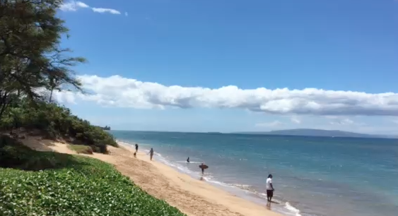
Image: Malika Dudley
Alerts
A Small Craft Advisory is posted for the Pailolo and ʻAlenuihāhā channels as well as Māʻalaea Bay through 6 a.m. Monday. East winds up to 25 knots are expected along with rough seas of up to 11 feet. Inexperienced mariners should avoid navigating in these conditions.
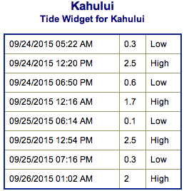
**Click directly on the images below to make them larger. Charts include: Maui County projected winds, tides, swell direction & period and expected wave heights.**
 Maui Surf Forecast
North: Wave heights are expected waist/shoulder high today for spots catching the trade swell. Best breaks could get up to head high on the sets late in the day. Many shadowed spots will remain smaller.
West: Wave heights knee/thigh high are expected today as our SSW fades. Spots shadowed by other islands will be smaller.
South: The south-southwest is expected to bring knee/thigh high waves today. Spots open to the trade swell could get up to waist/chest high.
 Our SSW swell is expected to continue to slowly fade through the week. Small scale south-southwest swells are expected through the end of the month but nothing super notable.
Trade winds will continue to generate short-period choppy surf at moderate levels along east facing shores through the weekend. Other than that, there is nothing of note out of the NPAC.
Tropical Depression 6-C may bring us a bump soon. We will keep an eye on the forecast to see what develops.
Keep in mind, surf heights are measured on the face of the wave from trough to crest. Heights vary from beach to beach, and at the same beach, from break to break.
**Click here for your detailed Maui County weather report.**

Image: NOAA / NWS

Image: NOAA / NWS

Image: NOAA / NWS
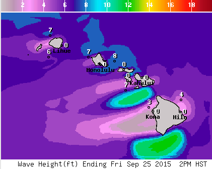
Image: NOAA / NWS
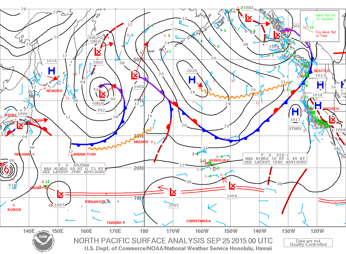
Image: NOAA / NWS
Sponsored Content


