

New Swells Fill in Today, SSW Holds
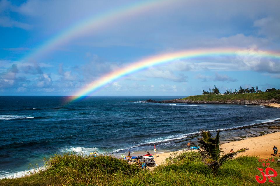
Image: Jimmie Hepp
Alerts
A Small Craft Advisory is posted for the Pailolo and ʻAlenuihāhā channels as well as Māʻalaea Bay through 6 a.m. Thursday. East to northeast winds up to 25 knots are forecast along with seas up to 10 feet.
Check our breaking news section for any urgent weather alerts.
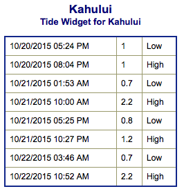
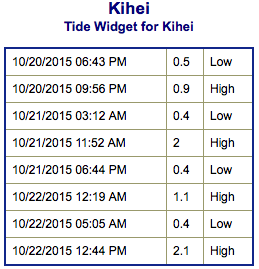
**Click directly on the images below to make them larger. Charts include: Maui County projected winds, tides, swell direction & period and expected wave heights.**
 Maui Surf Forecast
North: Wave heights are expected waist/chest high today. Waves could get up to head high at the best exposures. Olaf swell is expected to build for east exposures, mainly for Hana area.
West: Wave heights waist/chest high are expected today. The best exposures could get up to shoulder high on the sets. Spots shadowed by other islands will be smaller.
South: The south-southwest is expected to bring waist/chest high waves today. The best breaks could be a bit bigger on the sets.
 Our current shot of northwest is expected build through the day and peak Wednesday night before easing late Thursday into Friday.
Our current south-southwest swell is expected to hold Wednesday. New swell out of the southern hemisphere is expected Thursday into Friday.
Tropical swell is expected mainly for the north and east shores of the Big Island, generated by hurricane Olaf. An advisory is in effect for those areas and warning level surf could occur. The swell is expected to quickly build Wednesday and peak Thursday and Friday. For Maui we will see wave heights building mainly around Hana. Will keep an eye on it.
Keep in mind, surf heights are measured on the face of the wave from trough to crest. Heights vary from beach to beach, and at the same beach, from break to break.
**Click here for your detailed Maui County weather report.**

Image: NOAA / NWS
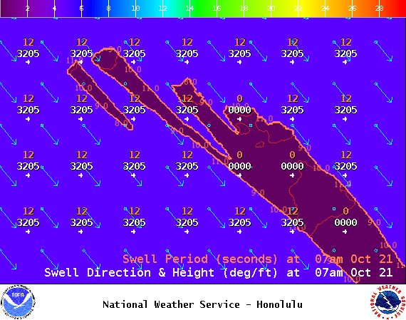
Image: NOAA / NWS
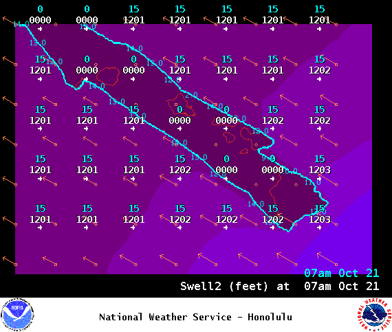
Image: NOAA / NWS
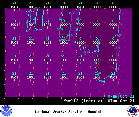
Image: NOAA / NWS
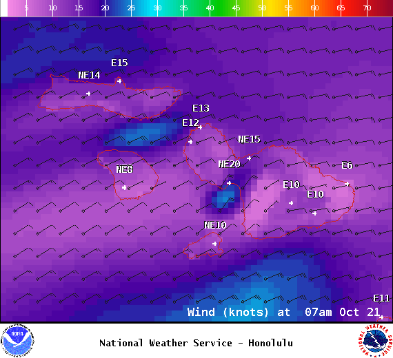
Image: NOAA / NWS
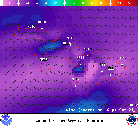
Image: NOAA / NWS
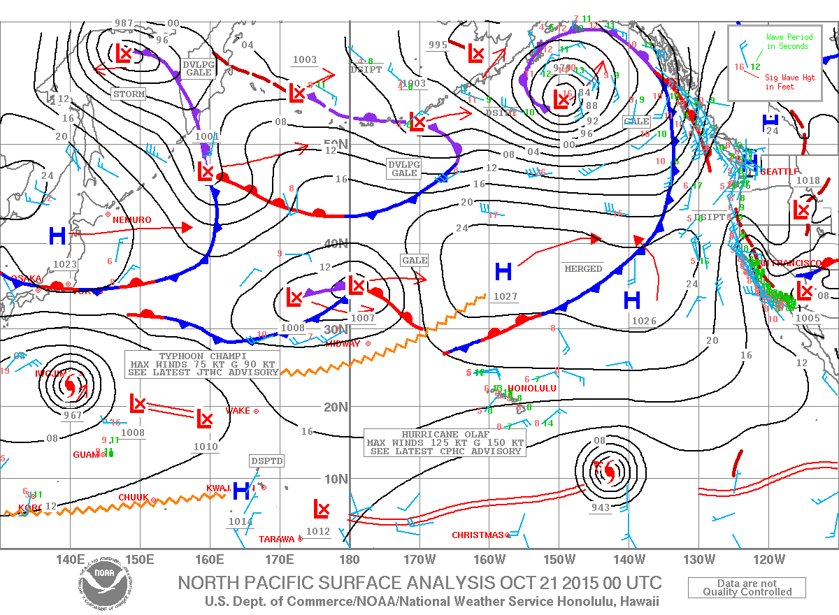
Image: NOAA / NWS
Sponsored Content


