

Surf Advisory Continues, New WNW Fills in
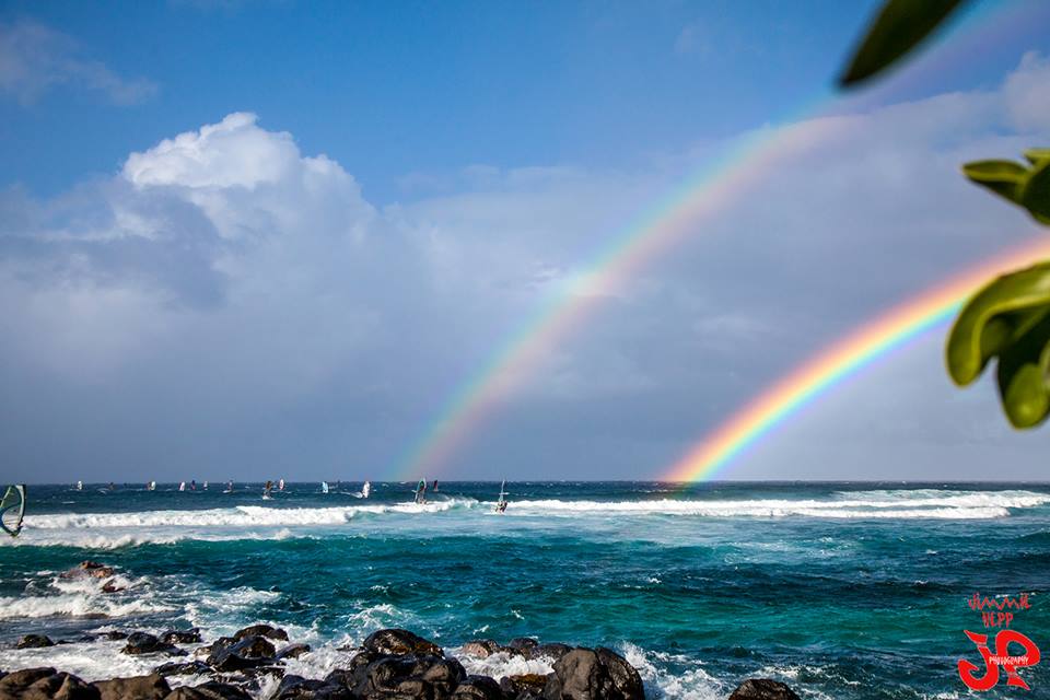
Image: Jimmie Hepp
Alerts
A Small Craft Advisory is posted for all Maui County waters through 6 a.m. Tuesday for east winds up to 30 knots and rough seas up to 13 feet.
A High Surf Advisory is in effect for the east facing shores of Maui and Molokai through Tuesday at 6 p.m. Surf heights of 5 to 8 foot faces are expected.
Check our breaking news section for any urgent weather alerts.
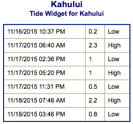
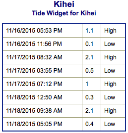
**Click directly on the images below to make them larger. Charts include: Maui County projected winds, tides, swell direction & period and expected wave heights.**
 Maui Surf Forecast
North: Wave heights are expected to be knee/waist high today by sunset. Trade swell continues for Hana area and spots open to trade swell with wave heights up to a few feet overhead on the sets.
West: Wave heights are well below waist high today – just leftovers. Spots shadowed by other islands will be pretty flat.
South: Wave heights are well below waist high today – just leftovers. Breaks open to the trade swell could get up to head high or bigger on the sets east on Wailua side.
 An advisory level east-northeast trade swell will continue to affect windward coasts.
Our current south-southwest continues to trend down today. A new south-southwest is expected later this week.
A larger west-northwest swell is expected to build midweek with knee/waist high waves late Tuesday. Wednesday into Thursday the swell is expected to top out with some spots going up to double overhead on the sets. Easing trend expected Friday into Saturday. Thursday and Friday the swell will shift more out of the northwest with head high to overhead waves. The swell fades over the weekend.
Keep in mind, surf heights are measured on the face of the wave from trough to crest. Heights vary from beach to beach, and at the same beach, from break to break.
**Click here for your detailed Maui County weather report.**
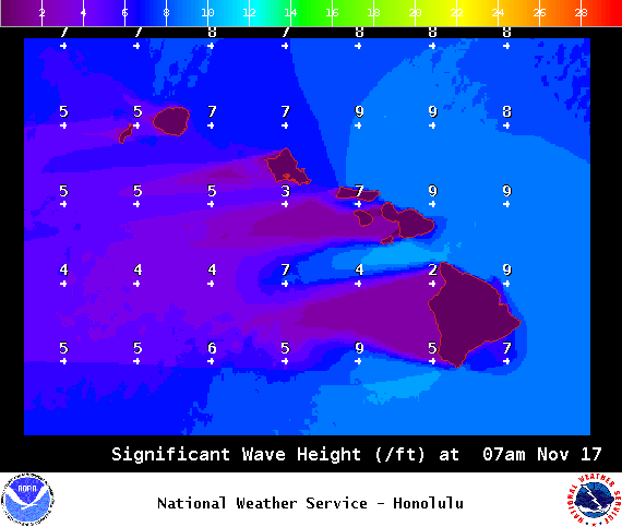
Image: NOAA / NWS

Image: NOAA / NWS

Image: NOAA / NWS
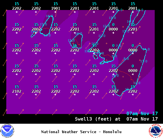
Image: NOAA / NWS
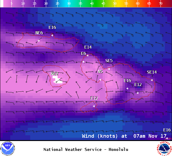
Image: NOAA / NWS
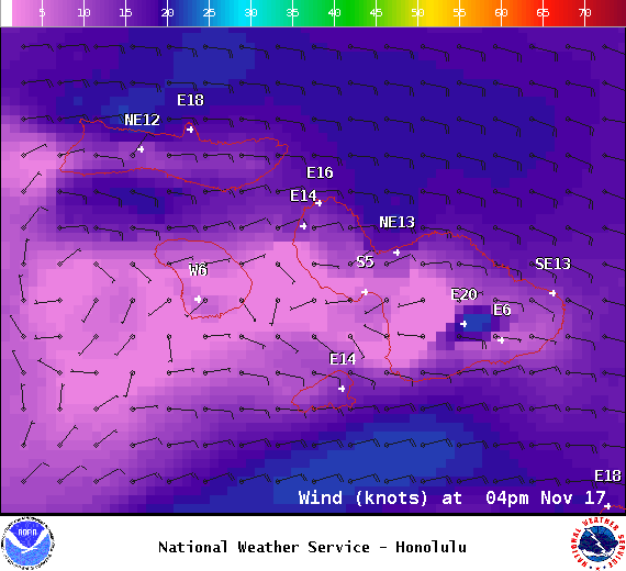
Image: NOAA / NWS

Image: NOAA / NWS
Sponsored Content


