

Eye of Irma Advances Toward Lower Florida Keys
The eye of Hurricane Irma is about to move across the lower Florida Keys as of 5 a.m. EDT on Sunday, Sept. 10, 2017. The Category 4 hurricane had sustained winds of 130 mph and was moving toward the NW at 8 mph.
The National Hurricane Center reports that a turn toward the NNW and an increase in forward speed are expected later today, with that motion continuing through Monday.
As of 5 a.m. EDT (11 p.m. HST previous day) the eye of Irma should move over the Lower Florida Keys in the next few hours, then move near or over the southwestern coast of the Florida Peninsula later today through tonight. The NHC reports that Irma should then move inland over the Florida panhandle and southwestern Georgia on Monday afternoon.
Forecasters say that while weakening is forecast, Irma is expected to remain a powerful hurricane as it moves through the Florida Keys and and near the west coast of Florida. The track shifted towards the west from previous forecasts released late last week.
The agency advises that hurricane-force winds extend outward from the center up to 80 miles and tropical-storm-force winds extend up to 220 miles from the center of the system.
Summary of Watches and Warnings
as of 5 a.m. EDT Sunday, Sept. 10, 2017 (11 p.m. HST Saturday, Sept. 9, 2017)
(Update via: National Hurricane Center)
A Storm Surge Warning is in effect for…
* South Santee River southward to Jupiter Inlet
* North Miami Beach southward around the Florida peninsula to the
Ochlockonee River
* Florida Keys
* Tampa Bay
A Hurricane Warning is in effect for…
* Fernandina Beach southward around the Florida peninsula to Indian
Pass
* Florida Keys
* Lake Okeechobee
* Florida Bay
* Cuban provinces of Ciego de Avila, Sancti Spiritus, Villa Clara,
Matanzas, and La Habana
A Hurricane Watch is in effect for…
* North of Fernandina Beach to Edisto Beach
A Tropical Storm Warning is in effect for…
* West of Indian Pass to the Okaloosa/Walton County Line
* North of Fernandina Beach to South Santee River
A Tropical Storm Watch is in effect for…
* Bimini and Grand Bahama

Hurricane Irma storm surge innundation. PC: (9.9.17)National Hurricane Center/ Google maps.

Hurricane Irma satellite imagery. PC: (9.9.17)National Hurricane Center/ Google maps.

Hurricane Irma track. PC: (9.9.17)National Hurricane Center/ Google maps.
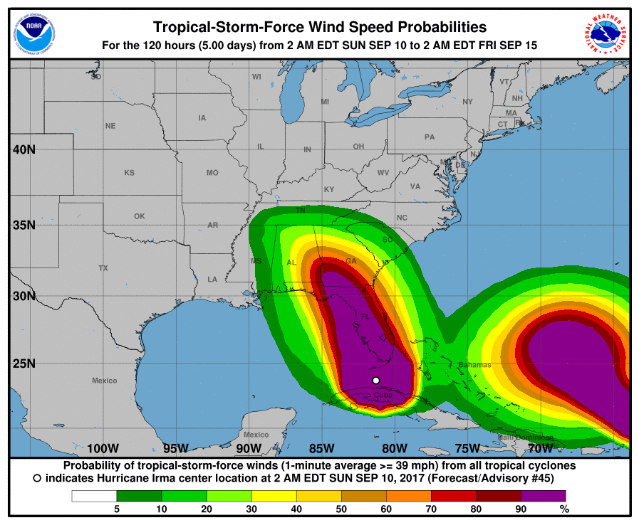
Hurricane Irma wind speed probabilities. PC: (9.9.17)National Hurricane Center/ Google maps.

Irma potential flood surge map. PC: PDC.
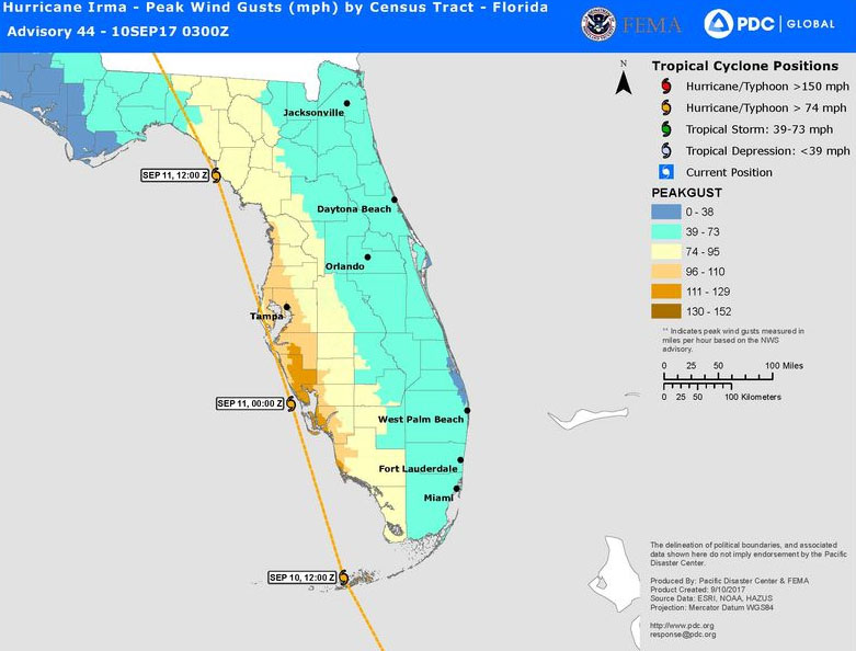
Hurricane Irma peak wind gusts, (9.10.17) PC: Pacific Disaster Center.
Sponsored Content


