

No Tsunami After 4.6 Earthquake in SW Rift Zone of Kīlauea
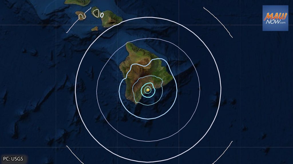
There is no tsunami expected after a 4.6 (preliminary magnitude 4.4) earthquake reported at 8:37 p.m. on Tuesday, Oct. 5, 2021 in the SW rift zone of the Kīlauea volcano on Hawaiʻi Island.
The Pacific Tsunami Warning Center reports that “No tsunami is expected; however some areas may have experienced shaking.”
The USGS reports that the quake occurred at a depth of 32.6 km, and was located near the following cities:
- Pāhala, Hawaiʻi, 5.7 miles WSW
- Hawaiian Paradise Park, Hawaiʻi, 37.4 miles NE
- Hilo, Hawaiʻi, 40 miles NNE
- Kailua-Kona, Hawaiʻi, 48.7 miles NW
- Honolulu, Hawaiʻi, 214.9 miles NW
The most “felt reports” recorded in the first 20 minute on the USGS Did You Feel It website occurred in Hilo, Volcano and Pāhoa on Hawaiʻi Island. The quake was felt across Hawaiʻi Island, and as far away as Honokaʻa. The website received more than 210 felt reports within the first hour of the earthquake.
The Hawaiian Volcano Observatory reports that the earthquake was centered about 5 miles ENE of Pāhala, at a depth of 33 km (20 miles).
According to HVO Scientist-in-Charge, Ken Hon, the earthquake had no observable impact on Mauna Loa and Kīlauea volcanoes. “This earthquake is part of the ongoing seismic swarm under the Pāhala area, which started in August 2019. Webcams and other data streams show no impact on the ongoing eruption at Kīlauea. Please be aware that aftershocks are possible and may be felt. HVO continues to monitor Hawaiian volcanoes for any changes. The Alert Levels/Color Codes remain at WATCH/ORANGE for Kīlauea and ADVISORY/YELLOW for Mauna Loa at this time.”
Earthquakes in this swarm occur beneath Kīlauea’s lower SW Rift Zone, beneath the town of Pāhala and in an area extending about 6 miles offshore. Most of the earthquakes occur at depths of 15–25 miles, according to the HVO. The observatory reports that earthquakes in this region have been observed at least as far back as the 1960s.
Sponsored Content


