

4.5 earthquake on south flank of Kīlauea, no tsunami generated
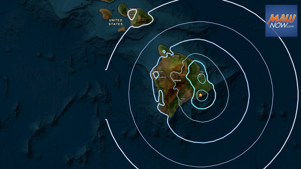
A magnitude-4.6 earthquake occurred 9 miles south-southeast of Fern Forest on the Island of Hawaiʻi at a depth of 3 miles below sea level at 11:49 p.m. on Tuesday, Nov. 25, 2025, according to the Hawaiian Volcano Observatory. The earthquake had no apparent impact on either Mauna Loa or Kīlauea volcanoes according to the HVO, and there was no tsunami generated according to emergency management officials.
The event followed the end of episode 37 lava fountaining on Kīlauea by 10 minutes, but does not appear directly related to the eruption, according to the HVO.
“Most earthquakes in this region are caused by movement of the south flank of Kīlauea. The location, depth, and waveforms recorded as part of today’s earthquake are consistent with slip along south flank faults,” the HVO reports.
There were more than 200 felt reports on the USGS “Did You Feel It?” website within the first hour (http://earthquake.usgs.gov/dyfi/).
The USGS Hawaiian Volcano Observatory continues to monitor Hawaiian volcanoes for any changes. The Maui Emergency Management Agency is also monitoring.
- Additional earthquake information can be found at usgs.gov/programs/earthquake-hazards/earthquakes
- For preparedness tips and hazard information, visit the MEMA website at mauicounty.gov/emergency .
- USGS National Earthquake Information Center Maps and Reports for this Event: https://earthquake.usgs.gov/earthquakes/eventpage/hv74837442
- USGS-HVO Interactive Earthquake Map of Hawaiʻi: https://www.usgs.gov/observatories/hawaiian-volcano-observatory/earthquakes
Sponsored Content


