

HDOT collaborates to address wildfire risk with evacuation routes and vegetation management
As the kau wela or hot season continues the Hawaiʻi Department of Transportation is outlining its actions to address wildfire risk statewide. HDOT’s wildfire efforts are heavily focused on vegetation management based on priorities received from county fire departments and creation/maintenance of evacuation routes in vulnerable communities.
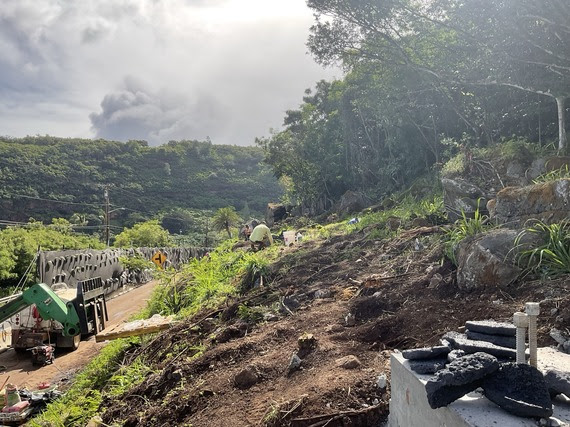
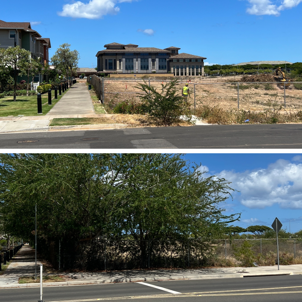
Vegetation Management – Since 2023, HDOT has been collaborating with county fire departments to remove vegetation in areas with high risk for wildfire ignition.
In Fiscal Year 2026, HDOT crews and contractors cut vegetation in the areas below.
- Royal Kunia along Kunia Road and along Anonui and Anoiki Streets
- Alongside Koʻoloaʻula Townhomes by Kroc Center
- Along the National Oceanic and Atmospheric Administration’s Pacific Tsunami Center
- Makakilo Gulch
- Behind Kroc Center
- City and County of Honolulu property along Kapolei Parkway
- Vegetated area between Komohana Place and Malakole Street
- Access Road within Varona Village
- Along 87-842 Farrington Highway in Māʻili
Areas currently being addressed on Kaua‘i:
- Approximately 1,400 feet of clearing behind residences along Laukona Street
- Approximately 1,400 feet of clearing behind residences along Kīpuka Street
Areas identified by fire departments to be addressed:
Maui
- Pi‘ilani Highway from North Kῑhei Road to Wailea Ike Drive
- Additional areas in Lahaina and Upcountry to be determined
O‘ahu
- Ikuone Place and Manuku Street to Farrington Highway
- Mākaha Valley Plantation/Oceanview Estates
- Mākaha Valley Road
- Kea‘au Beach Park
- Honokai Hale
- Pikaiolena Street by Black Rock
- Oheohe Street, Sea Country
- Fort Barrett Road
- Kalo‘i Gulch
- Komohana Place/Malakole Street
- Whitmore Village
- Walkerville in Kahuku
- Hanaloa and Ka‘uiki Streets
- Pokapahu Pl., Poka St., Pana Pl., Paikau St., Makalike Pl., Poka Pl.
- Kunia Road – gulch areas
- Lumipolu Street
- Viewpointe townhomes in Waikele
Hawai‘i (Big Island)
- Alahaki Road
- Discovery Harbour
- Nā‘ālehu Town
- Kaʻū Baseyard
- Kawaihae Village
- Old Puakō Road
- Pa‘auilo Makai
Native Plantings – According to the National Weather Service, non-native grasses and shrubs cover only 26% of Hawai‘i, but account for 75% of the area burned annually.
HDOT has an annual goal of 1,000 native plantings per year. To date in 2026, we’ve planted over 1,756 native plants, not including 12,375 ʻĀnapanapa, ʻIlima papa, Milo, ʻIlieʻe, Pōhinahina, Pili grass, Ahuʻawa, ʻAuhuhu, Mauʻu and ʻAkiʻaki planted on the slopes above Waimea Bay. A running total of HDOT’s native plantings is online at https://highways.hidot.hawaii.gov/stories/s/Native-Species-Public-Page/w327-azg3
Fire Fighting Mutual Aid – Under the Federal Aviation Administration’s 139.325 Airport Emergency Plan, HDOT Aircraft Rescue Fire Fighters have mutual aid agreements with county fire departments and actively reach out to dispatch to check if assistance is needed during fires.
Evacuation Routes –
| Route/Facility | Island | Status | Description |
| Lahaina school evacuation route | Maui | Completed | 2.5 mile route between the Lahainaluna fire lane to the Lahaina Bypass. |
| Mililani Mauka emergency access road | O‘ahu | Completed | 15’ gated gravel road to facilitate emergency evacuation to the H-2 northbound on-ramp |
| Pa‘akea Road | O‘ahu | Completed | Secondary access between Lualualei Naval Road and Hakimo Road |
| Kolekole Pass | O‘ahu | Usable but additional rock scaling is planned | Evacuation route between Nānākuli and Wahiawā through Navy and Army facilities |
| Waikoloa evacuation access to Queen Ka‘ahumanu Highway | Hawai‘i (Big Island) | Completed but additional emergency access route is planned | HDOT constructed access between the privately built emergency route and Queen Ka‘ahumanu Highway between Mauna Lani Resort and Puakō |
| North Hākau Place connection to Lahaina Bypass | Maui | Completed | Gated access for Kelawea Mauka to Lahaina Bypass to facilitate emergency evacuation |
| Farm Fair emergency road | Oahu | Completed | Path between Saipan Drive and Kamehameha Highway cut in 2025 that can also serve as an emergency route for Whitmore Village and Joint Base Pearl Harbor Hickam |
| Lahaina Bypass Phase 1C | Maui | In planning environmental stage | Continuation of the Lahaina Bypass northward from Keawe Street to Kaka‘alaneo Drive |
As HDOT continues its efforts to reduce fire risk to communities across the state, we encourage everyone to learn about wildfires and make emergency plans in the event of a fire in their area by visiting https://www.hwmo.org/lookout
Sponsored Content


