


Fausto on track to pass north of the Hawaiian Islands on Tuesday and Wednesday as a tropical storm
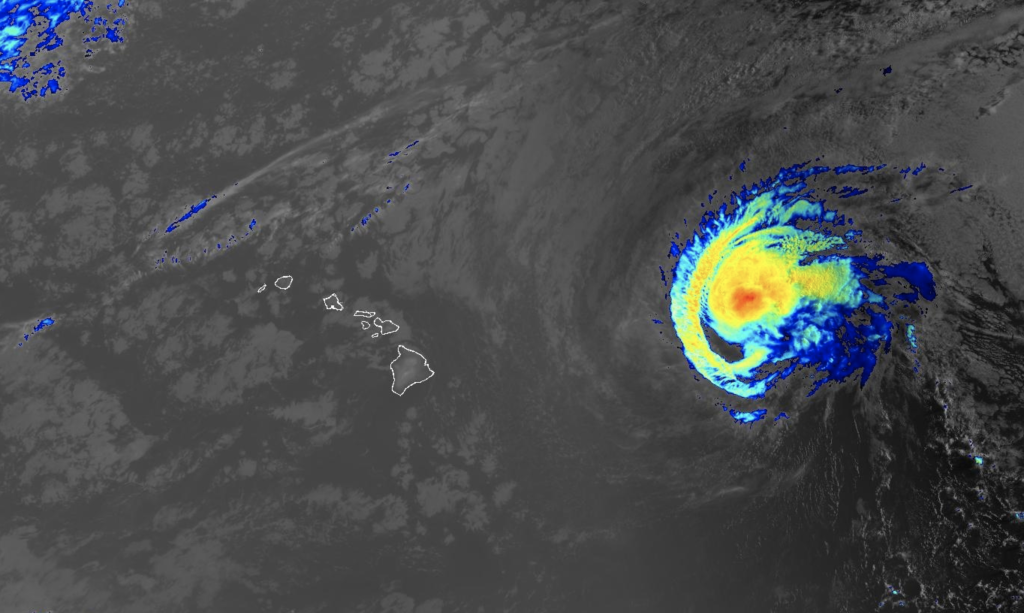
Hurricane Fausto remains on track to pass north of the Hawaiian Islands on Tuesday and Wednesday as a tropical storm, according to the National Weather Service.
A drier and breezy trade wind weather pattern will return across the state from Thursday onward as Fausto drifts westward away from the Hawaiian Islands.
“The environment ahead of Fausto grows more unfavorable on approach to the islands and we expect it to weaken into a tropical storm before arrival in the vicinity of the Hawaiian Islands,” according to the NWS forecast. “That said, we remain cautious at this stage that even subtle southern shifts in the track or delayed weakening trends may still produce changes to our island by island impacts.”
Forecasters strongly encourage the public to pay close attention to this passing storm system as weather impacts over the Hawaiian Islands will evolve the closer Fausto gets.
Fausto is expected to bring high surf, possibly above warning thresholds, for east facing shores today through Tuesday. A High Surf Advisory is in effect for east facing shores through Wednesday, with the possibility of an upgrade to a warning.
The NWS says strong winds to around 40 mph may develop near and north of the low center and possible heavy rain threats from Tuesday through Wednesday.
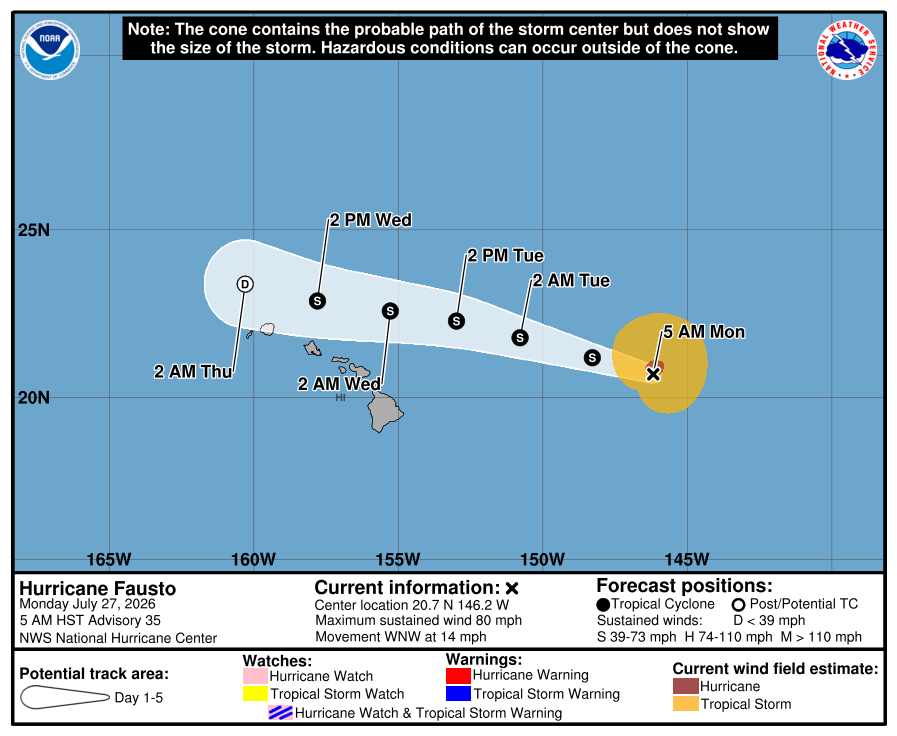
At 5 a.m., the Central Pacific Hurricane Center reported that the center of Fausto was located near latitude 20.7 North, longitude 146.2 West. The system was moving toward the west-northwest near 14 mph, and a general W to WNW motion is expected to continue for the next several days. Maximum sustained winds remain near 80 mph with higher gusts. Gradual weakening is forecast during the next several days. Hurricane-force winds extend outward up to 35 miles from the center and tropical-storm-force winds extend outward up to 140 miles. The estimated minimum central pressure is 986 mb (29.12 inches).
To prepare, every household should have at least a 14 day supply of food and water available if needed during this years active hurricane season, which runs through the end of November.
The NWS forecast calls for a strong high pressure system far north of the Hawaiian Islands to produce moderate to breezy trade winds through today with periods of showers favoring windward mountain areas in the overnight and early morning hours.
Sponsored Content


_(1)_1787857947612.webp)

















