

Hawai’i’s 2026 dry season 3rd wettest in 30 years; but wet season will be opposite with increased wildfire risk
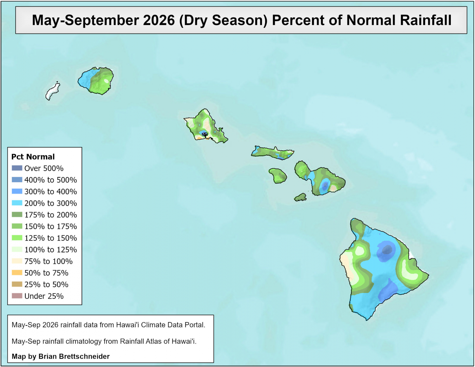
Forecasters were right: Rainfall turned out to be above average during Hawai‘i’s 2026 dry season, which ran May through September.
The National Oceanic and Atmospheric Administration’s Climate Prediction Center forecast favored development of a strong El Niño with above-normal precipitation for all Hawaiian Islands through early autumn 2026.
That’s in line with past El Niño impacts, according to an Oct. 22 NOAA news release.
Overall, the 2026 dry season ranked as the third wettest in the last 30 years (based on average rankings from eight representative sites around the state).
But the opposite will be true for Hawaiʻi’s wet season, which began in October and runs through April.

The wet season outlook calls for below average rainfall and a higher potential for “out of season” wildfires due to a prolonged period of dry fuels and additional fuel load from several heavy rain events in 2026. Wildfire danger can be exacerbated by strong wind episodes, which are still possible during El Niño winters.
To slow or prevent wildfire spread, create defensible space by clearing dry vegetation around homes and other structures.
For the dry season, the majority of rainfall totals were above average across the state, with many areas experiencing twice the average. Although rainfall in some downwind areas of O‘ahu, Moloka‘i and the Big Island were below average.
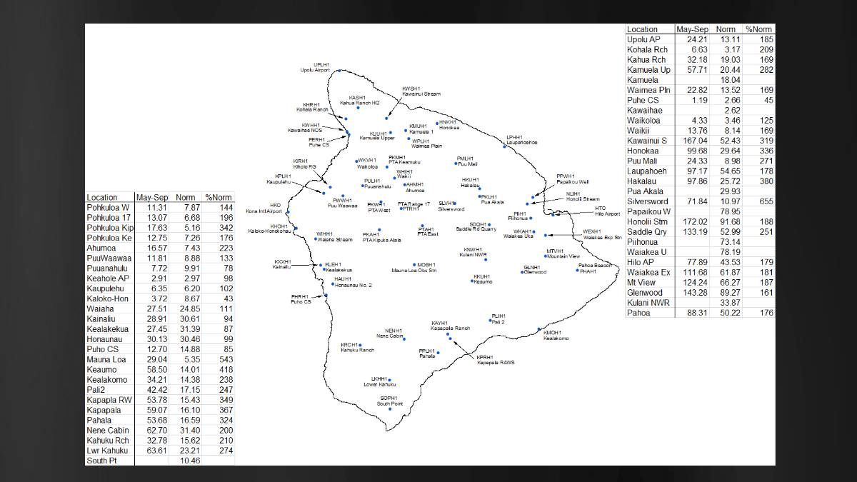
Drought conditions changed little, with about 3% of the state affected as of early May and no official drought statewide through September. Abnormal dryness remains in the Kona and South Kohala Districts of the Big Island.
As of October, the first month of the 2026-27 wet season that runs through April, El Niño is in the very strong category and is expected to continue strengthening through the end of the year, with a high chance for a historic event.
An El Niño advisory is in effect.
The wet season rainfall forecast is consistent with a winter El Niño event, with below normal rainfall statewide likely through early spring 2027. Rainfall amount and distribution can be influenced by the strength of El Niño.
If the rainfall forecast verifies, anticipate drought conditions to develop in many areas across the state during the second half of the winter and potentially worsen through the spring.
Despite the below-average rainfall forecast for the wet season, residents should still prepare for isolated heavy rain events. Flash flooding can still happen within a drought.
Reminders:
- Do not drive on roads with fast-flowing water. Less than two feet of fast-flowing water can sweep most vehicles off a road. Roads may also be severely undercut and collapse.
- Do not walk across flooded streams. Wait for the water to recede.
- If you live in or travel through a flood-prone area, have an evacuation plan and identify alternate routes ahead of time.
- Stay informed of rapidly changing conditions. Wireless Emergency Alerts on mobile phones notify you if you’re in a significant, life-threatening flash flood warning area.
Sponsored Content