Flood Watch in Effect Wed morn 1/12/11 to Thurs afternoon 1/13/11
(Update 8 p.m. 1/11/11)
The National Weather Service in Honolulu has continued the Flash Flood WATCH for all Hawaiian Islands from Wednesday morning through Thursday afternoon.
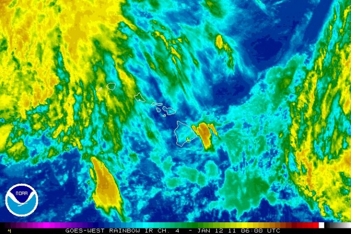
8 p.m. 1/11/11 Satellite imagery courtesy National Weather Service. Click image to enlarge.
A Flash Flood Watch means that conditions may develop that lead to flash flooding.
Forecasters are monitoring a cold front approaching from the northwest. The system will bring the threat of heavy rain and flash flooding, mainly to the western portion of the state. The greatest flood risk is expected Wednesday and Wednesday night. The front will slow down over the state on Thursday with a continued threat of heavy rain statewide.
Rain and runoff will make driving hazardous due to ponding, reduced visibility and poor braking action. Motorists and pedestrians should not cross rising or fast flowing water in their vehicle or on foot.
(Information courtesy the National Weather Service)
(Update 6:12 a.m. 1/11/11)
Heavy rains are possible for Hawaii starting Wednesday morning as a strong cold front approaches the state from the northwest.

Warnings, watches and advisories. Image courtesy National Weather Service.
Heavy rains and severe weather resulted in power outages, road closures and messy conditions across Maui. A fallen tree in the gulch near the Longs Drug Store in Pukalani knocked out power to residents in that community, while a lightning strike reported at around 6:45 last night caused a widespread outage that stretched from Makawao to Kula, Paia and Hana. Power to most areas was restored by 8 p.m. The heavy rains also forced the one hour closure of the Honoapiilani Highway until 7:25 p.m. because of rocks, mud and debris on the roadway. The state remains under a Flood Potential Outlook as more wet weather is expected Wednesday and Thursday, mainly over the western portion of the state.
The system will bring the threat of heavy rainfall and flash flooding. Forecasters with the National Weather Service say the western portion of the state will see the greatest flood risk Wednesday and Wednesday night, with a continued threat of heavy rain statewide on Thursday.
A Flash Flood WATCH is in effect from Wednesday morning through Thursday Afternoon for the entire state.
A Flood Watch means that conditions may develop that lead to flash flooding. If flooding turns imminent or is already occurring, the National Weather Service will update the Watch to a Warning.
Yesterday, emergency personnel from the County of Maui met in a special meeting to discuss response and preparedness efforts.
(Posted by Wendy Osher, supporting information courtesy The National Weather Service)
Sponsored Content