

No Tsunami Threat to Hawaiʻi After 7.3 Papua New Guinea Quake
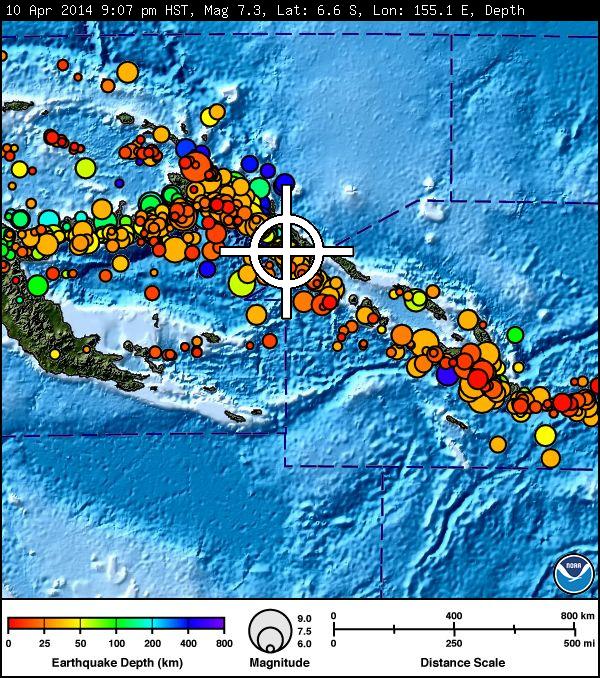
Image of Solomon Islands/Papua New Guinea earthquake, April 10, 2014. Courtesy Pacific Tsunami Warning Center.
By Wendy Osher
There is no tsunami threat to Hawaiʻi following two large earthquakes reported in the Solomon Islands/Papua New Guinea region on Thursday night, April 10, 2014, according to the Pacific Tsunami Warning Center.
The first quake was a preliminary magnitude 7.3 reported in the Solomon Islands/Papua New Guinea region at 9:07 p.m. on Thursday, April 10, 2014.
The second quake was a preliminary magnitude 6.7 reported in the same region at 10:17 p.m. HST on Thursday, April 10, 2014.
The Pacific Tsunami Warning Center issued a statement for each incident saying that based on all available data, a destructive Pacific-wide tsunami is not expected and there is no tsunami threat to Hawaiʻi.
The US Geological Survey reports that the initial quake occurred at a depth of 31.5 miles and was located: 38 miles SW of Panguna, Papua New Guinea; 45 miles SW of Arawa, Papua New Guinea; 248 miles SE of Kokopo, Papua New Guinea; 345 miles ESE of Kimbe, Papua New Guinea; and 386 miles WNW of Honiara, Solomon Islands.
According to the USGS, the second quake occurred at a depth of 50 km, and was located 50 miles SW of Panguna, Papua New Guinea; 57 miles SW of Arawa, Papua New Guinea; 251 miles SE of Kokopo, Papua New Guinea; 342 miles ESE of Kimbe, Papua New Guinea; and 383 miles WNW of Honiara, Solomon Islands.
Sponsored Content


