

Malika Dudley’s Maui County Forecast – 11/05/14
By Meteorologist Malika Dudley / Email: malika@mauinow.com
**A breakdown of expected conditions specific to Maui County is presented below. All graphics are provided by the National Weather Service in Honolulu. Click directly on the image to make it larger.**
Alerts
A SMALL CRAFT ADVISORY has been posted for Māʻalaea Bay and the Pailolo and ʻAlenuihāhā channels from 9 a.m. today until 6 a.m. Thursday. Northeast winds of 25 knots are expected with rough seas up to 11 feet. Inexperienced mariners are cautioned to avoid navigating these conditions.
Today
A bit of relief from the hot and sticky conditions we experienced yesterday. Trade wind weather is expected to take over the forecast today. That means we expect partly cloudy skies for windward and mauka areas with morning showers. Leeward spots of Maui County will be mostly clear with just isolated morning showers in the forecast as trades might be strong enough to blow some moisture over from the windward sides. High temperatures should fall in the range of 83° to 88° with a high of about 69° at 5000 feet. Generally we expect trade winds from 10 to 20 mph.
Sunrise: 6:30 a.m.
Sunset: 5:48 p.m.
UV index at 8 (“very high” exposure level)
Tonight
Tonight we should get trade winds from 10 to 20 mph. Scattered showers are expected for windward and mauka areas overnight with just isolated showers for leeward spots. Low temperatures should fall in the range of 72° to 77° with a low of about 55° at 5000 feet.
Moonrise: 5:14 p.m.
Moonset: 6:19 a.m.
Next Full Moon: Nov 6, 2014 at 12:23 p.m.
Next New Moon: Nov 22, 2014 at 2:33 a.m.
Looking Ahead
Moderate trades are expected to start filling back in late Tuesday into Wednesday. Another front is expected to approach the island chain starting Thursday, this will cut our trade winds off again. It’s still too far out to say for sure, but at this point the front is expected to impact Maui County Saturday into Sunday.
 Surf & Seas
North: Surf is expected in the waist to head high range. Best breaks could see overhead to a couple feet overhead set waves, especially later in the day.
West: Breaks that don’t catch the swells are forecasted to get smaller surf in the ankle high range. Spots that are open to the north swell should see waist to head high waves. Maybe even overhead from time to time, especially late in the day.
South: Ankle-slappers to possibly thigh high surf is expected.
Our current new northwest swell (315-335°) peaked overnight with a reinforcement on tap out of the north-northwest swell (330-360°) building today and Thursday and peaking Thursday in the chest to head high range with bigger sets at the best breaks. Maybe an even bigger swell (310-345°) on the horizon for next weekend, possibly peaking with waves well overhead. Super Typhoon Nuri could possibly bring us a series of solid swells starting around Nov. 11.
 Small swells generated in the South Pacific are expected to bring us waves in the thigh high or less range. You might see possible plusses at the best tides and exposures but they will be inconsistent at best and some west shores, blocked by other islands, will remain flat. There isn’t much on the horizon out of the South Pacific.
Keep in mind, surf heights are measured on the face of the wave from trough to crest. Heights vary from beach to beach, and at the same beach, from break to break.
Almanac for Kahului Airport
Maximum Temperature for today:
Normal 85°
Record 92° / Set in 1952
Minimum Temperature for today:
Normal 69°
Record 60° / Set in 1953 and tied in 1971
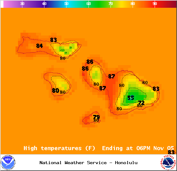
Image: NOAA / NWS
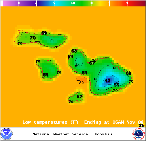
Image: NOAA / NWS
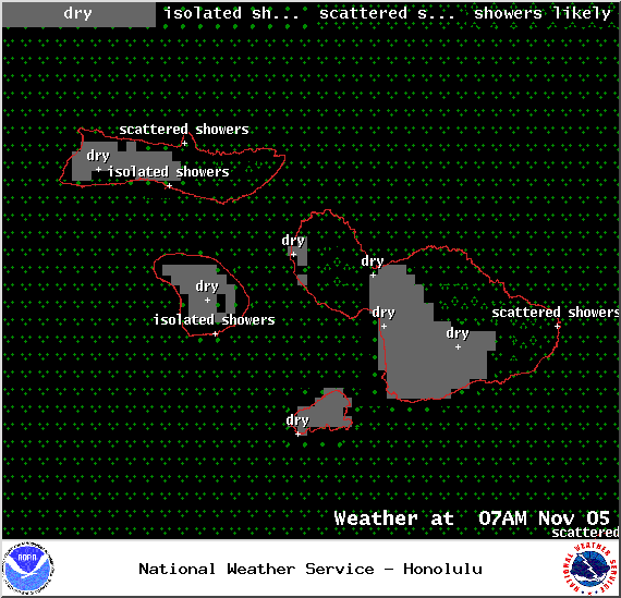
Image: NOAA / NWS

Image: NOAA / NWS
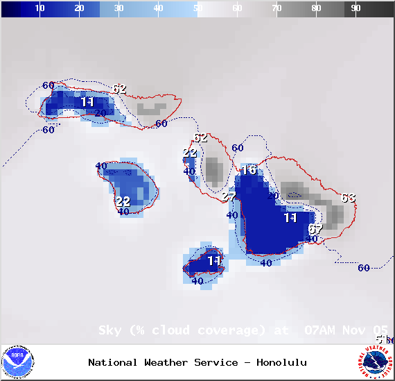
Image: NOAA / NWS
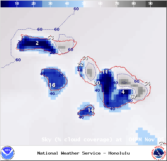
Image: NOAA / NWS
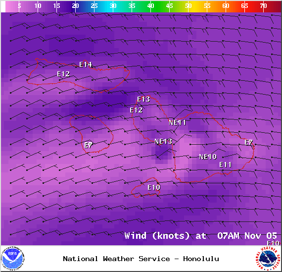
Image: NOAA / NWS
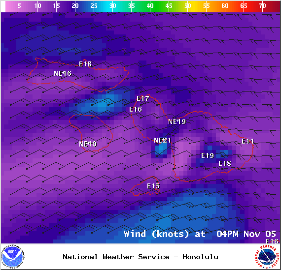
Image: NOAA / NWS
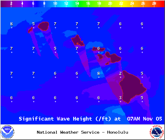
Image: NOAA / NWS
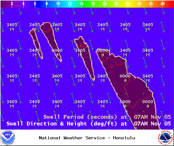
Image: NOAA / NWS
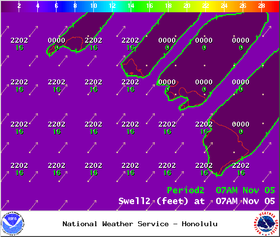
Image: NOAA / NWS
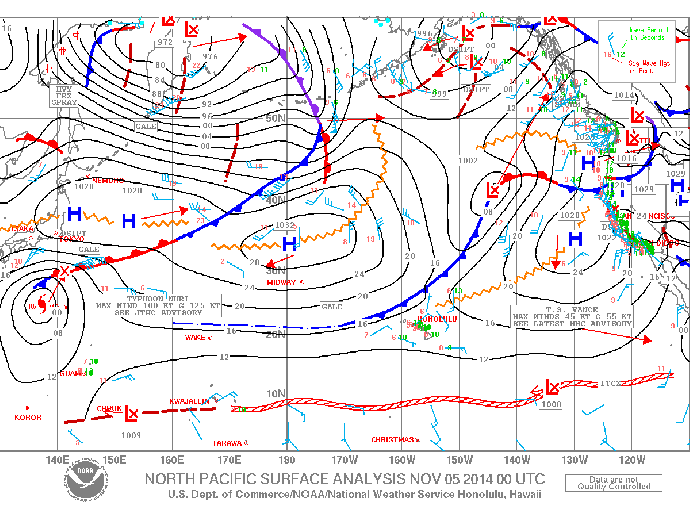
Image: NOAA / NWS

November Sky Map / Image: Bishop Museum
Sponsored Content


