

Pe’ahi Swell Expected, Warning Level Surf on the Way

Ho’okipa yesterday / Image: Jimmie Hepp
By Meteorologist Malika Dudley / Email: [email protected]
Alerts
A High Surf Advisory has been posted by the National Weather Service for north and west-facing shores of Molokaʻi and north shores of Maui through 6 p.m. Thursday. Surf is expected from 15 to 20 foot faces for north shores and 10 to 15 foot faces for the west side of Molokaʻi.
Expect strong breaking waves, shore break and strong longshore and rip currents making swimming difficult and dangerous.
A Small Craft Advisory has been issued by the National Weather Service for the ʻAlenuihāhā & Kaiwi channels along with Maui County windward waters through 6 a.m. Thursday for northeast winds at 10 to 20 knots and rough seas of 8 to 14 feet. This advisory may need to be extended as another very large NW swell is expected to build late in the day.
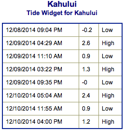
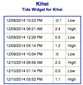
**Click directly on the images below to make them larger. Charts include: Maui County projected winds, forecasted swell direction, height & period, tides, a surface map and expected wave heights.**
 Maui County Surf Forecast, Tuesday December 9, 2014
North: New northwest swell expected to bring surf heights solidly double to triple overhead for most spots as the swell fills in late in the day. Outer reefs could be even bigger, maybe even up to 30 foot faces or more on the sets. Warning expected to be posted tonight / tomorrow.
West: Spots open to the swell are expected to get waves in the waist to overhead range. Otherwise, breaks that don’t catch the swell are forecasted to get smaller surf at ankle high or flat.
South: Many areas will remain flat today.
Our current north-northwest swell is expected to peak Tuesday morning. An overlapping swell is forecasted to help increase surf heights on Wednesday afternoon solidly 3 to 4x overhead or more at the best exposures. This swell is expected to peak Wednesday / Thursday with waves up to 35 foot faces. Pe’ahi (Jaws) could be even bigger… we’ll keep our eye on it!
 A series of swells are expected over the weekend and into next week as well.
Super small trace amounts of swell expected out of the SPAC. Not much to get excited about. Late in the weekend or early next week we could see a fun little boost.
Keep in mind, surf heights are measured on the face of the wave from trough to crest. Heights vary from beach to beach, and at the same beach, from break to break.
**Click here for your detailed Maui County weather report.**
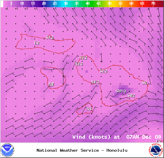
Image: NOAA / NWS
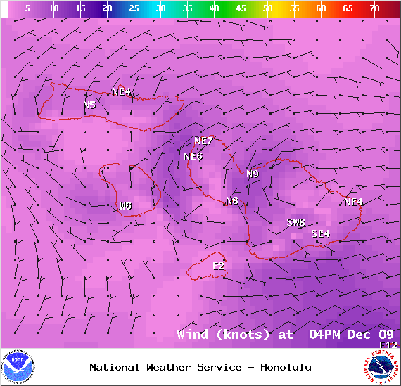
Image: NOAA / NWS
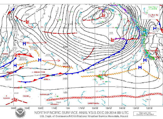
Image: NOAA / NWS
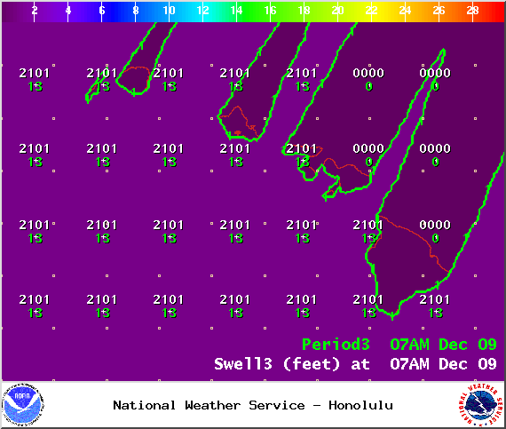
Image: NOAA / NWS
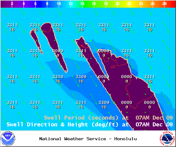
Image: NOAA / NWS
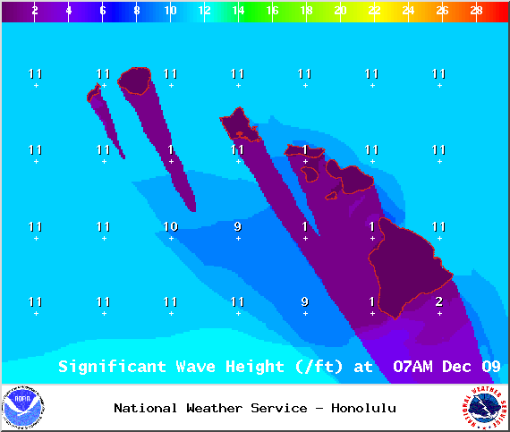
Image: NOAA / NWS
Ho’okipa yesterday / Image: Jimmie Hepp
Sponsored Content


