

Scattered Showers Likely, Slight Chance of Thunderstorms
By Meteorologist Malika Dudley / Email: malika@mauinow.com
Alerts
Throughout the current weather event, all weather alerts will be posted HERE.
We set a record for rainfall in Kahului yesterday with 2.14 inches measured. This breaks the old record of 1.91 inches set in 1982. This number will probably go up as additional rainfall is expected through the night. The record is a departure from normal of 2.02 inches.
**Click directly on the images below to make them larger. Charts include: Maui County high/low forecasted temperatures, projected winds, chance of cloud cover, projected localized weather conditions and expected wave heights.**
Today, Wednesday, December 24, 2014
Today showers are likely in windward and mauka areas with scattered showers forecasted for leeward spots. A slight chance of thunderstorms exists as well and locally heavy rainfall is possible. Winds will be out of the northeast around 15 mph becoming variable in the afternoon. High temperatures should fall in the range of 76° to 81° and around 67° at 5000 feet.
Sunrise: 6:59 a.m.
Sunset: 5:51 p.m.
UV index at 5 (“moderate” exposure level)
Tonight
Partly to mostly cloudy skies are expected tonight in Maui County with showers likely in windward and mauka spots. A slight chance of thunderstorms exists and heavy rain is possible. Winds are expected out of the northwest from 10 to 15 mph. Low temperatures from 67° to 72° degrees are expected with a low of about 52° at 5000 feet.
Moonrise: 9:19 a.m.
Moonset: 9:06 p.m.
Next Full Moon: Jan. 4 at 6:54 p.m.
Next New Moon: Jan. 20 at 3:14 a.m.
Looking Ahead
Unstable conditions will continue into Wednesday as a cutoff low high in the atmosphere develops near the islands. The threat for heavy flooding rainfall exists through Wednesday. We are not sure if all of the ingredients will be present for severe weather. The amount of moisture available to fuel unstable weather is not certain. It’s snowing on the summits of Mauna Kea and Mauna Loa but high winds have yet to materialize. Models are forecasting strengthening tomorrow but are also indicating a decrease in chance of snow. The Blizzard Warning may be dropped and replaced with a High Wind Warning for the summits. The disturbance is expected to slowly lift off to the northeast Christmas eve and day, leading to a drier northwest flow at the surface. Friday another disturbance is expected, its effects are not certain at this time. Moderate northerly winds will shift to a typical trade wind direction during the weekend.
Almanac for Kahului Airport
Maximum Temperature for today:
Normal 81°
Record 90° / Set in 1992
Minimum Temperature for today:
Normal 64°
Record 54° / Set in 1962
**Click here for your detailed Maui County surf report.**
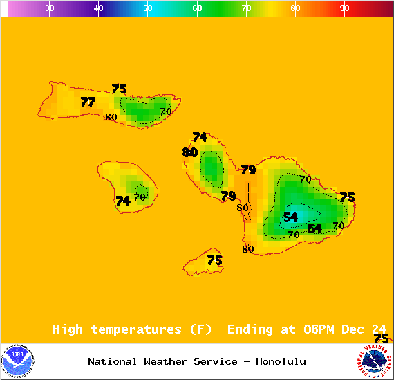
Image: NOAA/NWS
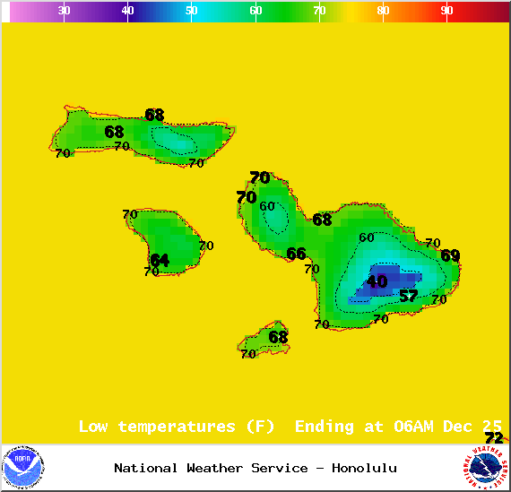
Image: NOAA/NWS
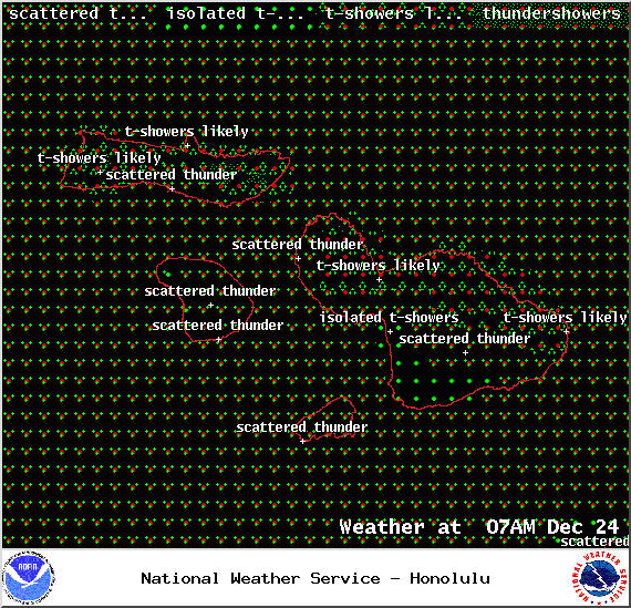
Image: NOAA/NWS
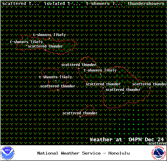
Image: NOAA/NWS

Image: NOAA/NWS
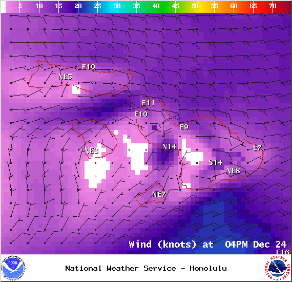
Image: NOAA/NWS
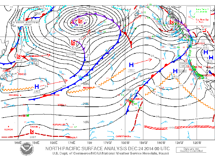
Image: NOAA/NWS
Sponsored Content


