

SSW Builds Today
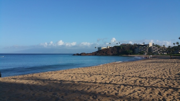
Image: Asa Ellison
By Meteorologist Malika Dudley / Email: [email protected]
Alerts
A High Surf Advisory is posted for the east facing shores of Maui and Moloka’i through 6 a.m. Wednesday. Surf of 6 to 10 feet is expected. Expect strong breaking waves, shore break and strong longshore and rip currents making swimming difficult and dangerous.
Small Craft Advisory is posted for all Maui County waters through 6 a.m. Tuesday. Northeast winds up to 30 knots and rough seas up to 15 feet are forecasted. Inexperienced mariners should avoid navigating in these conditions.
A Gale Warning is posted through Tuesday morning at 6 a.m. for the ʻAlenuihāhā Channel. East winds up to 35 knots and rough seas up to 18 feet are forecasted. Mariners without the proper vessel and experience should remain in port until gale conditions end.
**Click directly on the images below to make them larger. Charts include: Maui County projected winds, forecasted swell direction, height & period, tides, a surface map and expected wave heights.**
Maui County Surf Forecast
North: Wave heights are expected to be waist to shoulder high today. The best breaks could see a few sets slightly overhead.
West: Wave heights thigh to waist high at the breaks open to the northwest swell. Otherwise, pretty flat conditions are expected today for spots shadowed from the swells.
South: Knee to waist high waves are expected early in the day building to chest high or more by sunset.
Our current reinforcing northwest is expected to hold through the first half of this week. It should fade out by Thursday.
South-southwest building on Monday with another pulse overlapping in the afternoon. Tuesday another dose of surf energy is expected holding through Thursday.
Keep in mind, surf heights are measured on the face of the wave from trough to crest. Heights vary from beach to beach, and at the same beach, from break to break.
**Click here for your detailed Maui County weather report.**
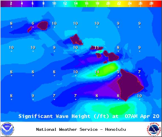
Image: NOAA
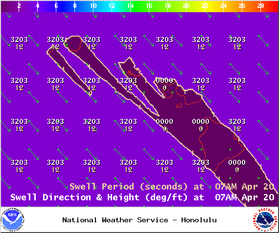
Image: NOAA
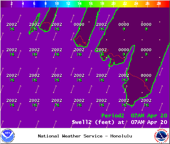
Image: NOAA
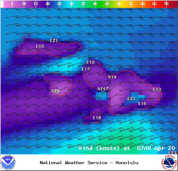
Image: NOAA
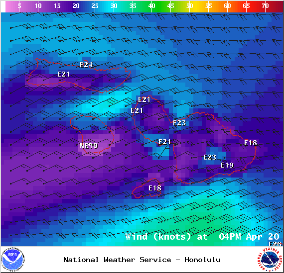
Image: NOAA
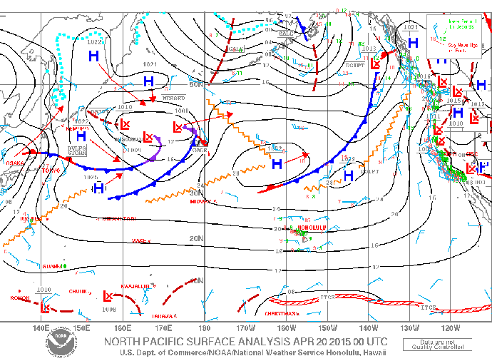
Image: NOAA
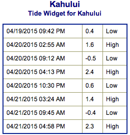
Image: NOAA / NWS
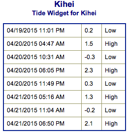
Image: NOAA / NWS
Sponsored Content


