

SSW Holds Saturday, Fades Sunday
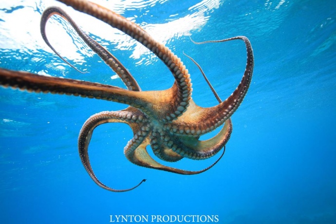
Image: Aaron Lynton
By Meteorologist Malika Dudley / Email: malika@mauinow.com
Alerts
A Small Craft Advisory is posted for the Pailolo and ʻAlenuihāhā channels as well as Māʻalaea Bay. Winds of 20 to 25 knots out of the east are forecasted with rough seas up to 10 feet. This advisory is posted through 6:00 p.m. Sunday. Inexperienced mariners should avoid navigating in these conditions.
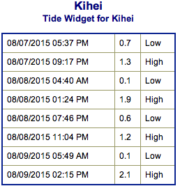
**Click directly on the images below to make them larger. Charts include: Maui County projected winds, tides, swell direction & period and expected wave heights.**
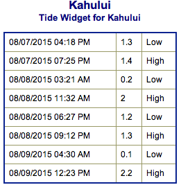 Maui Surf Forecast
North: Wave heights of about waist/chest high are expected today.
West: Wave heights waist/tummy high are expected. Ankle/knee high waves expected for the spots that are blocked by other islands.
South: Wave heights waist/chest high are expected at the best breaks.
 Ex-Guillermo swell continues to fade. Trade swell mixes in for easterly exposures. If tropical system, Hilda, continues on its forecasted path we expect swell to be generated for the islands around the middle of next week.
Our current south-southwest swell is expected to hold today and begin fading Sunday into early next week. Small overlapping swells expected late next week. Otherwise, pretty quiet.
Keep in mind, surf heights are measured on the face of the wave from trough to crest. Heights vary from beach to beach, and at the same beach, from break to break.
**Click here for your detailed Maui County weather report.**
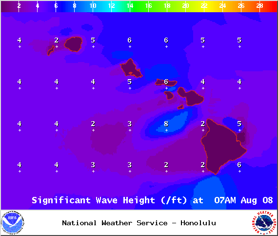
Image: NOAA / NWS
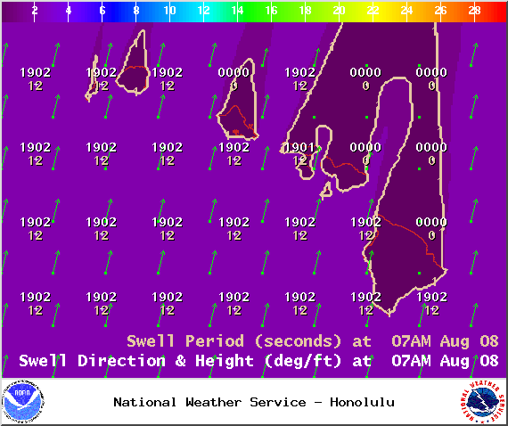
Image: NOAA / NWS

Image: NOAA / NWS
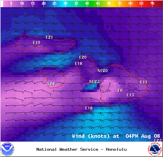
Image: NOAA / NWS
Sponsored Content


