

Tropical Cyclone Generated Swells Expected This Weekend
Image: Jimmie Hepp
By Meteorologist Malika Dudley / Email: [email protected]
Alerts
The National Weather Service has issued a Flash Flood Watch for the island of Maui in anticipation of widespread rain expected this weekend. The watch will go into effect at 6 p.m. Saturday and will be posted through 6 p.m. Monday. A large area of moisture to the east of tropical storm Kilo is expected to spread across Maui and the Big Island. As the deep tropical moisture interacts with the land, flooding is possible due to heavy, slow-moving rainfall episodes.
A Small Craft Advisory is in effect for the Pailolo and ʻAlenuihāhā channels, as well as Māʻalaea Bay, through 6:00 a.m. Sunday. East winds are expected up to 25 knots with rough seas from about 9 to 12 feet. Inexperienced mariners should avoid navigating in these conditions.
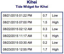
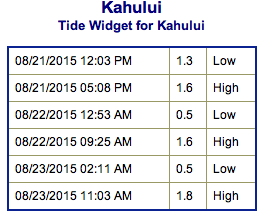
**Click directly on the images below to make them larger. Charts include: Maui County projected winds, tides, swell direction & period and expected wave heights.**
 Maui Surf Forecast
North: Wave heights of about waist/chest high are expected today for the best breaks. Spots not catching the northeast swell will be pretty flat.
West: Wave heights knee/waist/chest high are expected at the best breaks. Spots shadowed by other islands will be smaller or even flat.
South: Wave heights waist/chest high are expected at the best breaks.
 Our current south swell is expected to hold through Saturday morning before beginning to fade.
A small west swell generated by Super-Typhoon Atsani is expected to move in on the weekend. This system could go extratropical next week and curve northwest. If so, we could get more swell out of this system.
Kilo is expected to strengthen over the next couple of days. If so, we could see some short-period wind swell building today and into Sunday for southeast exposures. Keeping a close eye on this system and will bring you the latest.
Keep in mind, surf heights are measured on the face of the wave from trough to crest. Heights vary from beach to beach, and at the same beach, from break to break.
**Click here for your detailed Maui County weather report.**
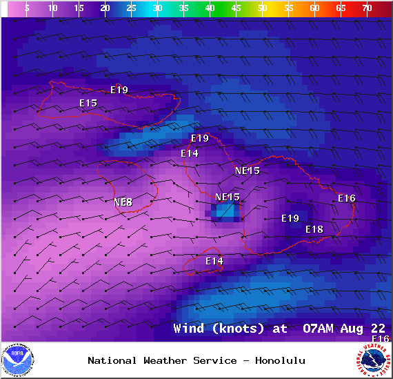
Image: NOAA / NWS

Image: NOAA / NWS
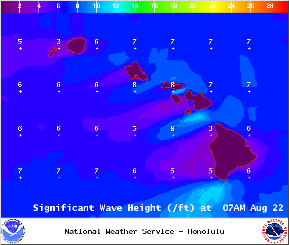
Image: NOAA / NWS
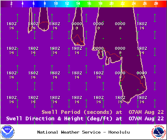
Image: NOAA / NWS
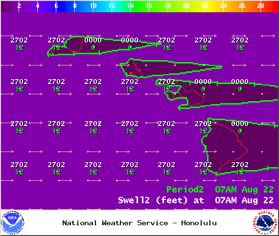
Image: NOAA / NWS
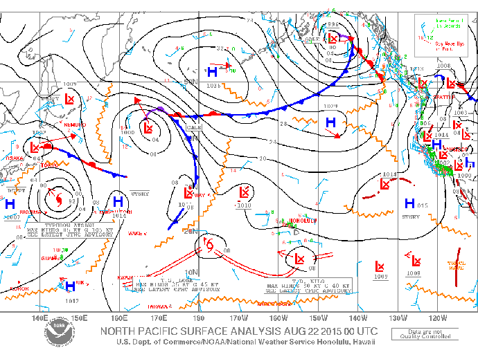
Image: NOAA / NWS
Sponsored Content


