

New NW and SSW Swells Expected This Weekend
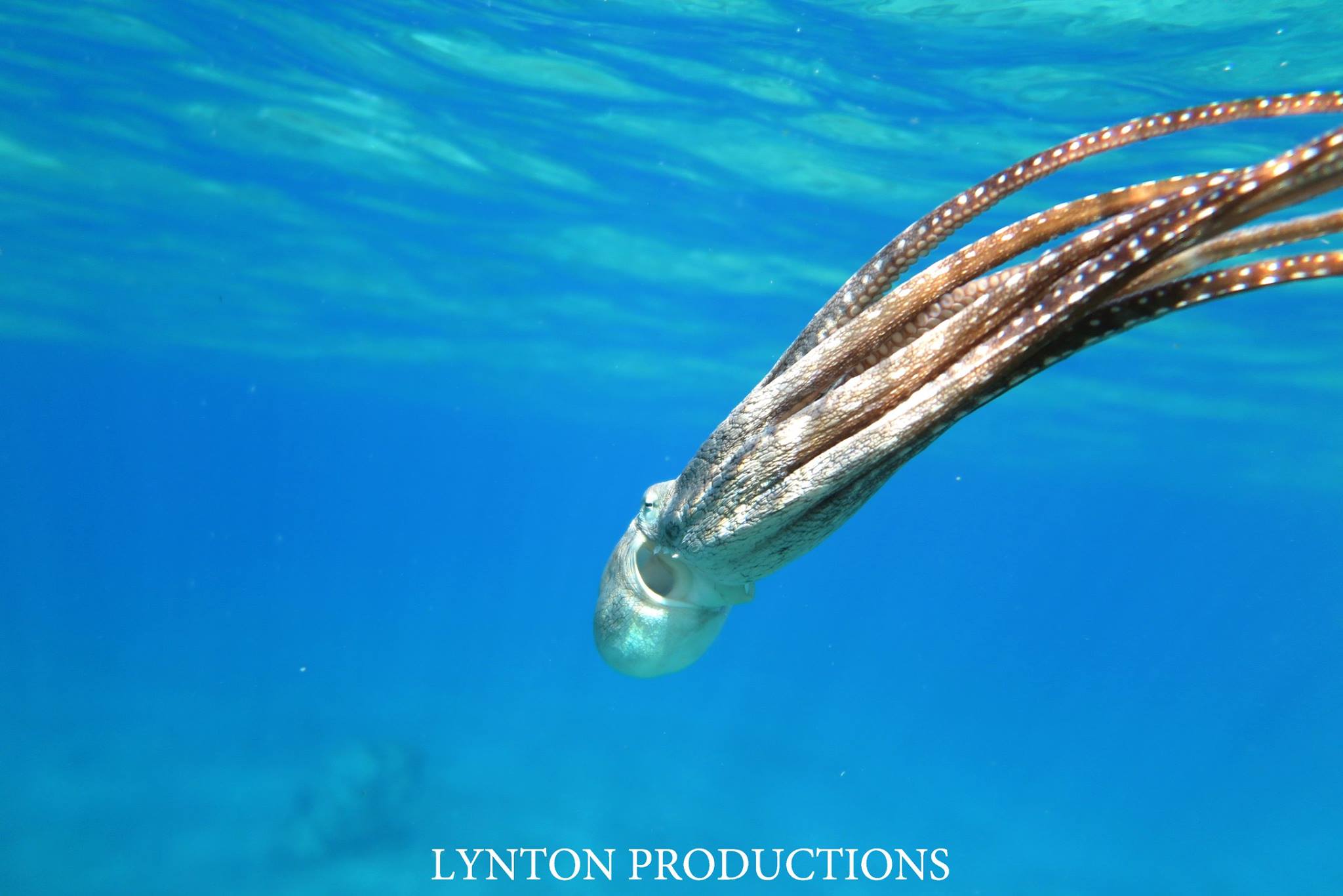
Image: Aaron Lynton
Alerts
A Small Craft Advisory is posted through Monday at 6 a.m. for winds up to 30 knots and seas up to 12 feet.
A Wind Advisory is posted for Kahoolawe and Lāna’i due to very strong and gusty winds. East winds from 20 to 30 mph are forecast with gusts up to 50 mph.
A Gale Warning is posted for the Alenuihaha and Pailolo channels through 6 a.m. Sunday for winds up to 35 knots and seas up to 13 feet.
A High Surf Advisory is posted for east facing shores of Maui and Molokai through 6 a.m. Monday for 6 to 8 foot faces.
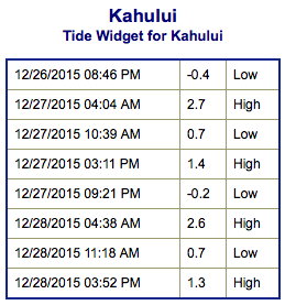
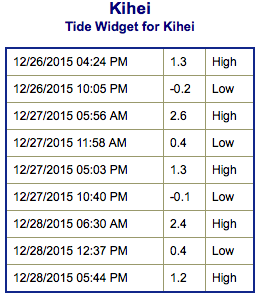
**Click directly on the images below to make them larger. Charts include: Maui County projected winds, tides, swell direction & period and expected wave heights.**
 Maui Surf Forecast
North: Wave heights are expected to build to a few feet overhead today with double overhead waves expected in the afternoon. Trade swell will also mix in at a few feet overhead.
West: Wave heights are head high today out of the northwest and knee/waist high out of the south-southwest.
South: Wave heights are knee/waist high today with sets up to chest high. Trade swell will get up to head high or more.
 A new northwest swell is forecast to fill in overnight into Sunday morning and peak in the afternoon. Another larger reinforcement is expected to build late Sunday and peak early Monday before starting an easing trend through Tuesday.
A new south-southwest is expected to build this weekend and peak Sunday into Monday around waist/chest high before fading on Tuesday.
Keep in mind, surf heights are measured on the face of the wave from trough to crest. Heights vary from beach to beach, and at the same beach, from break to break.
**Click here for your detailed Maui County weather report.**
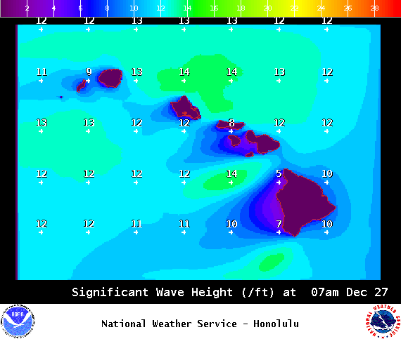
Image: NOAA /NWS

Image: NOAA /NWS
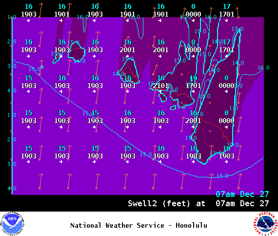
Image: NOAA /NWS
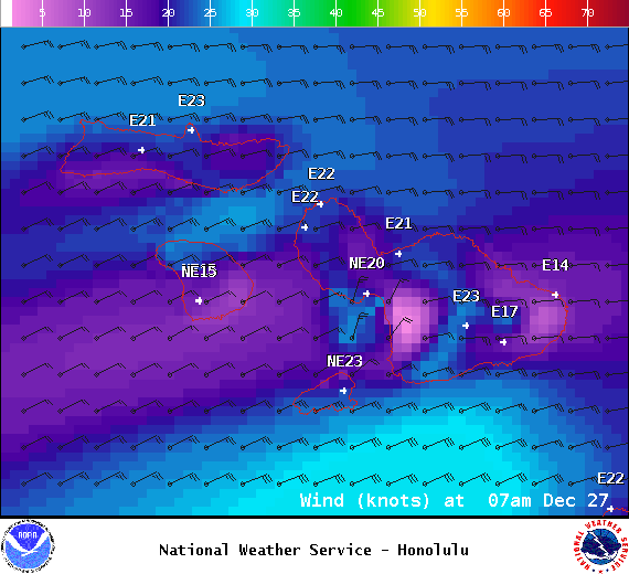
Image: NOAA /NWS

Image: NOAA /NWS
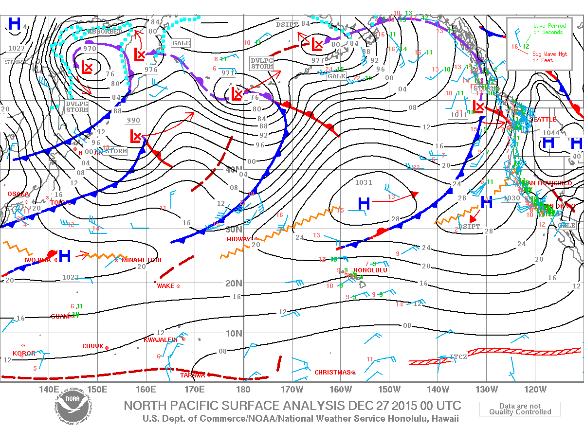
Image: NOAA /NWS
Sponsored Content


