

XL Pe’ahi Swell Expected Today
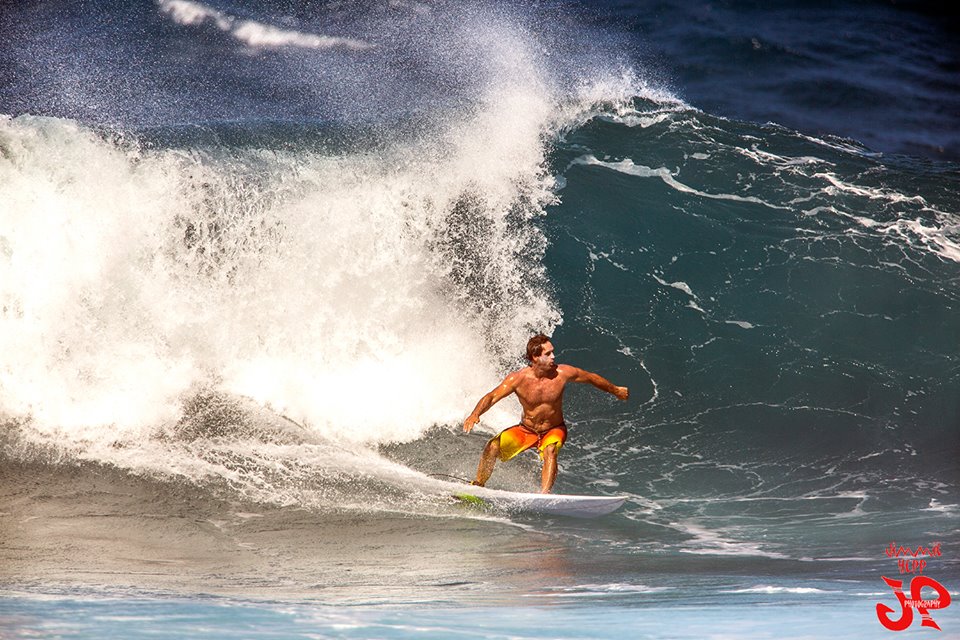
Image: Jimmie Hepp
Alerts
A High Surf Warning is posted for north and west facing shores of Molokai and the north shore of Maui through 6 p.m. Monday.
A Small Craft Advisory is in effect for all channels (except Pailolo) and windward Maui County waters through 6 p.m. Tuesday.
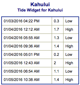
**Click directly on the images below to make them larger. Charts include: Maui County projected winds, tides, swell direction & period and expected wave heights.**
 Maui Surf Forecast
North: An extra large swell is expected to fill in and peak today. The best outer reef, deep water breaks will be 20 to 30 feet with some spots reaching up to 40 foot faces on the sets early in the day.
West: Wrap from our XL swell will bring 10 to 20 foot faces to West Maui spots that have northern exposure. Out of the south-southwest just knee high waves expected.
South: Wave heights are knee high today out of the south-southwest.
 Dangerously large west-northwest / northwest swell is expected to build with deep water breaks reaching 20 to 30 foot faces, maybe even near 40 feet for stand out outer reef breaks. The swell is forecast to peak in the morning and begin to drop in the afternoon through Tuesday.
Trade swell is expected to remain pretty small.
Our current south-southwest continues to ease through Monday.
Keep in mind, surf heights are measured on the face of the wave from trough to crest. Heights vary from beach to beach, and at the same beach, from break to break.
**Click here for your detailed Maui County weather report.**
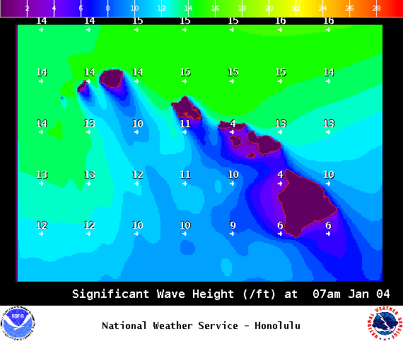
Image: NOAA / NWS
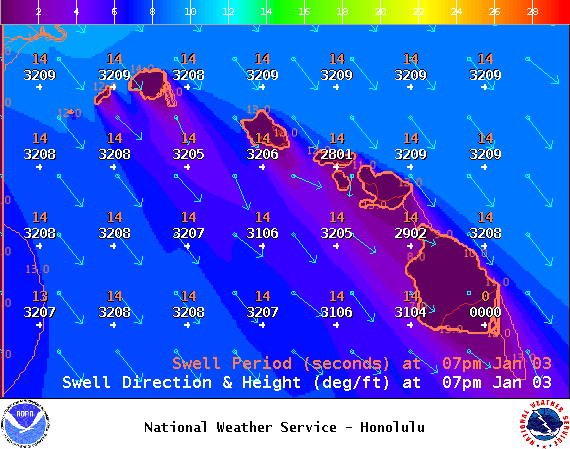
Image: NOAA / NWS

Image: NOAA / NWS

Image: NOAA / NWS

Image: NOAA / NWS
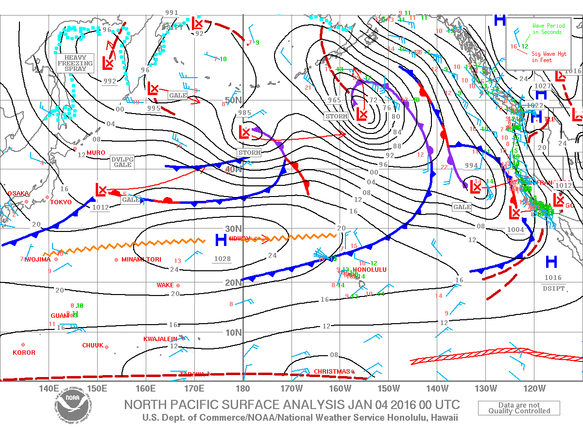
Image: NOAA / NWS
Sponsored Content


