

Large NW Swell Builds Today for Outer Reefs
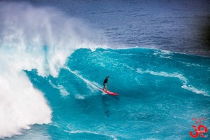
Image: Jimmie Hepp
Alerts (as of 1:00 a.m.)
There are no marine alerts posted at this time.
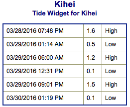
**Click directly on the images below to make them larger. Charts include: Maui County projected winds, tides, swell direction & period and expected wave heights.**
 Maui Surf Forecast
North: Wave heights are expected to rise through the day with exposed spots getting up to double overhead by sundown. The best deep water breaks could get up to triple overhead or more.
West: Ankle/knee high surf is expected. Pretty flat for most spots. Breaks catching the wrap could get up to double overhead or more.
South: Surf is ankle/knee high today.
 A small long period south-southwest is expected to fill in Tuesday and peak Wednesday up to about shoulder high. Nothing promising out of the SPAC anytime soon.
Tuesday into Wednesday a large northwest swell is forecast to fill in. Wednesday morning the swell should peak for deep water outer reef breaks around 35 foot faces or perhaps more. Models are showing another northwest swell around April 6th. Will keep an eye on the progress.
Keep in mind, surf heights are measured on the face of the wave from trough to crest. Heights vary from beach to beach, and at the same beach, from break to break.
**Click here for your detailed Maui County weather report.**
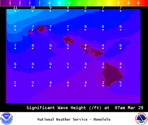
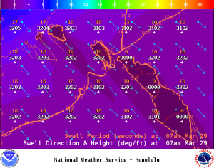
Image: NOAA / NWS
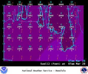
Image: NOAA / NWS
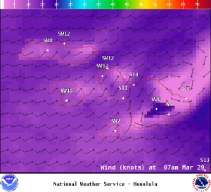
Image: NOAA / NWS
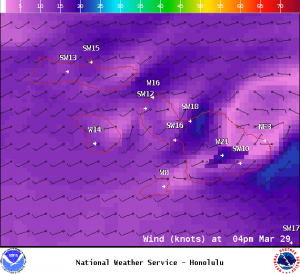
Image: NOAA / NWS
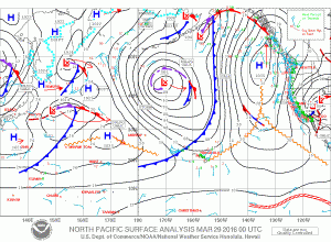
Image: NOAA / NWS
Sponsored Content


