

NW Bump Expected, Minimal SSW Today

Image: Chris Archer / Mākena
Alerts (as of 1:00 a.m.)
There are no weather alerts posted at this time.
**Click directly on the images below to make them larger. Charts include: Maui County projected winds, tides, swell direction & period and expected wave heights.**
Maui Surf Forecast
North: Wave heights are expected to be about knee/waist high in the morning building to chest/head high by sunset.
West: Surf is pretty flat today for west shores without exposure to the swells. Exposures catching the swell will get up to knee/waist high, possibly more by the afternoon.
South: Surf is knee/waist high today.
A moderate swell is expected for Friday the 13th. This swell should peak Friday night and hold through Saturday morning before fading Saturday afternoon and into Sunday. No significant swells on the horizon out of the NPAC further out.
Southerly exposures will be waist high or less today. Middle of next week we could a moderate swell. Will keep an eye on it.
Keep in mind, surf heights are measured on the face of the wave from trough to crest. Heights vary from beach to beach, and at the same beach, from break to break.
**Click here for your detailed Maui County weather report.**

Image: NOAA / NWS
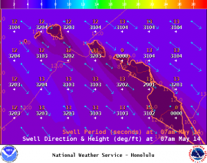
Image: NOAA / NWS

Image: NOAA / NWS

Image: NOAA / NWS

Image: NOAA / NWS
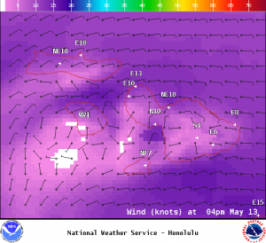
Image: NOAA / NWS
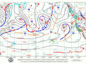
Image: NOAA / NWS
Sponsored Content


