

WNW Holds Through Morning, XL Swell Expected Soon
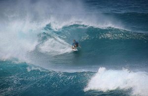
Image: John Varney
Alerts (as of 1:00 a.m.)
High Surf Advisory: North and west facing shores of Molokai and north shore of Maui through 6 a.m. Tuesday.
**Click directly on the images below to make them larger. Charts include: Maui County projected winds, tides, swell direction & period and expected wave heights.**
Maui Surf Forecast
North: Surf heights are overhead to double overhead today. The best breaks could even bigger than that on the sets, especially early in the day.
West: Surf is knee/waist high today. Spots catching the northwest will be bigger.
South: Surf is knee/waist high today.
West-northwest swell is fading some Tuesday. A reinforcing XL shot of northwest swell is expected to build on Wednesday. Thursday morning 18 to 25 foot faces are expected for the deep water breaks. This swell will start easing Thursday and through the weekend.
A small south-southwest is expected for Tuesday through Friday with a slightly bigger swell right on its heels for the weekend.
Keep in mind, surf heights are measured on the face of the wave from trough to crest. Heights vary from beach to beach, and at the same beach, from break to break.
**Click here for your detailed Maui County weather report.**
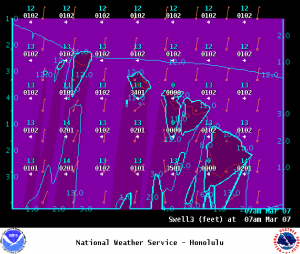
Image: NOAA
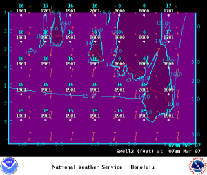
Image: NOAA
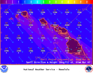
Image: NOAA
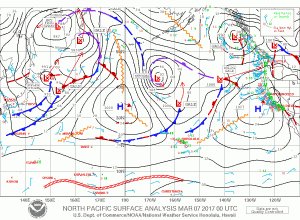
Image: NOAA
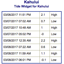
Image: NOAA
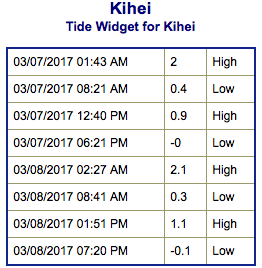
Image: NOAA
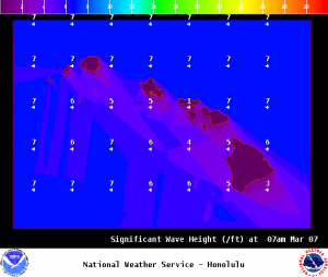
Image: NOAA
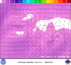
Image: NOAA
Sponsored Content


