

High Surf Warning Issued, Peʻahi Swell Expected
By Meteorologist Malika Dudley / Email: malika@mauinow.com
Alerts
Forecasters with the National Weather Service say a powerful storm off of the Kamchatka Peninsula a few days ago generated a large northwest swell that is expected to reach the Hawaiian Islands tonight, and persist through early Wednesday Morning. A HIGH SURF WARNING is posted from 9 p.m. on Monday, Nov. 10, 2014, to 6 a.m. on Wednesday, Nov. 12. The NWS says surf heights will increase to 20 to 30 feet along the north and west facing shores of Niʻihau and Kauaʻi, and along the north facing shores of Oʻahu, Maui and Molokaʻi.
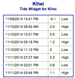
**Click directly on the images below to make them larger. Charts include: Maui County projected winds, forecasted swell direction, height & period, tides, a surface map and expected wave heights.**
Maui County Surf Forecast
North: Surf is expected overhead to possibly double overhead in the morning. Fading throughout the day to head high + by end of day.
West: Breaks that don’t catch the swells are forecasted to get smaller surf at ankle high or less. Spots that are open to the north-northwest swell will get some wrap with waves expected waist to chest high at the best breaks.
South: Ankle-slappers to possibly thigh high surf is expected.
 Our current north-northwest swell (320-345°) will gradually fade through the day.
Former super typhoon Nuri made history. After becoming extratropical and merging with a frontal system a couple of days ago, the storm became the strongest non-tropical storm ever recorded in the NPAC.
The system is expected to bring us a solid northwest swell (310-335°) building through Veteran’s day, peaking in the afternoon with 15 to 25 foot faces possible at the best exposures. A HIGH SURF WARNING will be in effect later today. Deepwater, big wave spots could possibly even see bigger waves. The swell should begin to gradually fade Wednesday morning.
 A series of northwest and north-northwest swells is expected to bring swell energy through the weekend with a couple of reinforcing swells showing up on models for early next week as well.
Small swells generated in the South Pacific are expected to bring us waves in the thigh high or less range and gradually fade through the week.
There isn’t much on the horizon out of the South Pacific.
Keep in mind, surf heights are measured on the face of the wave from trough to crest. Heights vary from beach to beach, and at the same beach, from break to break.
**Click here for Malika’s full Maui County weather report.**
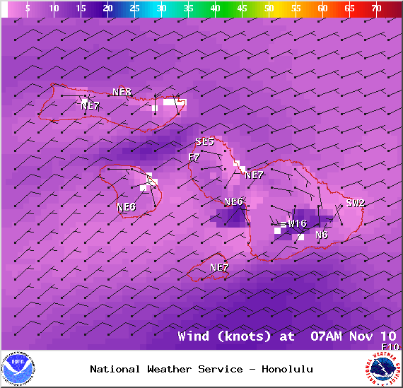
Expected winds at 7am – Image: NOAA / NWS
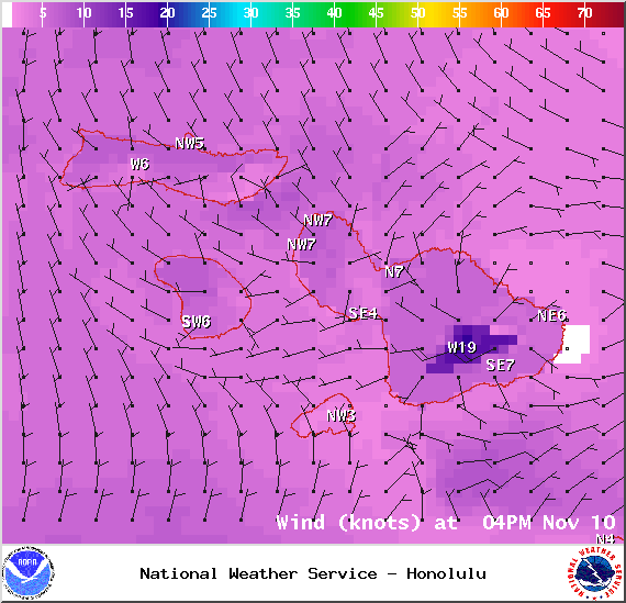
Expected winds at 4pm – Image: NOAA / NWS
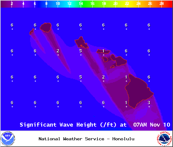
Expected swell height at 7am – Image: NOAA / NWS

swell 1 at 7am – Image: NOAA / NWS
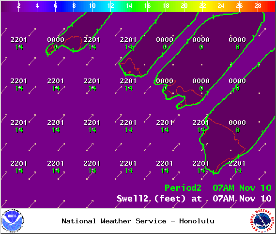
swell 2 at 7am – Image: NOAA / NWS
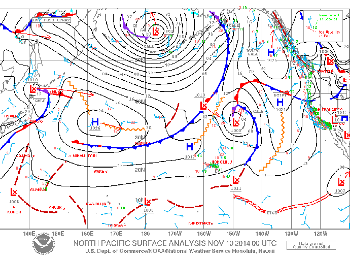
Surface map – Image: NOAA / NWS
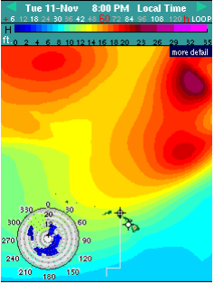
Tuesday’s Swell / Image: Surfline.com
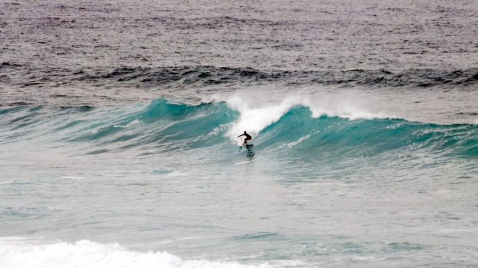
Ho’okipa Surf on Nov. 9, 2014 / Image: Asa Ellison
Sponsored Content


