

Gusty Southwest Winds, Thunderstorms Possible as Front Approaches

First sunset of 2015 / Image: Jimmie Hepp
By Meteorologist Malika Dudley / Email: malika@mauinow.com
Alerts
Click HERE for the latest weather alerts throughout this weather event.
**Click directly on the images below to make them larger. Charts include: Maui County high/low forecasted temperatures, projected winds, chance of cloud cover, projected localized weather conditions and expected wave heights.**
Today, Friday, January 2, 2015
Today, we expect scattered showers through the day as a front approaches. There is a chance of thunderstorms in the afternoon. Some of these thunderstorms could produce damaging winds late in the day. Locally heavy rainfall is also possible during that time. High temperatures are expected to fall in the range of 75° to 80°. Winds are out of the southwest from 15 to 25 mph and increasing to 40 mph in the afternoon with possible gusts up to 50 mph especially where winds may accelerate downslope on the windward sides.
Sunrise: 7:03 a.m.
Sunset: 5:57 p.m.
UV index at 7 (“high” exposure level)
Tonight
Windy conditions are expected with 15 to 30 mph west winds forecasted, gusting to 60 mph in some spots. Showers are likely and a chance of thunderstorms exists for windward and mauka areas. Frequent showers and a chance of thunderstorms also exists for leeward spots. Some thunderstorms could produce damaging winds and locally heavy rainfall is possible. Low temperatures from 68° to 73° degrees.
Moonrise: 4:17 p.m.
Moonset: 5:42 a.m. on Jan. 3
Next Full Moon: Jan. 4 at 6:54 p.m.
Next New Moon: Jan. 20 at 3:14 a.m.
Looking Ahead
Friday a strong cold front is expected to sweep down the island chain. Gusty southwest winds will increase Friday afternoon ahead of the front with heavy rain, thunderstorms and potentially damaging winds along the front. The front is expected to pass over Kauai Friday evening, Oahu and Maui county Friday night, and the Big Island Saturday morning. The front is expected to move quickly, at about 25 mph, so the threat for flooding is greatly reduced but can’t be ruled out. The greatest threat for damage comes from the winds. Cool and dry weather is expected after the front passes.
Almanac for Kahului Airport
Maximum Temperature for today:
Normal 81°
Record 89° / Set in 1956
Minimum Temperature for today:
Normal 64°
Record 54° / Set in 1971
**Click here for your detailed Maui County surf report.**
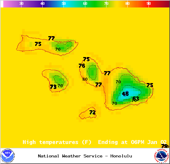
Image: NOAA / NWS
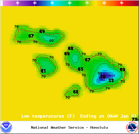
Image: NOAA / NWS

Image: NOAA / NWS
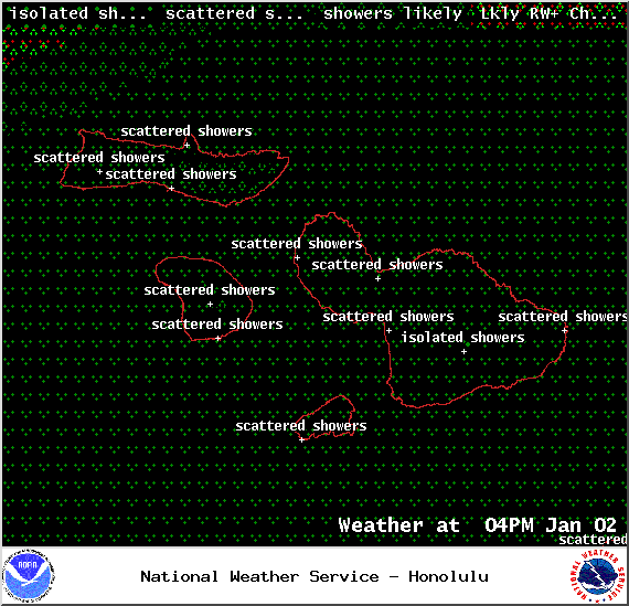
Image: NOAA / NWS

Image: NOAA / NWS
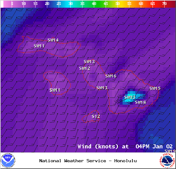
Image: NOAA / NWS
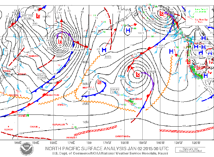
Image: NOAA / NWS
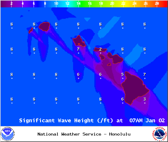
Image: NOAA / NWS

Image: NOAA / NWS
Sponsored Content


