

Pe’ahi Size Swell Expected
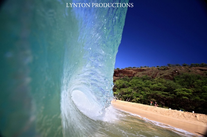
Mākena / Image: Chris Archer
By Meteorologist Malika Dudley / Email: malika@mauinow.com
Alerts
A High Surf Warning will go into effect at 4:00 p.m. today for rapidly building surf along the north facing shores of Moloka’i and Maui (25 to 35 foot faces) and the west side of Moloka’i (15 to 25 feet).
A Small Craft Advisory is posted for all Maui County waters (except Māʻalaea Bay) through 6:00 p.m. Tuesday for southwest winds of 20 to 30 knots and rough seas up to 17 feet.
**Click directly on the images below to make them larger. Charts include: Maui County projected winds, forecasted swell direction, height & period, tides, a surface map and expected wave heights.**
 Maui County Surf Forecast
North: Surf heights are expected head high to overhead early today. The best breaks open to the swell will be even bigger, especially late in the day. An increasing trend in the afternoon is likely to bring warning level wave heights.
West: Spots open to the north could see wave heights of about waist to head high by sunset. Otherwise, breaks that don’t catch the swells, and / or are shadowed from them, are forecasted to get smaller surf at ankle to knee high.
South: Choppy and sloppy southwest wind chop swell from ankle to thigh high.
 Our current swell is fading Monday, however a high surf warning will go into effect as another large northwest swell builds Monday afternoon. The large surf will peak on Tuesday morning and remain near or above warning levels through Wednesday. Double to triple overhead waves are expected by sunset on Monday. Tuesday, 20 to 25 foot faces are expected with the deep water breaks (likes Pe’ahi ‘Jaws’) at 30 foot faces or more.
If models are correct and the storm behaves as expected, a second pulse is expected Thursday.
Nothing to get excited about out of the SPAC. A recent storm near New Zealand is expected to bring some fun knee to chest high waves for southern exposures late this week.
Keep in mind, surf heights are measured on the face of the wave from trough to crest. Heights vary from beach to beach, and at the same beach, from break to break.
**Click here for your detailed Maui County weather report.**
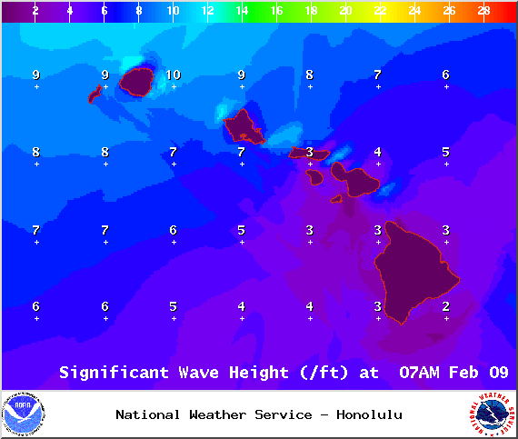
Image: NOAA / NWS

Image: NOAA / NWS
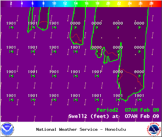
Image: NOAA / NWS
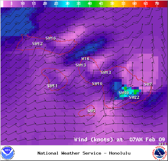
Image: NOAA / NWS
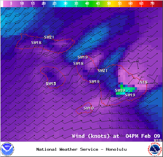
Image: NOAA / NWS
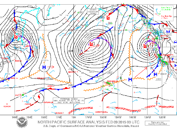
Image: NOAA / NWS
Sponsored Content


