

New NW Swell Builds Late Today
Mākena / Image: Hokuloa Pezel
By Meteorologist Malika Dudley / Email: malika@mauinow.com
Alerts
A Small Craft Advisory is posted for the Pailolo and ʻAlenuihāhā channels as well as Māʻalaea Bay through 6:00 a.m. Wednesday. East winds up to 25 knots and rough seas up to 10 feet are forecasted. Inexperienced mariners should avoid navigating in these conditions.
**Click directly on the images below to make them larger. Charts include: Maui County projected winds, forecasted swell direction, height & period, tides, a surface map and expected wave heights.**
 Maui County Surf Forecast
North: Wave heights start out about waist high. The best breaks are expected to reach head high to overhead by sunset.
West: Wave heights start out flat and build to about chest high at the breaks open to the northwest swell. Otherwise, pretty flat conditions are expected today.
South: Ankle to knee high waves are expected today.
 A solid northwest swell is expected to build for the northeast coast Wednesday afternoon and overnight. The swell is forecasted to peak mid day Thursday and slowly fade out Friday into the weekend. Best spots are expected to be double overhead or more at the peak.
A reinforcing northwest is expected to move in Sunday.
Small south-southwest reinforcement swell keeps wave heights steady Wednesday and Thursday. Otherwise, nothing much on the horizon out of the South Pacific.
Keep in mind, surf heights are measured on the face of the wave from trough to crest. Heights vary from beach to beach, and at the same beach, from break to break.
**Click here for your detailed Maui County weather report.**
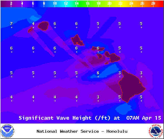
Image: NOAA / NWS
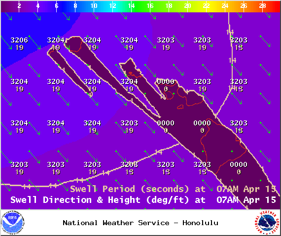
Image: NOAA / NWS
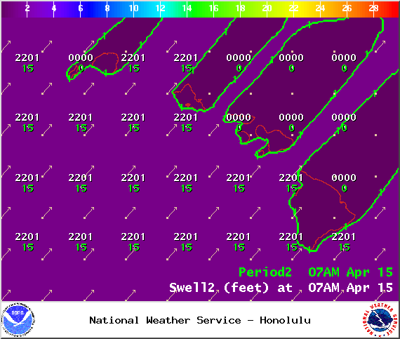
Image: NOAA / NWS

Image: NOAA / NWS
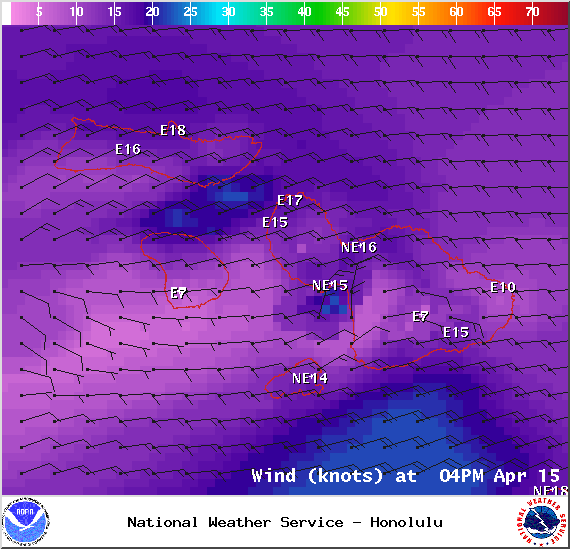
Image: NOAA / NWS
Image: NOAA / NWS
Sponsored Content


