

Two 3+ Magnitude Hawaiʻi Island Earthquakes
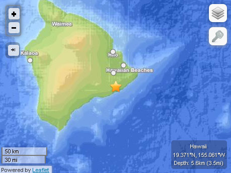
Hawaiʻi Island earthquake, 12/9/13. Map courtesy USGS, powered by Leaflet.
By Wendy Osher
A 3.0 magnitude earthquake was reported early this morning, about 9 miles South of Fern Acres on Hawaiʻi Island, at a depth of 3.5 miles, according to the Hawaiian Volcano Observatory.
The incident was reported at 2:29 a.m. on Monday, Dec. 9, 2013.
There were no immediate advisories issued for the event.
The USGS reports that other locations near the epicenter of the included: 3.5 miles SE of Puʻu ʻOʻo Crater; 5.5 miles WNW of Kalapana; and 8.1 miles NE of Kaʻena Point.
The quake comes on the heels of a larger 3.8 earthquake reported at 10:27 p.m.on Saturday, Dec. 7, about 8 miles ESE of Kailua-Kona.
The USGS reports the earthquake occurred at a depth of 9.3 miles, and was near the following locations: 6.1 miles ESE of Hōlualoa; 6.9 miles S of Hualālai Summit; and 7.6 miles NE of Captain Cook on Hawaiʻi Island.
Sponsored Content


