

Malika Dudley’s Maui County Forecast (10/24/14)
By Meteorologist Malika Dudley / Email: [email protected]
**A breakdown of expected conditions specific to Maui County is presented below in graphical form. High and low temperatures, swell, percent chance of clouds / rain and wind conditions are each depicted. All graphics are provided by the National Weather Service in Honolulu.**

Nākālele Blowhole / Image: Malika Dudley
Alerts
There are no alerts posted for Maui County at this time.
Today
We expect some relief from the muggy conditions today! Trade winds have picked up out of the northeast from 10 to 20 mph. Showers are expected to ride in on our winds impacting windward and mauka areas through about noon today.
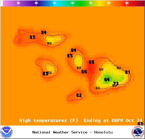
Map of expected high temperatures in Maui County on Friday October 24, 2014 / Image: NOAA / NWS
We could see some of that moisture pushing into leeward spots as well from time to time. Partly to mostly cloudy skies are expected with fewer clouds and showers expected in the afternoon. High temperatures should fall in the range of 84° to 89° with higher elevations experiencing lower temperatures overall.
Sunrise: 6:25 a.m.
Sunset: 5:55 p.m.
UV index at 8 (“very high” exposure level)
Tonight
Tonight we expect partly cloudy skies with scattered windward and mauka showers. If leeward sides get any moisture it will be light and in isolated brief batches. Low temperatures should fall in the range of 73° to 78° and trade winds are expected from 5 to 15 mph.
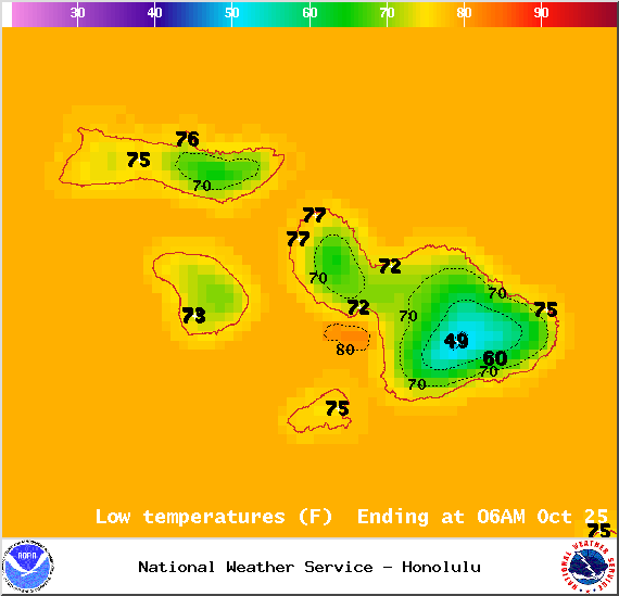
Map of expected overnight low temperatures in Maui County on Friday October 24, 2014 / Image: NOAA / NWS
Looking Ahead
Ana is expected to merge with a north Pacific low on Saturday which will push our trade wind producing high farther away. That means we expect lighter ESE winds by Saturday afternoon and through early next week. Late each day, showers are likely to be more active than usual as a deep pocket of moisture comes into the area. It’s still far out, so confidence in this scenario is not high, but trade winds could make a return to the Aloha State by Wednesday or Thursday.
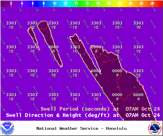
Swell map for Friday October 24, 2014 / Image: NOAA / NWS
Surf & Seas
Our current north-northwest swell (320-360°) peaks and is expected to fade through the weekend. We expect surf heights in the knee to possibly head high range at the best exposures. On Maui, showing strongest for Hoʻokipa eastward. A potential swell for West Maui is partially blocked by Molokaʻi, so small ankle slappers are expected on that side. A small to moderate reinforcing north swell should arrive late Saturday bringing shoulder to head high waves on the sets by sundown.
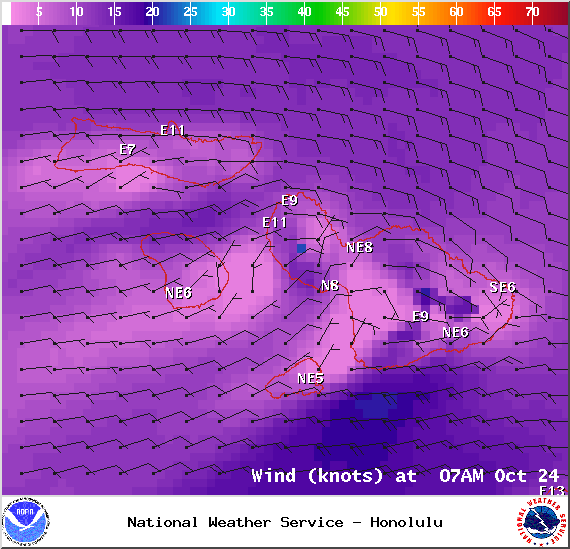
Map of expected wind conditions in Maui County at 7am on Friday October 24, 2014 / Image: NOAA / NWS
Our small south-southwest (200-190°) swell is lingering offering ankle to possibly waist high waves at our best exposed shores. This swell is expected to start fading Saturday dropping down to trace amounts by the weekend. Another small boost is expected by mid-week offering knee to waist high surf at best exposures.
If ANA continues on its current forecast track the remnants of ANA are expected to merge with a storm to our north. If that happens we may see some swell generated from “ANA” early next week. Otherwise, ANA is not looking to be a big swell producer.
All shores will be below advisory levels with surf heights.
Keep in mind, surf heights are measured on the face of the wave from trough to crest. Heights vary from beach to beach, and at the same beach, from break to break.
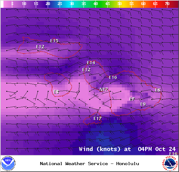
Map of expected wind conditions in Maui County at 4pm on Friday October 24, 2014 / Image: NOAA / NWS
Almanac for Kahului Airport
Maximum Temperature for today:
Normal 86°
Record 93° / Set in 1984
Minimum Temperature for today:
Normal 69°
Record 60° / Set in 1953
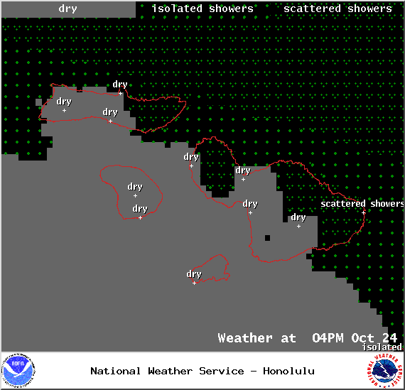
Map of expected weather conditions in Maui County at 4pm on Friday October 24, 2014 / Image: NOAA / NWS
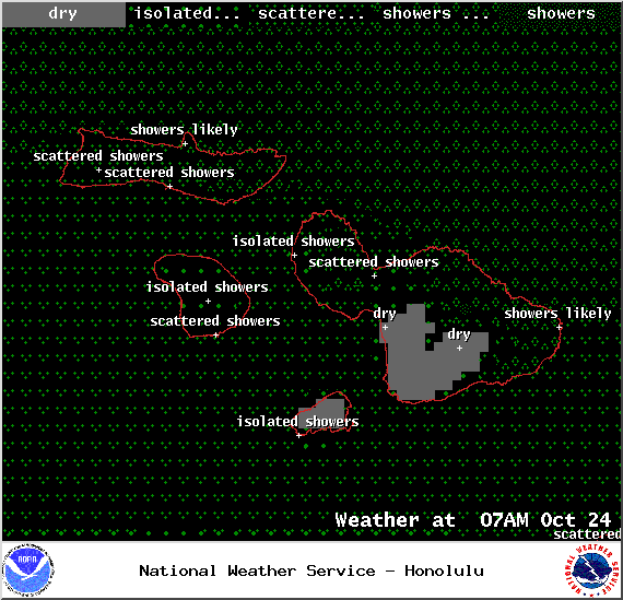
Map of expected weather conditions in Maui County at 7am on Friday October 24, 2014 / Image: NOAA / NWS

Map of expected cloud cover in Maui County at 7am on Friday October 24, 2014 / Image: NOAA / NWS
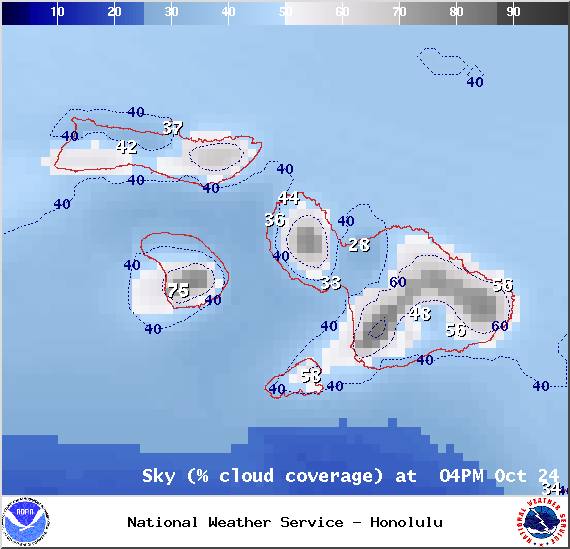
Map of expected cloud cover in Maui County at 4pm on Friday October 24, 2014 / Image: NOAA / NWS
Sponsored Content


