

High Surf Advisory Posted, Double Overhead Surf Expected
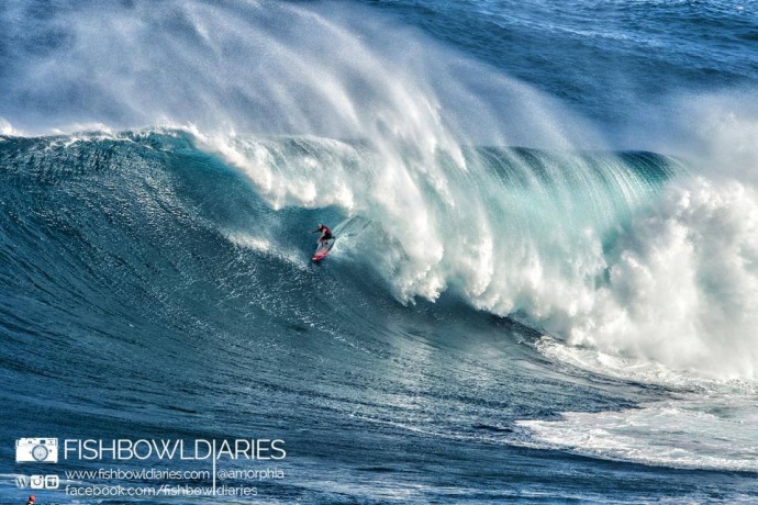
Shane Dorian at Pe’ahi “Jaws” / Image: Sophie Louca Fish Bowl Diaries
By Meteorologist Malika Dudley / Email: malika@mauinow.com
Alerts
The National Weather Service has extended the High Surf Advisory for the west side of Molokaʻi and the north shores of both Maui and Molokaʻi until Friday at 6 p.m.
Expect strong breaking waves, shore break and strong longshore and rip currents making swimming difficult and dangerous.
**Click directly on the images below to make them larger. Charts include: Maui County projected winds, forecasted swell direction, height & period, tides, a surface map and expected wave heights.**
Maui County Surf Forecast, Friday November 14, 2014
North: Surf is expected to remain elevated for the north shores of Maui and Molokaʻi. We could see overhead to double overhead waves up to 15 foot faces at the best breaks exposed to the swell.
West: Breaks that don’t catch the swell are forecasted to get smaller surf at knee high or smaller. Spots that are open to the north-northwest swell will get some wrap with waves expected overhead or even well overhead at the best breaks.
South: Ankle-slappers to flat surf conditions are expected.
A new north-northwest swell (325-350°) has filled in on top of the old one, expected to elevate surf to double overhead at the best breaks, maybe even some plusses on the sets.
Saturday the swell will start to fade. That trend is expected to continue through Sunday.
The next swell on the horizon is expected to arrive Monday afternoon. A storm near the Aleutians is expected to develop and generate the new north-northwest swell (330-350°). If so, we could see another round of overhead to double overhead surf for the best breaks along the north coasts of Maui and Molokaʻi.
Super small trace amounts of swell expected out of the SPAC. There isn’t much on the horizon out of the South Pacific.
Keep in mind, surf heights are measured on the face of the wave from trough to crest. Heights vary from beach to beach, and at the same beach, from break to break.
**Click here for your detailed Maui County weather report.**
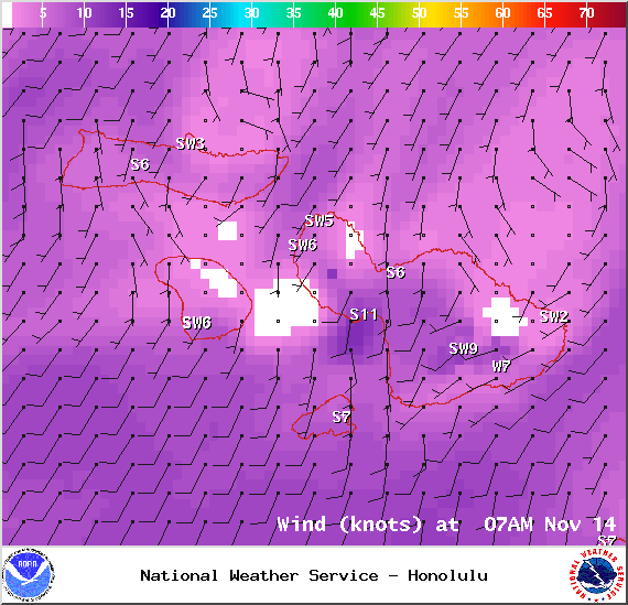
Winds at 7am – Image: NOAA / NWS
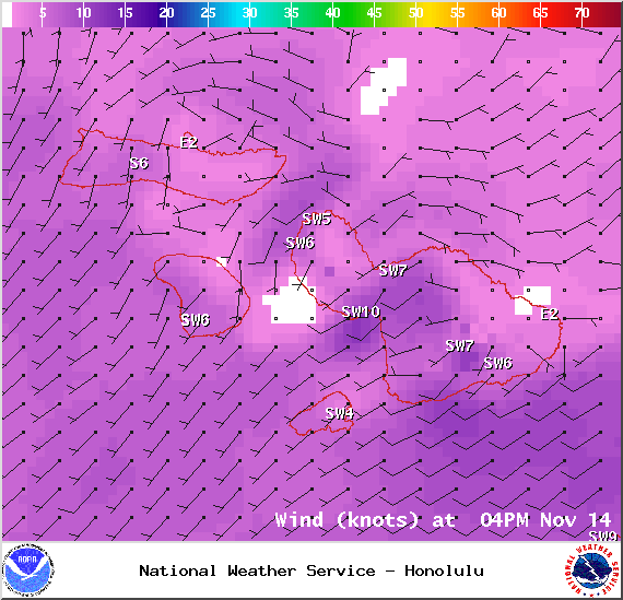
Winds at 4pm – Image: NOAA / NWS
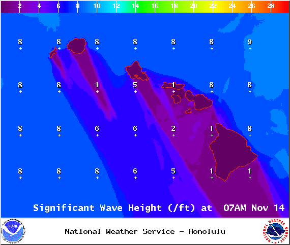
Significant Wave Height 7am – Image: NOAA / NWS
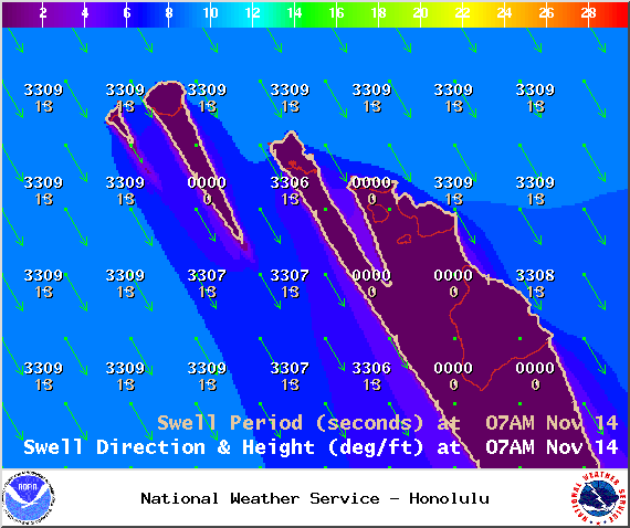
Image: NOAA / NWS
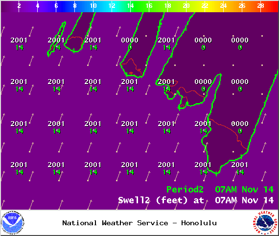
Image: NOAA / NWS
Sponsored Content


