Front Expected to Bring Showers This Weekend
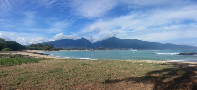
West Maui Mountains / Image: Asa Ellison
By Meteorologist Malika Dudley / Email: malika@mauinow.com
Alerts
There are no alerts posted at this time.
**Click directly on the images below to make them larger. Charts include: Maui County high/low forecasted temperatures, projected winds, chance of cloud cover, projected localized weather conditions and expected wave heights.**
Today, Saturday November 15, 2014
Today we expect partly sunny skies and the possibility of scattered showers. High temperatures should fall in the range of 84° to 89° with highs from 67 – 71° at 5000 feet. Winds are expected to be westerly from 5 to 15 mph.
Sunrise: 6:36 a.m.
Sunset: 5:45 p.m.
UV index at 7 (“high” exposure level)
Tonight
Tonight we expect partly cloudy skies with scattered windward and mauka showers in the evening then isolated showers after midnight. Leeward spots should get isolated showers throughout the night. Variable winds up to 15 mph are forecasted. Low temperatures should fall in the range of 67° to 72° with a low of about 48° at 5000 feet.
Moonset: 1:28 p.m.
Moonrise: 1:36 a.m. on Nov. 16
Next New Moon: Nov. 22, 2014 at 2:33 a.m.
Next Full Moon: Dec. 6 at 2:27 a.m.
The Leonid meteor shower is currently active. For details on the show in the sky click here.
Looking Ahead
Southwest winds are expected to spread over Maui County through the day today as a weak cold front pushes toward us out of the northwest. The front is expected to reach Kauaʻi Saturday and move down the island chain Saturday night through Sunday. Isolated thunderstorms are possible ahead of the front. Cooler, drier conditions and breezy winds are expected to fill in behind the front.
Almanac for Kahului Airport
Maximum Temperature for today:
Normal 84°
Record 90° / Set in 1977 and tied in 1991
Minimum Temperature for today:
Normal 68°
Record 59° / Set in 1949
**Click here for your detailed Maui County surf report.**
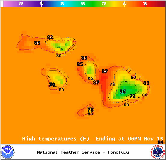
Image: NOAA / NWS
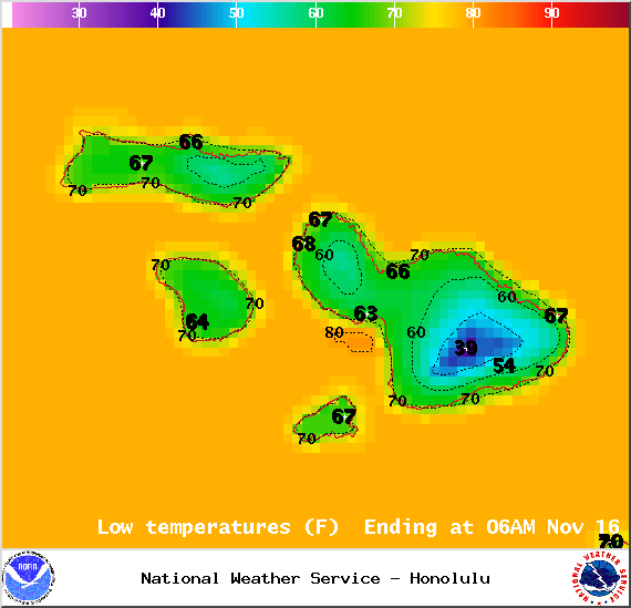
Image: NOAA / NWS
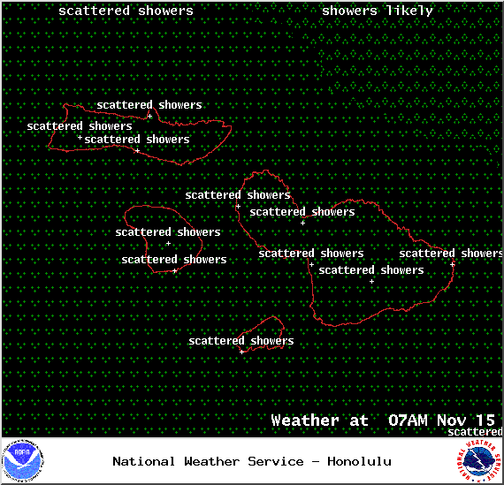
Weather at 7am – Image: NOAA / NWS
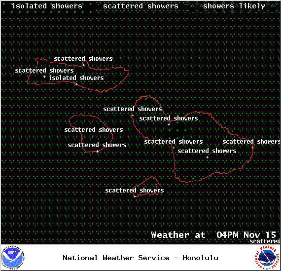
Weather at 4pm – Image: NOAA / NWS
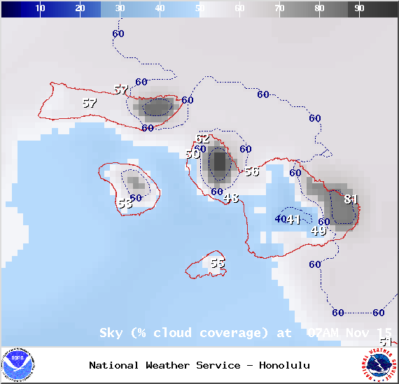
Chance of cloud cover at 7am – Image: NOAA / NWS
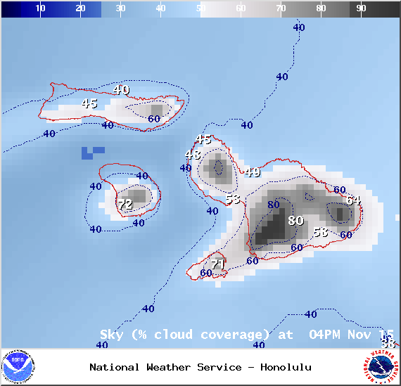
Chance of cloud cover at 4pm – Image: NOAA / NWS
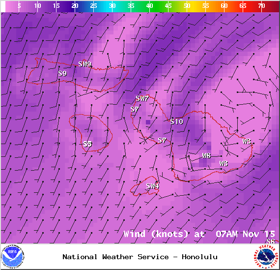
Winds at 7am – Image: NOAA / NWS
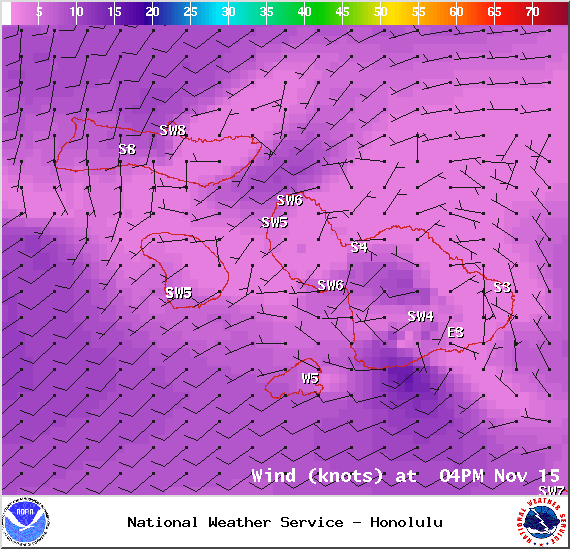
Winds at 4pm – Image: NOAA / NWS
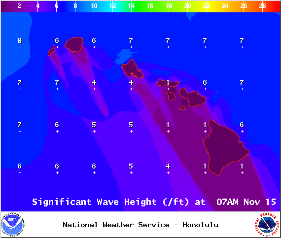
Swell height 7am – Image: NOAA / NWS
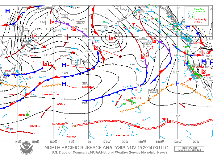
Surface Map – Image: NOAA / NWS
Sponsored Content