

NNW Fades, WNW Builds Late
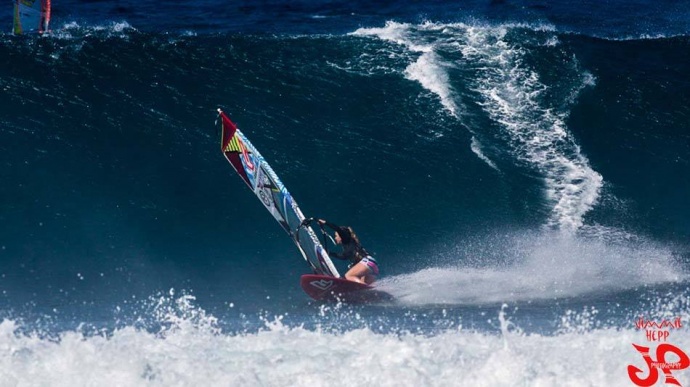
Ho’okipa Wind Surfing Yesterday / Image: Jimmie Hepp
Alerts
The Small Craft Advisory has been extended to Thursday at 6 a.m. for Maui County waters, the Pailolo Channel, Māʻalaea Bay and the ʻAlenuihāhā Channel. Winds of 25 to 30 knots are expected out of the northeast and seas up to 14 feet. Inexperienced mariners should avoid navigating in these conditions.
**Click directly on the images below to make them larger. Charts include: Maui County projected winds, forecasted swell direction, height & period, tides, a surface map and expected wave heights.**
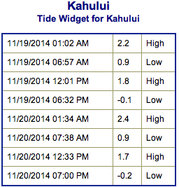 Maui County Surf Forecast, Wednesday November 19, 2014
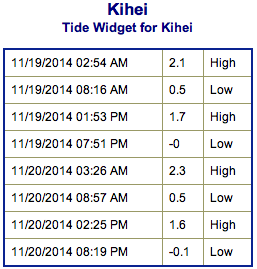
North: Surf is expected head high to possibly a couple feet overhead early in the day for the best spots on Molokaʻi and Maui’s northern exposures. Surf heights will fade as the day goes on.
West: Breaks that don’t catch the swell are forecasted to get smaller surf at ankle high or flat. Spots that are open to the north-northwest swell will get some wrap with waves expected shoulder high at the best breaks early on and fading through the day.
South: A small southwest will bring wave heights up to 3 foot faces to the best breaks but it’ll be inconsistent.
 Our current north-northwest swell (330-350°) is expected to continue to fade today. Another, but slightly smaller west-northwest swell (300-330°) is expected to slowly build late today and peak on Thursday holding through Friday. Expected wave heights east of Hoʻokipa may get surf several feet overhead as the swell peaks. Spots west of Hoʻokipa will be in the shadow of Molokaʻi.
Our current small bump (220-190°) is expected to be waist high or less at the best breaks Wednesday through Friday. Otherwise, super small trace amounts of swell expected out of the SPAC. There isn’t much on the horizon to get excited about.
**Click here for your detailed Maui County weather report.**
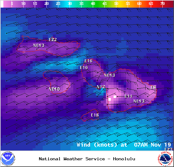
Wind Conditions at 7am – Image: NOAA / NWS
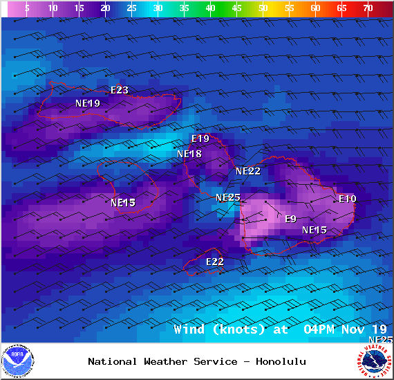
Wind Conditions at 4pm – Image: NOAA / NWS
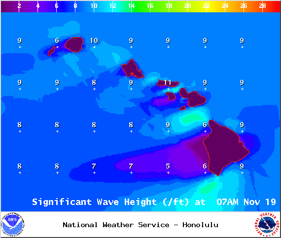
Swell Heights at 7am – Image: NOAA / NWS
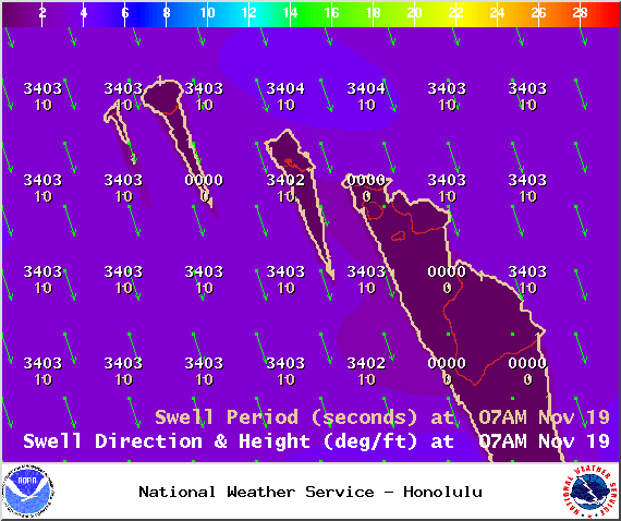
Swell 1 at 7am – Image: NOAA / NWS

Swell 2 at 7am – Image: NOAA / NWS
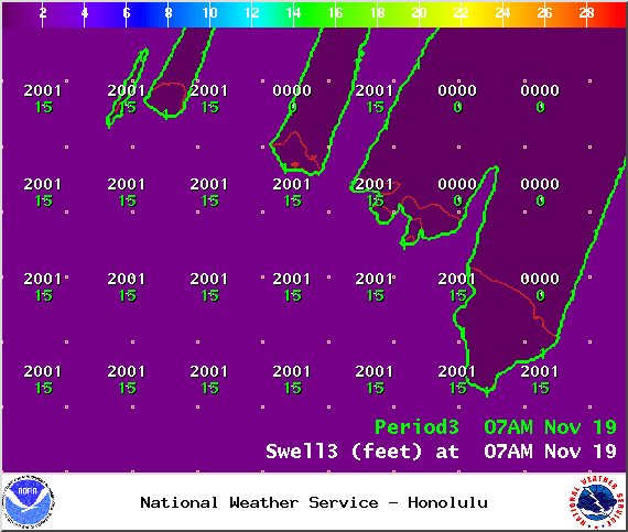
Swell 3 at 7am – Image: NOAA / NWS
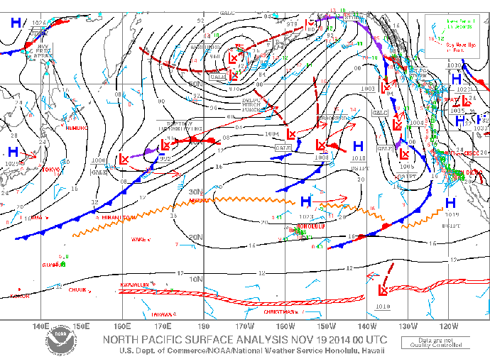
Surface Map – Image: NOAA / NWS
Sponsored Content


