

Series of North Swells Expected

Ho’okipa wind surfing 11/21/14 / Image: Jimmie Hepp
By Meteorologist Malika Dudley
Alerts
A Small Craft Advisory is posted for the ʻAlenuihāhā channel until 6 p.m. Winds up to 25 knots are expected out of the east and rough seas up to 10 feet. Inexperienced mariners should avoid navigating in these conditions.
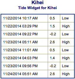
**Click directly on the images below to make them larger. Charts include: Maui County projected winds, forecasted swell direction, height & period, tides, a surface map and expected wave heights.**
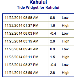 Maui County Surf Forecast, Saturday November 22, 2014
North: Surf is expected shoulder high to possibly a couple feet overhead for the best spots on Molokaʻi and Maui’s northern exposures.
West: Spots that are open to the north-northwest swell will get some wrap with waves expected thigh high or less. Breaks that don’t catch the swell are forecasted to get smaller surf at ankle high or flat.
South: A small southwest will bring wave heights up to 3 foot faces to the best breaks but it’ll be inconsistent. Spots exposed to the trade swell may get a little action as well.
Our current west-northwest swell (300-330°) is expected to hold through today. Best exposed are forecasted to get head high to slightly overhead waves through today before slowly weakening Sunday. This swell is showing best from Hoʻokipa eastward.
 Another northwest swell (305-330°) is expected to build through the day on Sunday. We could see wave heights starting out overhead to well overhead early on and building to double overhead or more by sundown. Models are also showing a reinforcing swell Monday and another north swell for the middle of next week.
Our current small bump (220-190°) is expected to be thigh high or less at the best breaks and continuing to fade through the weekend. Otherwise, super small trace amounts of swell expected out of the SPAC. There isn’t much on the horizon to get excited about.
**Click here for your detailed Maui County weather report.**
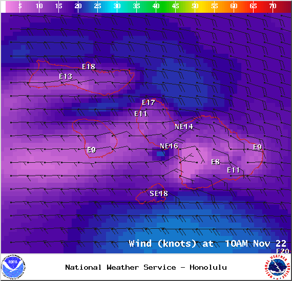
Image: NOAA / NWS

Image: NOAA / NWS
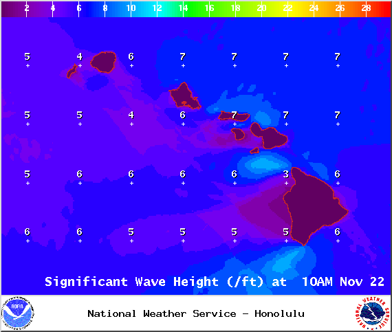
Image: NOAA / NWS

Image: NOAA / NWS

Image: NOAA / NWS
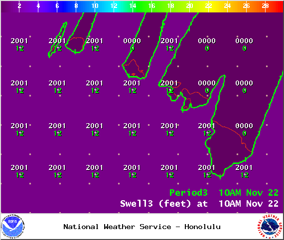
Image: NOAA / NWS
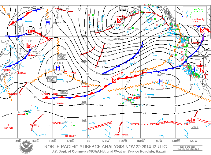
Image: NOAA / NWS
Sponsored Content


