Gusty Winds, Thunderstorms, Heavy Rain Possible Today

Front on the way / Image: Asa Ellison
By Meteorologist Malika Dudley / Email: malika@mauinow.com
Alerts
Throughout the current weather event, all weather alerts will be posted HERE.
**Click directly on the images below to make them larger. Charts include: Maui County high/low forecasted temperatures, projected winds, chance of cloud cover, projected localized weather conditions and expected wave heights.**
Today, Tuesday, December 23, 2014
Gusty conditions are expected today with northeast winds from 15 to 25 mph with gusts to 40 mph. Showers and thunderstorms are likely for windward and mauka areas with scattered showers and thunderstorms also possible in leeward areas. Locally heavy rainfall is also a possibility. High temperatures should fall in the range of 76° to 81° and around 67° at 5000 feet.
Sunrise: 6:59 a.m.
Sunset: 5:51 p.m.
UV index at 5 (“moderate” exposure level)
Tonight
Mostly cloudy skies are expected tonight in Maui County with scattered thunderstorms and showers likely in windward and mauka areas. Heavy rainfall can accompany these thunderstorms along with gusty winds. For leeward areas scattered showers are expected and thunderstorms are also possible. Winds are out of the northeast from 15 to 25 mph. Low temperatures from 66° to 71° degrees are expected with a low of about 52° at 5000 feet.
Moonset: 8:03 p.m.
Moonrise: 9:19 a.m. on Dec 24
Next Full Moon: Jan. 4 at 6:54 p.m.
Next New Moon: Jan. 20 at 3:14 a.m.
Looking Ahead
The leading edge of a slow-moving front will remain near the Big Island through today. When combined with a disturbance high in the atmosphere conditions are expected to be quite messy bringing widespread showers, strong winds, lightning, thunderstorms, hail and flooding conditions. Locally heavy showers are also possible. The threat for this potentially severe weather exists through Wednesday as the disturbance flaring up thunderstorms becomes a cutoff low and lingers in our area. The front is expected to fall apart on Tuesday but a surface low might develop which could suck moisture out of the south and up over the islands. The forecast is still a bit uncertain when it comes to the surface low developing and will be tweaked as it becomes more certain.
Almanac for Kahului Airport
Maximum Temperature for today:
Normal 81°
Record 88° / Set in 1952
Minimum Temperature for today:
Normal 64°
Record 53° / Set in 1969 and tied in 1983
**Click here for your detailed Maui County surf report.**
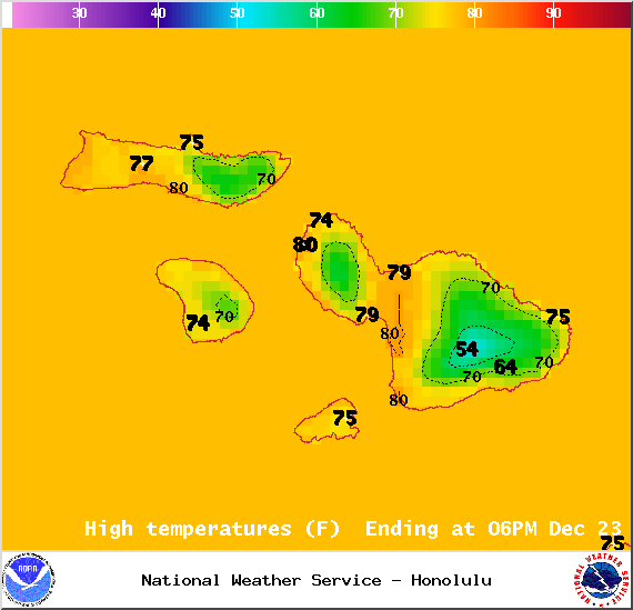
Image: NOAA / NWS

Image: NOAA / NWS
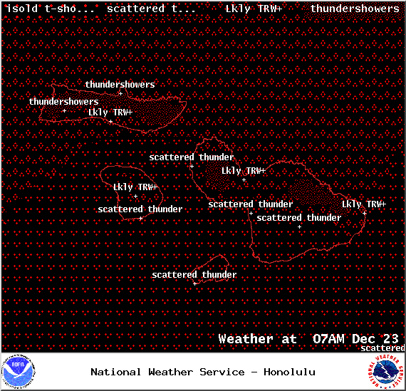
Image: NOAA / NWS
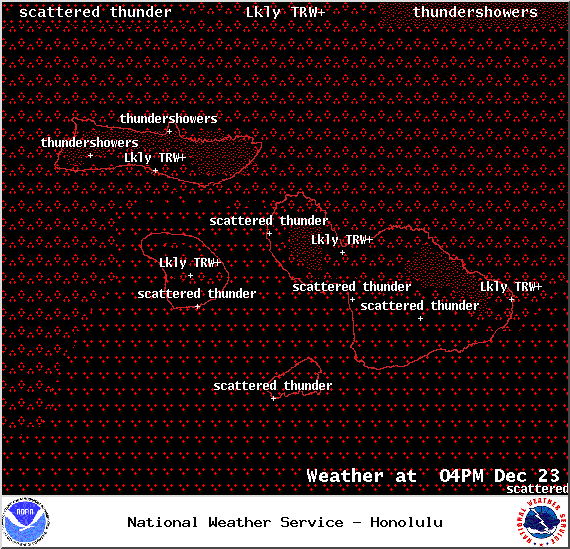
Image: NOAA / NWS
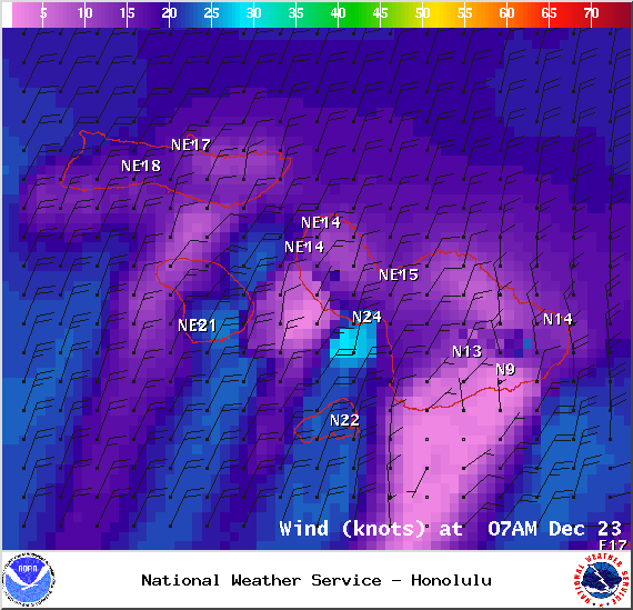
Image: NOAA / NWS
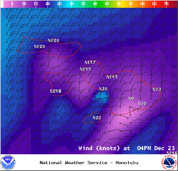
Image: NOAA / NWS
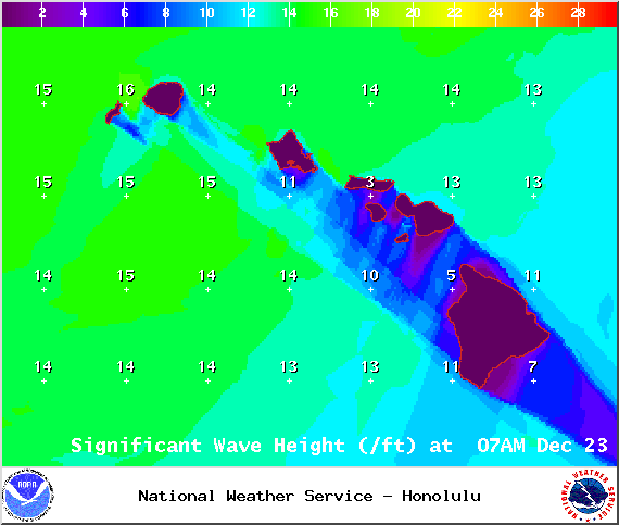
Image: NOAA / NWS
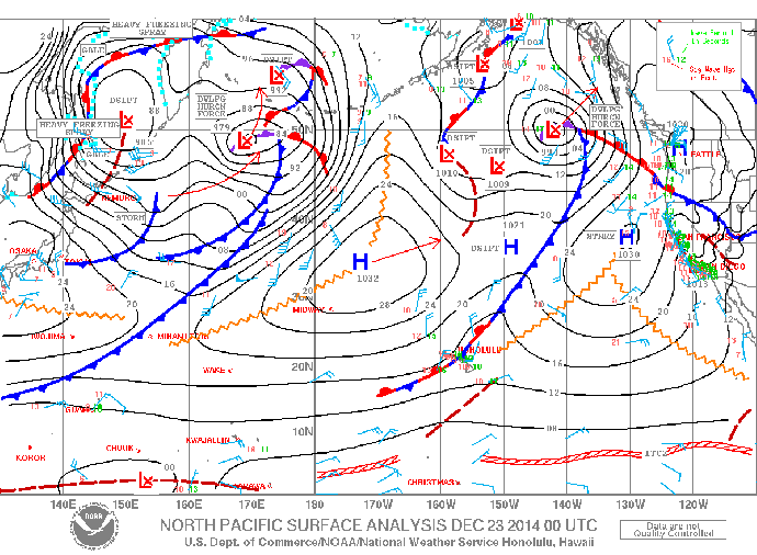
Image: NOAA / NWS
Sponsored Content