

Surf Energy Lingers Into Weekend

Maui Wind Surfers / Image: Chris Archer
By Meteorologist Malika Dudley / Email: malika@mauinow.com
Alerts
A Special Weather Statement has been issued by the National Weather Service. A strong front is expected to dig toward the Hawaiian Islands tomorrow (Friday, Jan. 2, 2014). Southwest winds will increase in the afternoon in front of the weather feature and become strong and gusty by night. Heavy rain and thunderstorms are expected as the front moves through Friday night. Strong winds, lightning and intense rainfall could occur with these thunderstorms if they become severe. While not everyone is expected to experience severe weather, the National Weather Service is asking that everyone be prepared to move indoors should intense weather appear in your area.
A Small Craft Advisory is posted for all Maui County coastal waters (excluding Mā’alaea Bay) from 6 p.m. Friday through 6 a.m. Sunday. Rough seas up to 6 to 17 feet are expected with southwest winds from 20 to 30 knots with higher gusts. Inexperienced mariners should avoid navigating in these conditions.
**Click directly on the images below to make them larger. Charts include: Maui County projected winds, forecasted swell direction, height & period, tides, a surface map and expected wave heights.**
 Maui County Surf Forecast, Friday, January 2, 2015
North: Surf heights are expected head high to a few feet overhead today at the best breaks, especially for spots east of Ho’okipa. As the day goes on, the swell is expected to fade.
West: Spots open to the swells are expected to get waves waist to head high on the sets at the best northerly breaks. Otherwise, breaks that don’t catch the swells, and / or are shadowed from them, are forecasted to get smaller surf at ankle high or flat.
South: Ankle to knee high surf is expected with a bit of wind swell in the mix today.
 A mix of north and northwest swell energy is expected through the end of the week. Energy lingers into the weekend as it fades out. Since the energy is coming from several directions, it will be a bit haphazard at times.
New overlapping swells are expected for the weekend and beyond for north and west shores. Still pending development of storms. Will keep an eye on it.
Nothing of note out of the SPAC to get excited about.
Keep in mind, surf heights are measured on the face of the wave from trough to crest. Heights vary from beach to beach, and at the same beach, from break to break.
**Click here for your detailed Maui County weather report.**
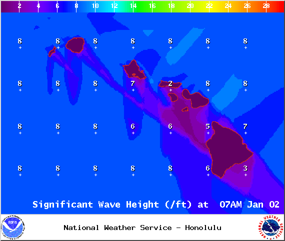
Image: NOAA / NWS
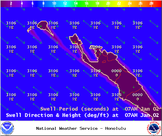
Image: NOAA / NWS
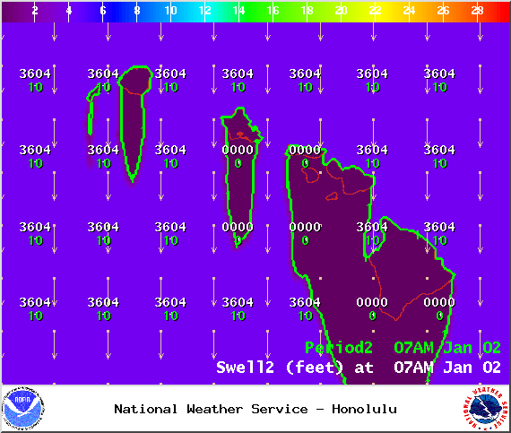
Image: NOAA / NWS

Image: NOAA / NWS
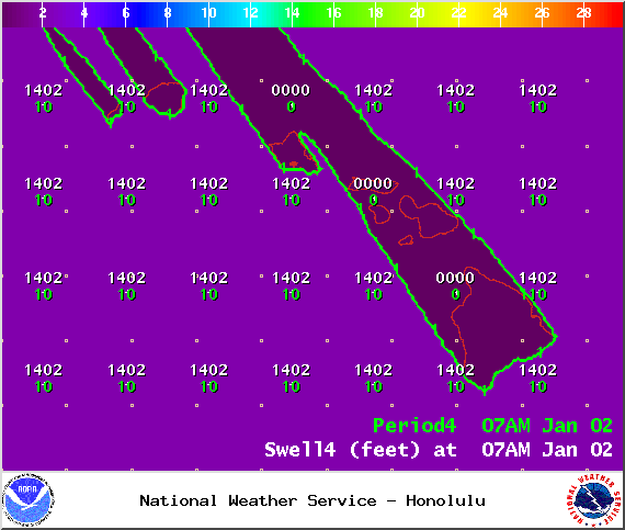
Image: NOAA / NWS
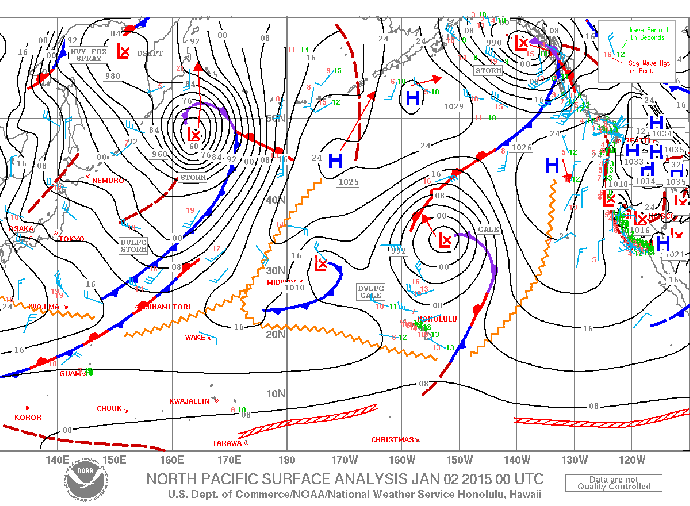
Image: NOAA / NWS

Image: NOAA / NWS
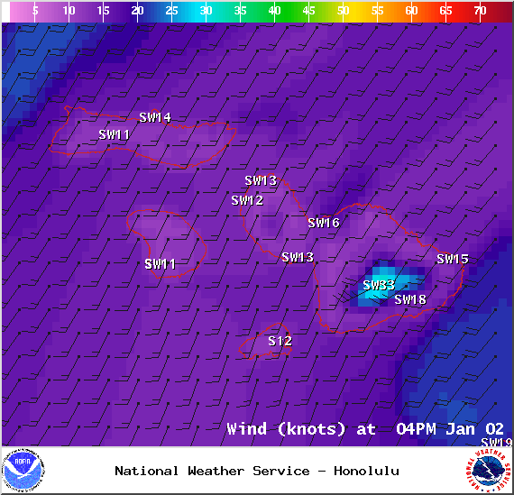
Image: NOAA / NWS
Sponsored Content


