

WEEKEND SURF: Series of Swells Expected

Image: Jimmie Hepp
By Meteorologist Malika Dudley / Email: malika@mauinow.com
Alerts
**Alerts updated at 4:00 p.m. 1/11/15**
A High Surf Advisory is posted for the north facing shores of Maui and Moloka’i from noon Monday through 6:00 a.m. The west side of Moloka’i is also included in the advisory. Wednesday. Surf is expected to build up to 15 to 20 feet for north shores late Monday. The west side of Moloka’i could get 10 to 15 foot faces. Expect strong breaking waves, shore break and strong longshore and rip currents making swimming difficult and dangerous.
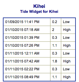
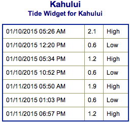
**Click directly on the images below to make them larger. Charts include: Maui County projected winds, forecasted swell direction, height & period, tides, a surface map and expected wave heights.**
 Maui County Surf Forecast, Saturday, January 10, 2015
North: Surf heights are expected from a few feet overhead to possibly double overhead at the best breaks, especially for spots east of Ho’okipa.
West: Spots open to the swells are expected to get some wrap – but the swell is pretty heavily shadowed from the west sides of our islands. Otherwise, breaks that don’t catch the swells, and / or are shadowed from them, are forecasted to get smaller surf at ankle high or flat.
South: Ankle high surf is expected. Most spots are flat.
 Our current west-northwest is expected to peak Saturday morning. This swell has prompted an advisory for north facing shores of Maui and Molokai already. The swell will gradually subside through the weekend. On Sunday overhead to well overhead surf will still push into the best breaks east of Ho’okipa before fading out throughout the day.
Pending development of storms, another shot of energy is expected early next week as well, with surf likely well above the advisory level along north and west facing shores. That swell will slowly subside through midweek. A northwest swell arriving next midweek may be larger still when it peaks next Thursday.
Nothing of note out of the SPAC to get excited about.
Keep in mind, surf heights are measured on the face of the wave from trough to crest. Heights vary from beach to beach, and at the same beach, from break to break.
**Click here for your detailed Maui County weather report.**

Image: NOAA / NWS
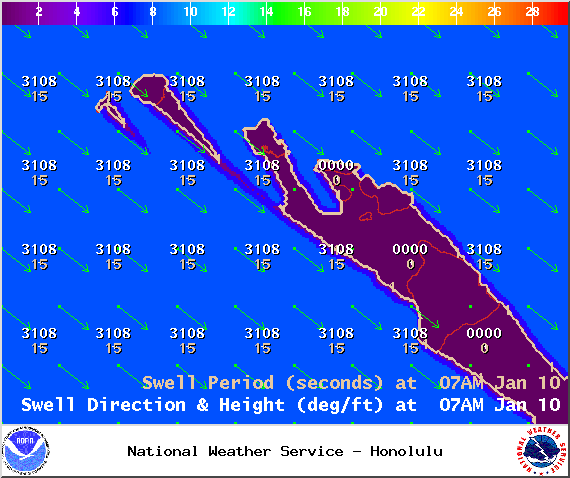
Image: NOAA / NWS
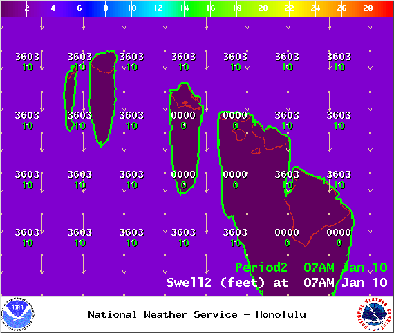
Image: NOAA / NWS

Image: NOAA / NWS
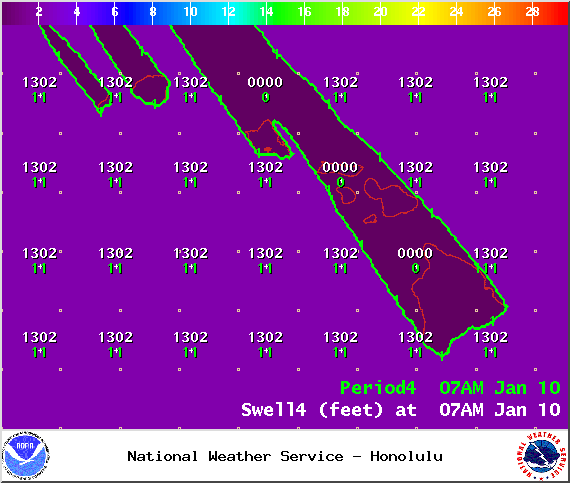
Image: NOAA / NWS
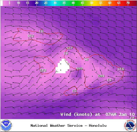
Image: NOAA / NWS
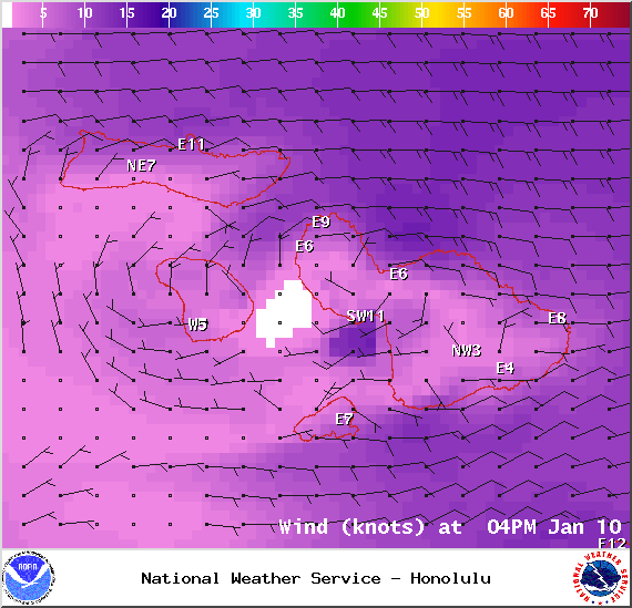
Image: NOAA / NWS
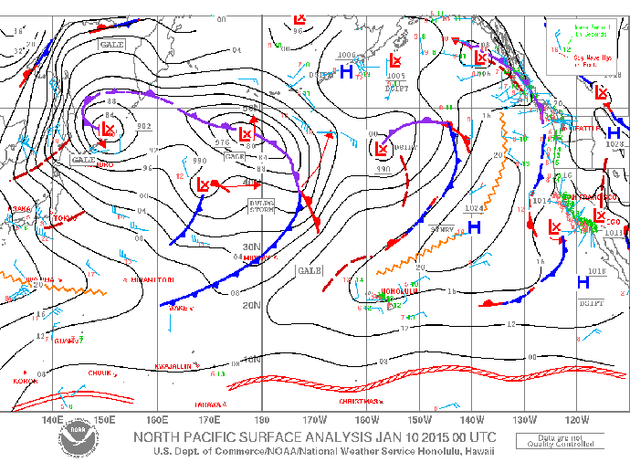
Image: NOAA / NWS
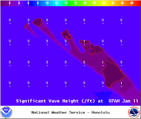
Image: NOAA / NWS
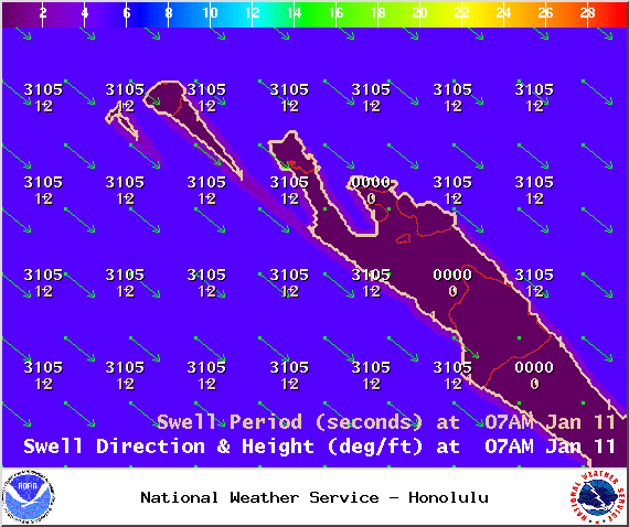
Image: NOAA / NWS
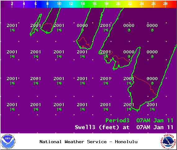
Image: NOAA / NWS

Image: NOAA / NWS

Image: NOAA / NWS
Sponsored Content


