

WEEKEND WEATHER: Sunshine and Light Winds

Oheo Gulch / Image: Chris Archer
By Meteorologist Malika Dudley / Email: malika@mauinow.com
Alerts
A High Surf Advisory is posted for the north facing shores of Maui and Moloka’i from noon Monday through 6:00 a.m. The west side of Moloka’i is also included in the advisory. Wednesday. Surf is expected to build up to 15 to 20 feet for north shores late Monday. The west side of Moloka’i could get 10 to 15 foot faces. Expect strong breaking waves, shore break and strong longshore and rip currents making swimming difficult and dangerous.
**Click directly on the images below to make them larger. Charts include: Maui County high/low forecasted temperatures, projected winds, chance of cloud cover, projected localized weather conditions and expected wave heights.**
Today, Saturday, January 10, 2015
Today we expect light and variable winds from 5 to 15 mph. Weaker winds mean a land and sea breeze pattern is likely to set up. Mostly sunny skies are in the forecast for Maui County. As the land heats up, sea breezes are expected to develop which may lead to afternoon cloud cover and possible isolated light showers. High temperatures are expected to fall in the range of 79° to 84°.
Sunrise: 7:05 a.m.
Sunset: 6:02 p.m.
UV index at 7 (“high” exposure level)
Tonight
Partly cloudy skies and isolated showers are expected. Leeward spots may be cloudy to start but are expected to clear as the land breeze takes hold. Low temperatures from 62° to 68° degrees. Light and variable winds are forecasted from 5 to 15 mph.
Moonrise: 10:58 p.m.
Moonset: 11:13 a.m. on Jan. 11
Next New Moon: Jan. 20 at 3:14 a.m.
Next Full Moon: 1:09 p.m. on Feb. 3
Almanac for Kahului Airport
Maximum Temperature for today:
Normal 81°
Record 90° / Set in 1959
Minimum Temperature for today:
Normal 64°
Record 50° / Set in 1970
Sunday, January 11, 2015
Partly cloudy skies expected today with isolated light showers. Winds are light and variable up to 15 mph. High temperatures should fall in the range of 79° to 84°. Lows are expected from 63° to 68°.
Sunrise: 7:05 a.m.
Sunset: 6:03 p.m.
UV index at 7 (“high” exposure level)
Looking Ahead
Light southeast flow is expected for the weekend resulting in land and sea breezes over the islands and periods of vog and haze. We don’t expect a lot of moisture in the coming days. A weakening front in our vicinity will cut off our trade winds for the early part of next week but isn’t expected to reach the islands. Another front is expected to to approach the Aloha State after that so light and variable winds with land and sea breeze conditions are expected through end of the week as well.
**Click here for your detailed Maui County surf report.**

Image: NOAA / NWS
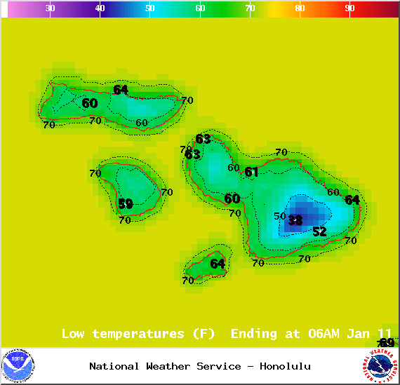
Image: NOAA / NWS
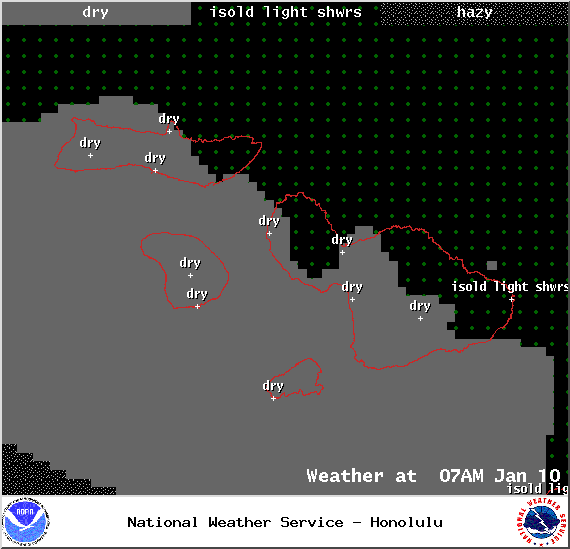
Image: NOAA / NWS
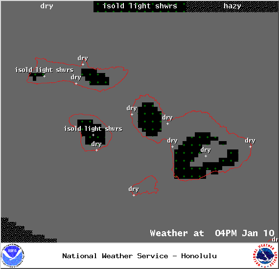
Image: NOAA / NWS
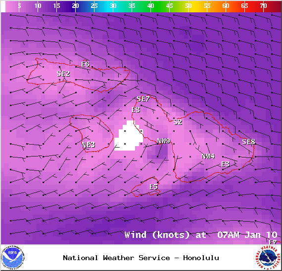
Image: NOAA / NWS
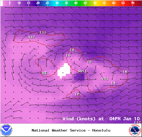
Image: NOAA / NWS

Image: NOAA / NWS
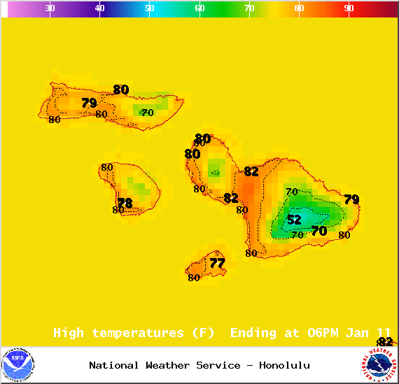
Image: NOAA / NWS

Image: NOAA / NWS
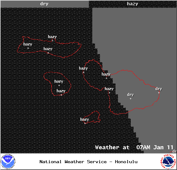
Image: NOAA / NWS
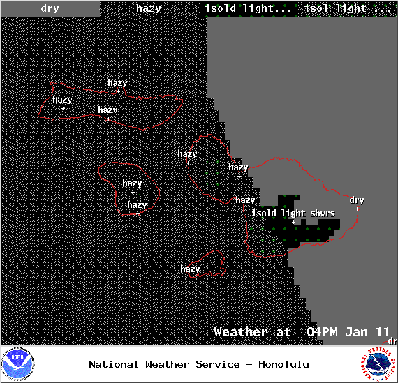
Image: NOAA / NWS

Image: NOAA / NWS

Image: NOAA / NWS
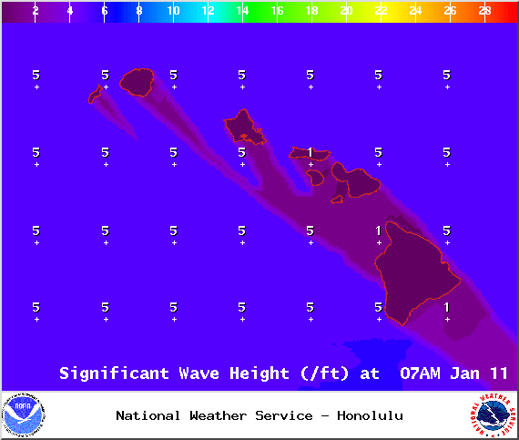
Image: NOAA / NWS
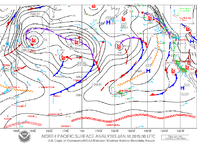
Image: NOAA / NWS

Saturday afternoon vog forecast – Image: UHSOEST
Sponsored Content


