

Swell Fades Today, XXL Swell in a Couple Days
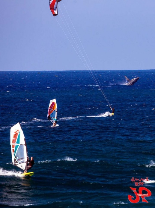
Ho’okipa Whale & Wind Surfers / Image: Jimmie Hepp
By Meteorologist Malika Dudley / Email: malika@mauinow.com
Alerts
A High Surf Advisory is posted through 4:00 a.m. Monday for the north and west facing shores of Moloka’i and the north shore of Maui. Surf from 10 to 15 feet is expected for the north exposures, while wave heights of 8 to 12 feet are expected for the west side of Moloka’i. Expect strong breaking waves, shore break and strong longshore and rip currents making swimming difficult and dangerous.
**Click directly on the images below to make them larger. Charts include: Maui County projected winds, forecasted swell direction, height & period, tides, a surface map and expected wave heights.**
 Maui County Surf Forecast, Monday, January 19, 2015
North: Surf heights are expected head high to well overhead. The best breaks, especially spots east of Ho’okipa, will be even bigger, possibly to well overhead, especially early in the day.
West: Some spots will catch wrap from the west-northwest swell. Waves will be biggest early in the day. Otherwise, breaks that don’t catch the swells, and / or are shadowed from them, are forecasted to get smaller surf at ankle high or flat.
South: Ankle high surf is expected. Most spots are flat.
Our northwest swell is expected to continue to fade with bigger waves expected early in the day Monday and dropping through the day.
Another west-northwest is on tap for Tuesday with well overhead waves expected.
 Models are predicting a much larger west-northwest swell arriving around the middle of next week, producing surf well above warning levels. This XXL swell is forecasted to move in Wednesday. If it behaves as models are indicating we could see the occasional 35 foot face at the peak of this event. If so, it would be the largest swell thus far this season.
Pending development of storms we could see another solid west-northwest swell next weekend with a smaller but still solid northwest a few days later.
Nothing of note out of the SPAC to get excited about.
Keep in mind, surf heights are measured on the face of the wave from trough to crest. Heights vary from beach to beach, and at the same beach, from break to break.
**Click here for your detailed Maui County weather report.**

Whale tail / Image: Ned Simonds

Image: NOAA / NWS
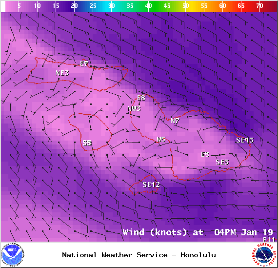
Image: NOAA / NWS
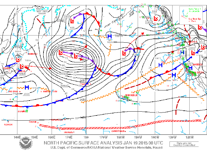
Image: NOAA / NWS
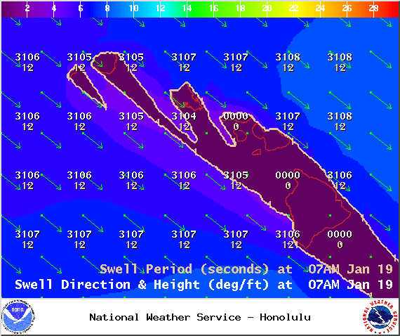
Image: NOAA / NWS
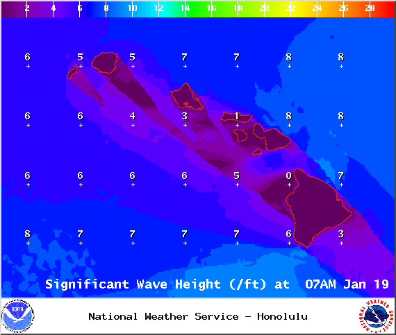
Image: NOAA / NWS
Sponsored Content


