

No Tsunami Threat After 4.3 Hawaiʻi Quake
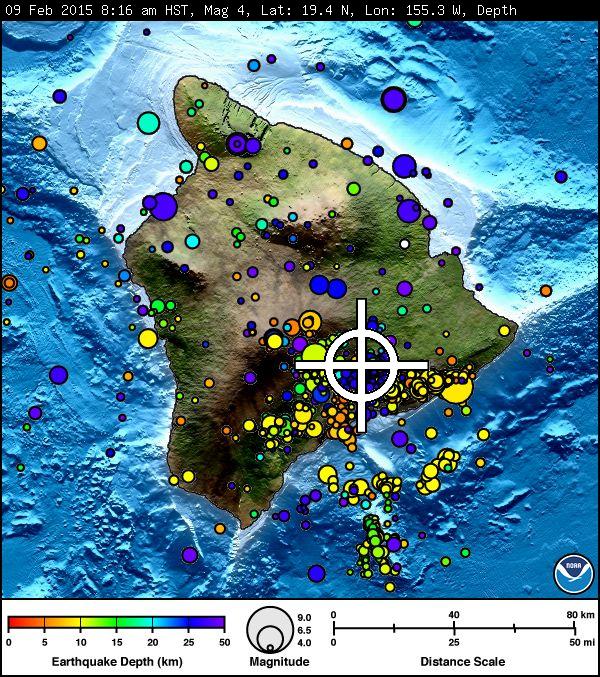
Kīlauea Earthquake, Monday, Feb. 9, 2015. Image courtesy Pacific Tsunami Warning Center.
By Wendy Osher
(Update: 12:22 p.m. 2/9/15)
The US Geological Survey’s Hawaiian Volcano Observatory upgraded the magnitude of this morning’s Kīlauea earthquake to a 4.3.
Agency officials say they received more than 80 responses within two hours of individuals saying they felt the quake with “weak shaking” reported.
As of 10 a.m., the USGS reported five aftershocks from the quake, the strongest of which was a magnitude 1.
According to an agency press release, “Today’s earthquake could lie on the fault that marks the boundary between Mauna Loa and Kīlauea, or it could have occurred on a reactivated fault within the old oceanic crust upon which the Island of Hawaiʻi is built.”
(Original Post: 2/9/15)
There is no tsunami threat to Hawaiʻi following a preliminary magnitude 4.0 earthquake reported at 8:16 a.m. HST on Monday, Feb. 9, 2015 in the summit region of the Kīlauea Volcano on Hawaiʻi Island, according to the Pacific Tsunami Warning Center.
The USGS and the Hawaiian Volcano Observatory report that the quake occurred at a depth of 8.2 miles and was located: 5.6 miles WSW of Kīlauea Summit; 8.3 miles WSW of Volcano; and 14.3 miles NE of Pahala.
According to the USGS Did You Feel It response website, the quake was felt across Hawaiʻi Island, and as far away as Kameula. Other locations where residents reported feeling the quake included: Captain Cook, Hawaiʻi National Park, Hilo, Honomū, Kurtistown, Mountain View, Naʻalehu, Pāhoa, Pepeʻekeo, and Volcano.
Sponsored Content


