

Mix of Swells Lingers, New Swells Sunday
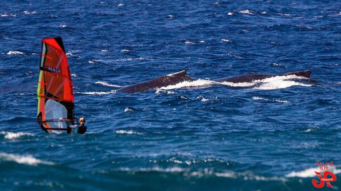
Ho’okipa Whales & Wind Surfers / Image: Jimmie Hepp
By Meteorologist Malika Dudley / Email: malika@mauinow.com
Alerts
A Small Craft Advisory is posted for all Maui County waters. The advisory is posted through 6:00 p.m. Saturday for northeast winds from 20 to 25 knots and rough seas up to 11 feet. Inexperienced mariners should avoid navigating in these conditions.
**Click directly on the images below to make them larger. Charts include: Maui County projected winds, forecasted swell direction, height & period, tides, a surface map and expected wave heights.**
 Maui County Surf Forecast
North: Waist to head high waves are expected today, bigger at the best breaks on the sets.
West: Pretty flat conditions are expected today. Exposures catching the mix of swells could see waist to chest high waves, maybe bigger on the sets.
South: Knee to thigh high waves are expected today. The best breaks could see waist high waves on the sets. Otherwise, shores that don’t catch the swells will be flat.
A mix of short to mid period north-northwest swell energy, mid period west-northwest swell and northeast trade swell is expected to linger the next few days for our northern exposures. Onshore winds will make conditions messy.
 Looking farther out, a northwest swell generated by a storm off of Japan is expected to bring a shot of surf energy Saturday, peaking Sunday. Another developing storm north of the state could bring a pulse late on Sunday through about Tuesday. Another storm expected to develop near the Aleutians could bring a solid swell around the 13th. Will keep an eye on it.
South shores are expected to go quiet through the first part of next week. We may get some energy headed our way around the 13th.
Keep in mind, surf heights are measured on the face of the wave from trough to crest. Heights vary from beach to beach, and at the same beach, from break to break.
**Click here for your detailed Maui County weather report.**
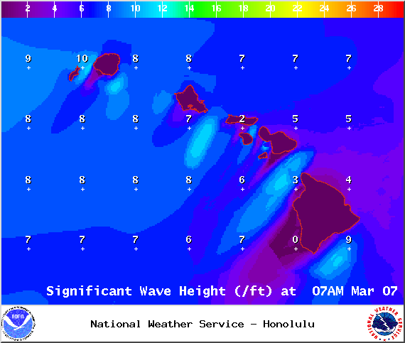
Image: NOAA / NWS
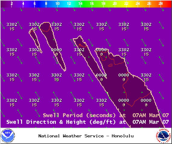
Image: NOAA / NWS
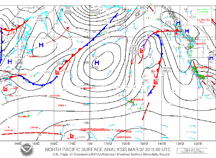
Image: NOAA / NWS
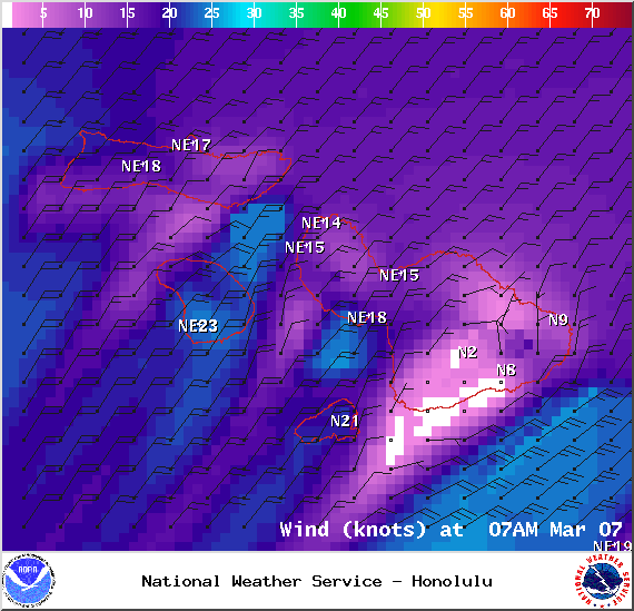
Image: NOAA / NWS
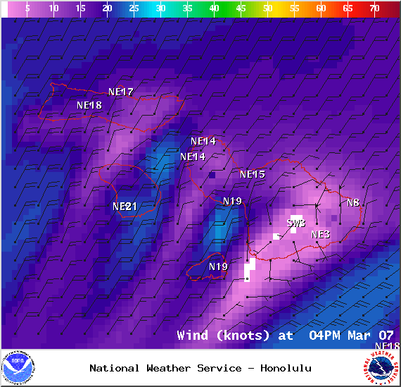
Image: NOAA / NWS
Sponsored Content


