

SSW Builds Tuesday, Heights Hold Through Weekend
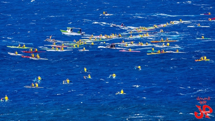
Olukai OC1 Race – Maliko to Kanaha / Image: Jimmie Hepp
By Meteorologist Malika Dudley / Email: malika@mauinow.com
Alerts
A Small Craft Advisory is posted for Pailolo and ʻAlenuihāhā channels as well as Māʻalaea Bay through 6:00 p.m. Tuesday. East winds up to 25 knots are forecasted along with rough seas of 7 to 11 feet. Inexperienced mariners should avoid navigating in these conditions.
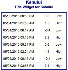
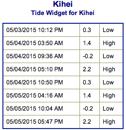
**Click directly on the images below to make them larger. Charts include: Maui County projected winds, forecasted swell direction, height & period, tides, a surface map and expected wave heights.**
 Maui County Surf Forecast
North: Wave heights are expected around waist/chest high today for spots along Hana for example. Messy conditions due to the winds.
West: Pretty flat conditions are expected today for spots shadowed from the swells. Under waist high for spots catching swells.
South: Knee/waist high waves are expected today.
 A boost out of the south-southeast is expected to fade over the next few days. We expect chest to head high surf out of the south-southwest to build on Tuesday and hold through the weekend. This stretch of elevated surf is actually comprised of two pulses, the first pulse is expected to peak on Wednesday in the overhead range. The second pulse is expected to peak over the weekend.
Not a lot expected out of the North Pacific for the next few days. A couple of small swells could move in around May 5th and again on the 8th.
Keep in mind, surf heights are measured on the face of the wave from trough to crest. Heights vary from beach to beach, and at the same beach, from break to break.
**Click here for your detailed Maui County weather report.**
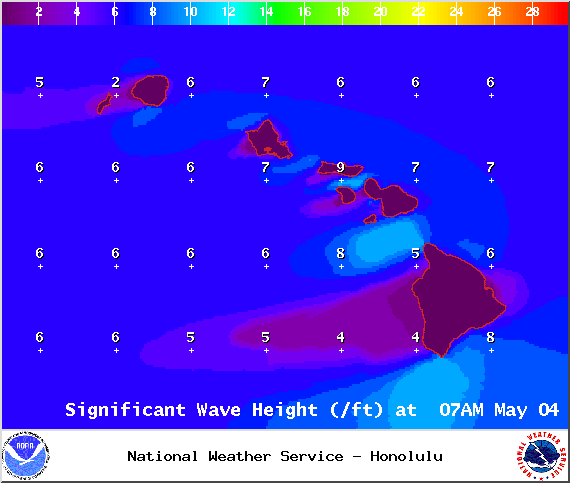
Image: NOAA / NWS
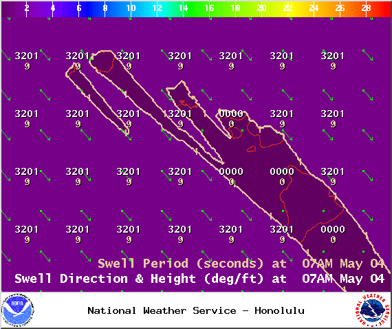
Image: NOAA / NWS
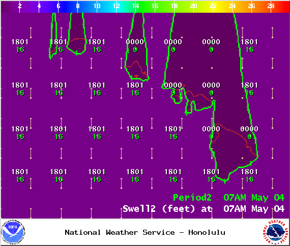
Image: NOAA / NWS
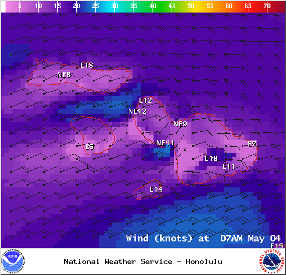
Image: NOAA / NWS
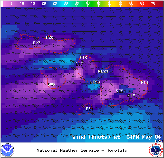
Image: NOAA / NWS
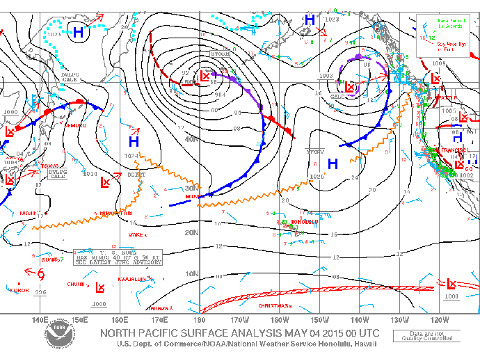
Image: NOAA / NWS
Sponsored Content


