

Jimena Prompts High Surf Warning
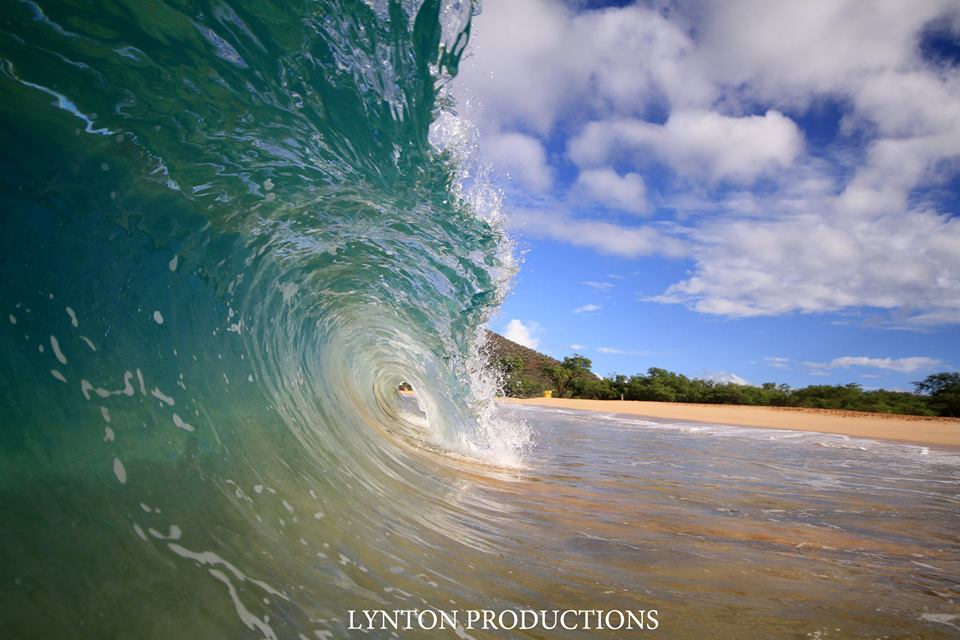
Image: Aaron Lynton
By Meteorologist Malika Dudley / Email: malika@mauinow.com
Alerts
A Flash Flood Watch is posted for all islands through the day Friday due to the threat of heavy rain and saturated grounds across the state. Thunderstorms are also possible.
A High Surf Warning is posted for windward Maui and Molokai through 6 p.m. Saturday with wave heights rising to 12 to 18 foot faces in some spots. Expect ocean water occasionally sweeping across portions of beaches, very strong breaking waves and strong longshore and rip currents. Breaking waves may occasionally impact harbors making navigating the harbor channel difficult. Large breaking surf, significant shore break and dangerous currents will make entering the water very hazardous. Boaters should be aware of an increased number of surfers in the water.
A High Surf Advisory is posted for south facing shores from 6:00 a.m. Friday through 6:00 p.m. Saturday. Expect strong breaking waves, shore break and strong longshore and rip currents making swimming difficult and dangerous.
A Small Craft Advisory is posted for Maui County windward waters as well as all channels through 6 p.m. Friday for rough seas of up to 13 feet. Inexperienced mariners should avoid navigating in these conditions.
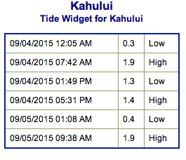
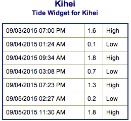
**Click directly on the images below to make them larger. Charts include: Maui County projected winds, tides, swell direction & period and expected wave heights.**
 Maui Surf Forecast
North: Spots that are pulling in the Ignacio swell could get up to overhead or maybe larger on the sets at the best exposures. This swell will show best at east-northeast breaks.
West: Wave heights waist/chest high are expected with the largest waves in the afternoon. Spots shadowed by other islands will be smaller.
South: Some spots will catch the east-northeast wrap. Otherwise, the south-southwest will be largest in the afternoon with waist/head high waves expected.
 Hurricane Jimena is delivering a solid shot of east-southeast shifting east swell to the islands. This prompted a high surf warning for east-facing shores of most islands. East-shore surf will remain near warning levels through the weekend, and likely into early next week.
The secondary swell from Ignacio continues with northeast, shifting north-northwest swell getting pumped out of this system through the work week. Northerly swell is expected to fade early next week.
Hurricane Kilo crossed into the west pacific and is therefore now a typhoon. Kilo has generated fun westerly swell for the islands Friday and is expected to hold through the weekend and possibly even into next week.
A long-period swell from the south-southwest will produce advisory-level surf along south-facing shores this weekend.
Keep in mind, surf heights are measured on the face of the wave from trough to crest. Heights vary from beach to beach, and at the same beach, from break to break.
**Click here for your detailed Maui County weather report.**
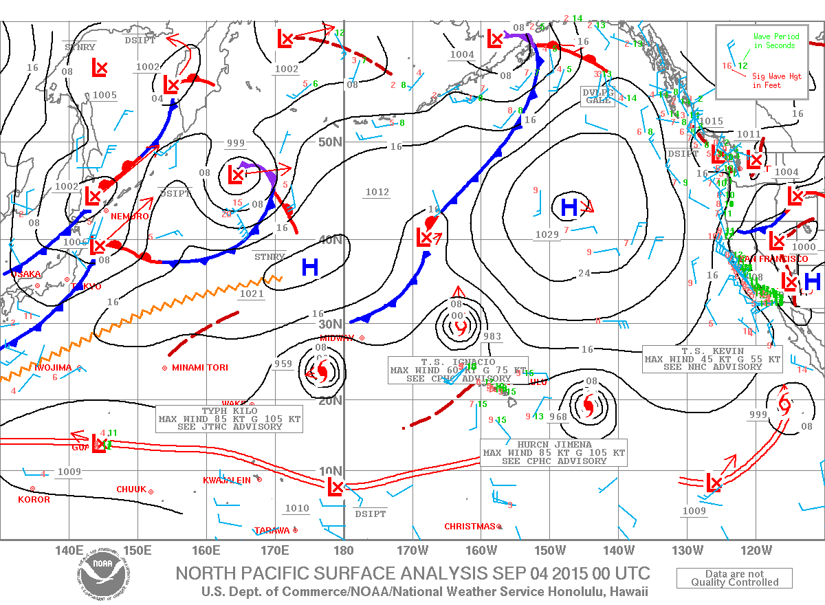
Image: NOAA / NWS
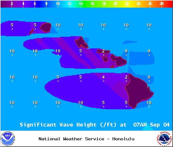
Image: NOAA / NWS
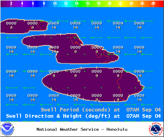
Image: NOAA / NWS
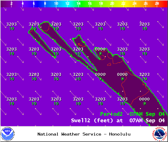
Image: NOAA / NWS
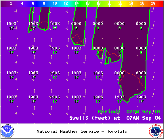
Image: NOAA / NWS
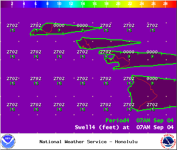
Image: NOAA / NWS
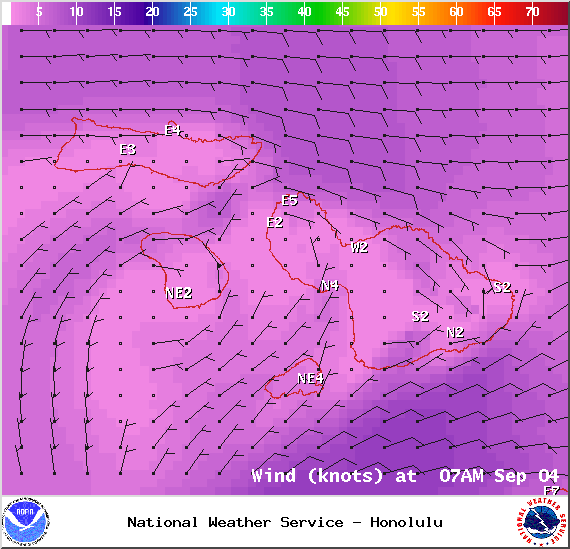
Image: NOAA / NWS
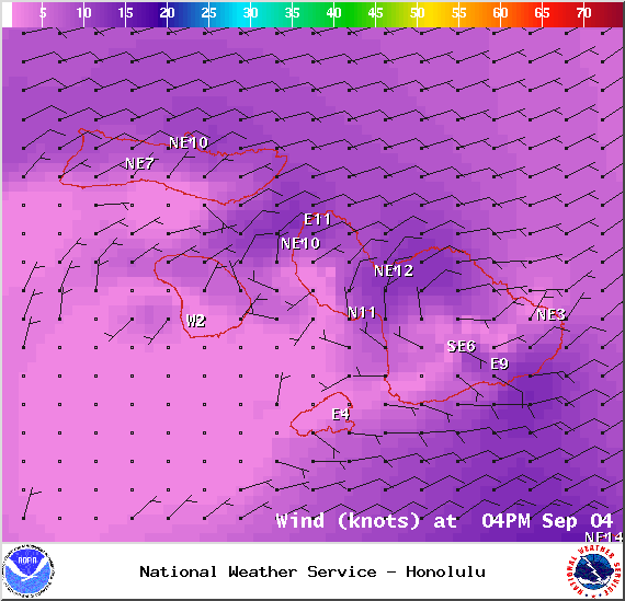
Image: NOAA / NWS
Sponsored Content


