

NNW Tops Out, No Nora Swell Expected
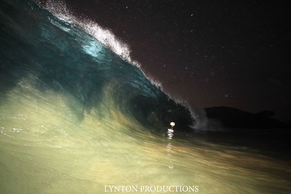
Image: Aaron Lynton
Alerts
There are no weather alerts posted at this time.
Check our breaking news section for any urgent weather alerts.
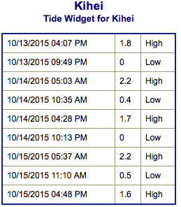
**Click directly on the images below to make them larger. Charts include: Maui County projected winds, tides, swell direction & period and expected wave heights.**
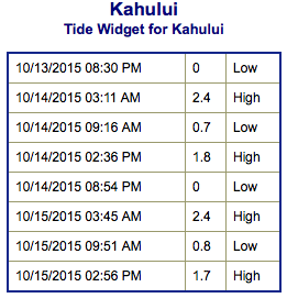 Maui Surf Forecast
North: Wave heights are expected shoulder high today. The best breaks could get sets up to overhead on the sets.
West: Wave heights thigh/waist high are expected today. Spots shadowed by other islands will be smaller. Northerly exposures get up to waist/chest/shoulder high.
South: The south-southwest is expected to bring knee/waist high waves today.
 North-northwest swell is expected to top out middle of the week before fading out. Smaller west surf generated by Choi-Wan continues to mix in for exposures open to the swell.
Nora is forecast to bring advisory level east-southeast swell to the Big Island through Thursday but Maui County will be heavily shadowed from any swell generated from this tropical system.
Our current south-southwest swell is expected to continue fading as a new small south-southwest fills in.
Keep in mind, surf heights are measured on the face of the wave from trough to crest. Heights vary from beach to beach, and at the same beach, from break to break.
**Click here for your detailed Maui County weather report.**

Image: NOAA / NWS
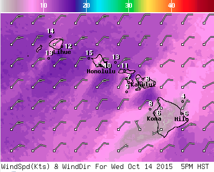
Image: NOAA / NWS
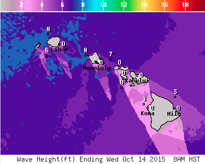
Image: NOAA / NWS
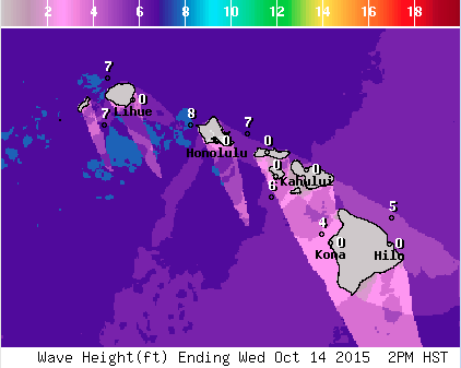
Image: NOAA / NWS
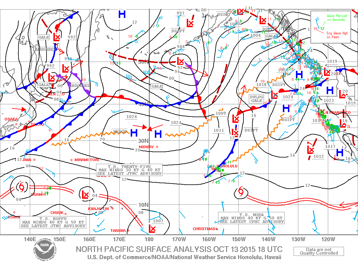
Image: NOAA / NWS
Sponsored Content


