

New Warning Level Swell Builds Today
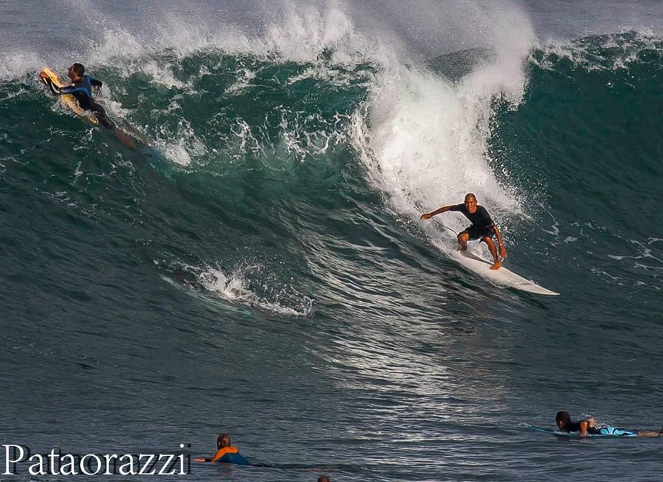
Image: John Patao
Alerts
A High Surf Warning is posted for north and west facing shores of Maui and Molokai through 6 p.m. Friday. Wave heights are expected to build to 12 to 18 feet today reaching 18 to 25 feet this evening and continuing through Friday. Surf along west facing shores is forecast to build to 9 to 12 feet today reaching 15 to 20 feet this evening and through Friday.
Check our breaking news section for any urgent weather alerts.
**Click directly on the images below to make them larger. Charts include: Maui County projected winds, tides, swell direction & period and expected wave heights.**
 Maui Surf Forecast
North: Wave heights are expected to be head to well overhead today early on with a downward trend through the day.
West: Wave heights knee/waist high are expected today. The best exposures could get up to tummy/chest high on the sets from time to time. Spots shadowed by other islands will be smaller. Some north-northwest will fill in for breaks open to the swell.
South: The south-southwest is expected to bring knee/waist high waves today. The best breaks could be a bit bigger from time to time.
 A solid north-northwest swell is presently affecting northwest exposures. This swell is expected to drop out quickly Thursday.
Another more ‘westerly’ swell (295° to 315°) is expected on the heels of the current swell energy. This swell is forecast to quickly build late Thursday and mix in with our current swell for head high to well overhead waves. This swell should peak late Friday before slowly fading.
Our current south-southwest is down to leftovers today. A new south-southwest fills in Thursday/Friday to keep wave heights around knee/waist/chest high.
Next week another pulse of south-southwest is expected. Will keep an eye on it.
Keep in mind, surf heights are measured on the face of the wave from trough to crest. Heights vary from beach to beach, and at the same beach, from break to break.
**Click here for your detailed Maui County weather report.**

Image: NOAA / NWS
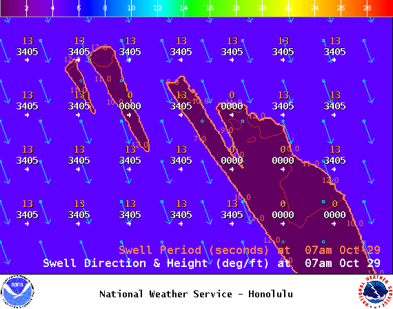
Image: NOAA / NWS
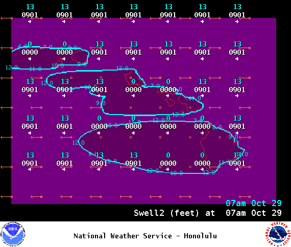
Image: NOAA / NWS
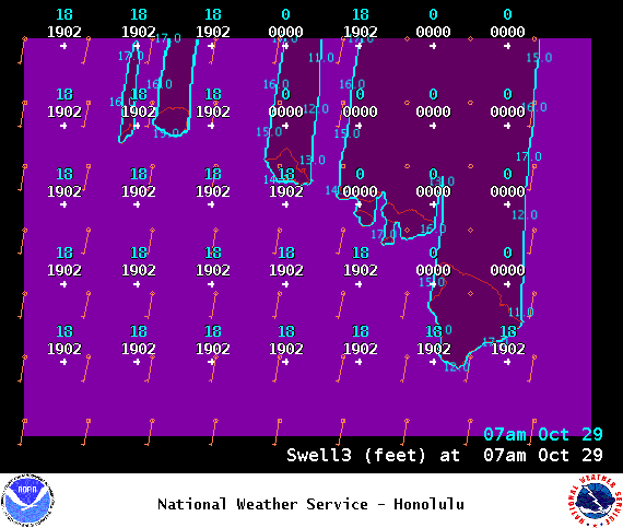
Image: NOAA / NWS

Image: NOAA / NWS
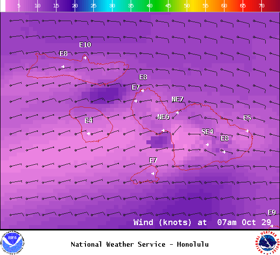
Image: NOAA / NWS

Image: NOAA / NWS
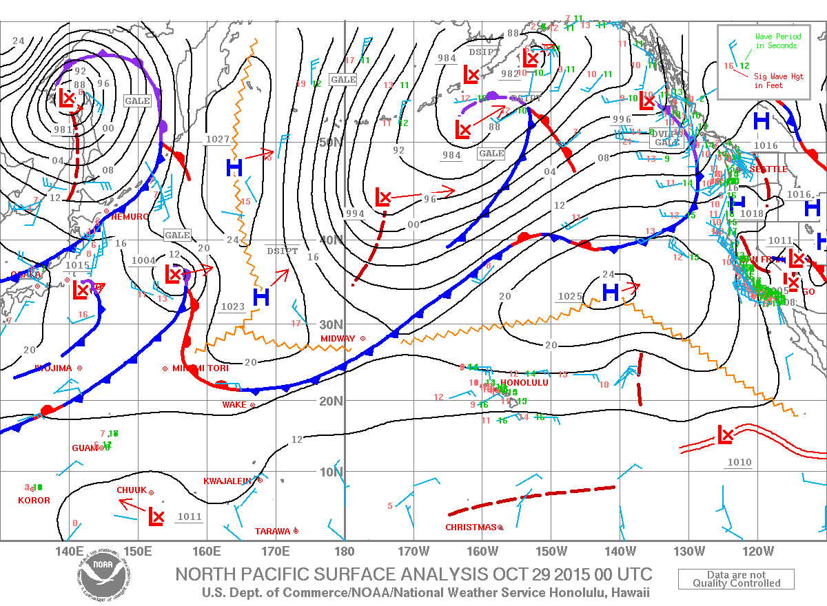
Image: NOAA / NWS
Sponsored Content


