

Very Large WNW Swell Builds Later Today
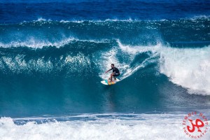
Image: Jimmie Hepp
Alerts (as of 1:00 a.m.)
There are no weather alerts posted at this time.
**Click directly on the images below to make them larger. Charts include: Maui County projected winds, tides, swell direction & period and expected wave heights.**
 Maui Surf Forecast
North: Many spots are expected to run up to a couple feet overhead the first part of the day before fading. A new west-northwest starts to fill in but really builds overnight.
West: Wrap from the northwest swell affecting some western shores today. Spots along the western coast will vary greatly in size based on the amount of exposure. Pretty flat for shores with no exposure to the swell. Slightly overhead for spots that get the exposure.
South: Wave heights are knee/waist high today.
 Our current northwest swell is forecast to continue fading today. Another round is on tap for the weekend out of a more westerly direction. By Saturday afternoon we should start to see this swell beginning to fill in. Sunday the swell is expected to be several times overhead at the best breaks.
A couple of small south-southwest swells will filter in this week at waist high or less. A fun size bump could fill in around March 7 – 9 for southern exposures. Chest/shoulder high sets are possible with this swell.
Keep in mind, surf heights are measured on the face of the wave from trough to crest. Heights vary from beach to beach, and at the same beach, from break to break.
**Click here for your detailed Maui County weather report.**
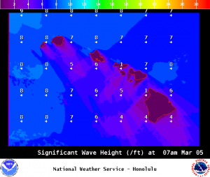
Image: NOAA /NWS
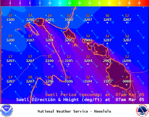
Image: NOAA /NWS
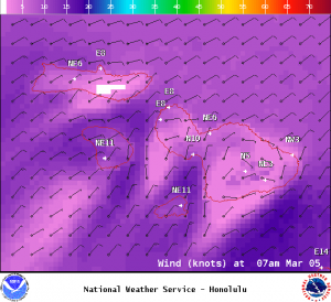
Image: NOAA /NWS
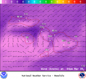
Image: NOAA /NWS

Image: NOAA /NWS
Sponsored Content


