

New WNW Swell Builds Today

Image: Atlantis Submarines
Alerts (as of 1:00 a.m.)
A Small Craft Advisory is posted for the ʻAlenuihāhā, Kaiwi & Pailolo channels, as well as Māʻalaea Bay through 6 a.m. Wednesday.
**Click directly on the images below to make them larger. Charts include: Maui County projected winds, tides, swell direction & period and expected wave heights.**
 Maui Surf Forecast
North: Wave heights are expected to be about knee/waist in the morning and chest/shoulder high by sunset.
West: Surf is ankle/knee high today for west shores that aren’t catching the northwest. Breaks catching the wrap are expected to be up to waist/chest high at the best exposures.
South: Surf is knee/chest high today at the best breaks on the sets.
 A new dose of west-northwest is expected to fill in today and peak on Thursday at about chest/head high with some plusses. More swell energy is expected for the weekend.
Our current mix of south-southeast and south-southwest swells is expected to continue easing. Another swell is expected to build for the weekend with similar size to our current swell.
Keep in mind, surf heights are measured on the face of the wave from trough to crest. Heights vary from beach to beach, and at the same beach, from break to break.
**Click here for your detailed Maui County weather report.**
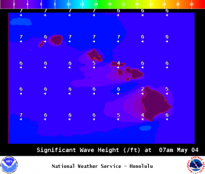
Image: NOAA / NWS

Image: NOAA / NWS

Image: NOAA / NWS
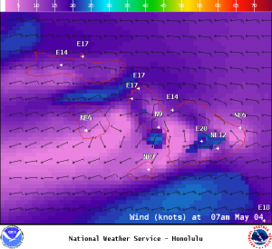
Image: NOAA / NWS
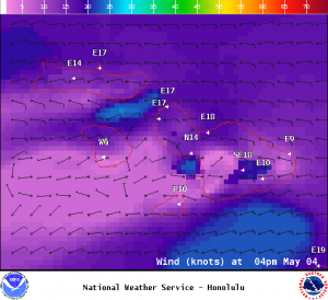
Image: NOAA / NWS
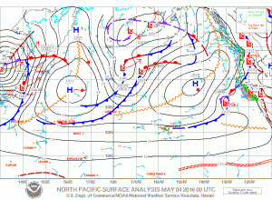
Image: NOAA / NWS
Sponsored Content


