

Garbage Patch: Marine Debris Most Prevalent on Niʻihau
The Hawaiian Island of Niʻihau has the most marine debris landing on its shores of all the main Hawaiian Islands, according to a new study released by the Department of Land and Natural Resources and the North Pacific Marine Science Organization.
The study found that 38% of the total debris identified in aerial surveys is on Niʻihau, and is likely due to its position in the island chain, and the particular ocean currents surrounding it. All other islands had 14% or less, with Oʻahu having the least density at only 5%.
The study was funded by the Ministry of the Environment of Japan to document and study the track of Japanese Tsunami Marine Debris. Researchers say very little of the debris documented was actually associated with the Japan tsunami.
On Maui, imagery analysis identified a total of 1,749 pieces of marine debris—40% of which was plastic, the majority of which was concentrated along the north side of the island, particularly around Kahului.
There were a total of 2,878 pieces of marine debris found in aerial imagery analysis of Molokaʻi. The most common types were plastic (37%) and buoys and floats (35%), with the majority of debris concentrated on the northwestern shores and a small area on the northeastern corner of the island.
On Kahoʻolawe, imagery analysis identified a total of 1,298 pieces of marine debris. The most common type was plastic (47%), with debris concentrated on the northern tip of the island and in the Keoneuli area on the eastern coast.
Imagery analysis on Lanaʻi, identified a total of 1,829 pieces of marine debris, mostly plastic (53%), that was concentrated on the northeast coast of the island.
“It’s heartbreaking to see a marine mammal tangled up in derelict fishing line. It’s sad to see an otherwise beautiful Hawaiian beach covered in a vast array of plastic,” said DLNR officials. “It’s telling when the stomach contents of seabirds often show they’ve ingested these plastics. Marine debris can have numerous impacts on the natural environment, many of them detrimental to the overall health of the ecosystem.”
The study, “Japanese Tsunami Marine Debris Aerial Imagery Analysis and GIS Support in the main Hawaiian Islands,” was made possible in part through the Japan Tsunami Gift Fund awarded to western states, including Hawai’i.
Kirsten Moy, DLNR’s Marine Debris Coordinator in the Division of Aquatic Resources, explained, “In order to characterize the potential ecological consequences of tsunami and other debris, it’s important to quantify it. Understanding the types, sizes and locations of debris accumulating on Hawaiian coastlines is crucial in developing plans to streamline removal and mitigate negative impacts.”
Suzanne Case, DLNR Chair commented, “This survey found a very limited amount of debris associated with the Japan tsunami. Most of what was mapped is common, everyday items that someone haphazardly tossed onto the ground or directly into the water. These items get caught up in ocean currents and unfortunately much of it eventually lands, mostly on north and east facing shores. Hawai’i is recognized around the world for our beautiful beaches. Unfortunately we cannot say they are pristine, because they’ve been so seriously impacted by our trash.”
Aerial surveys were conducted between August and November, 2015.
Results from other islands is as follows:
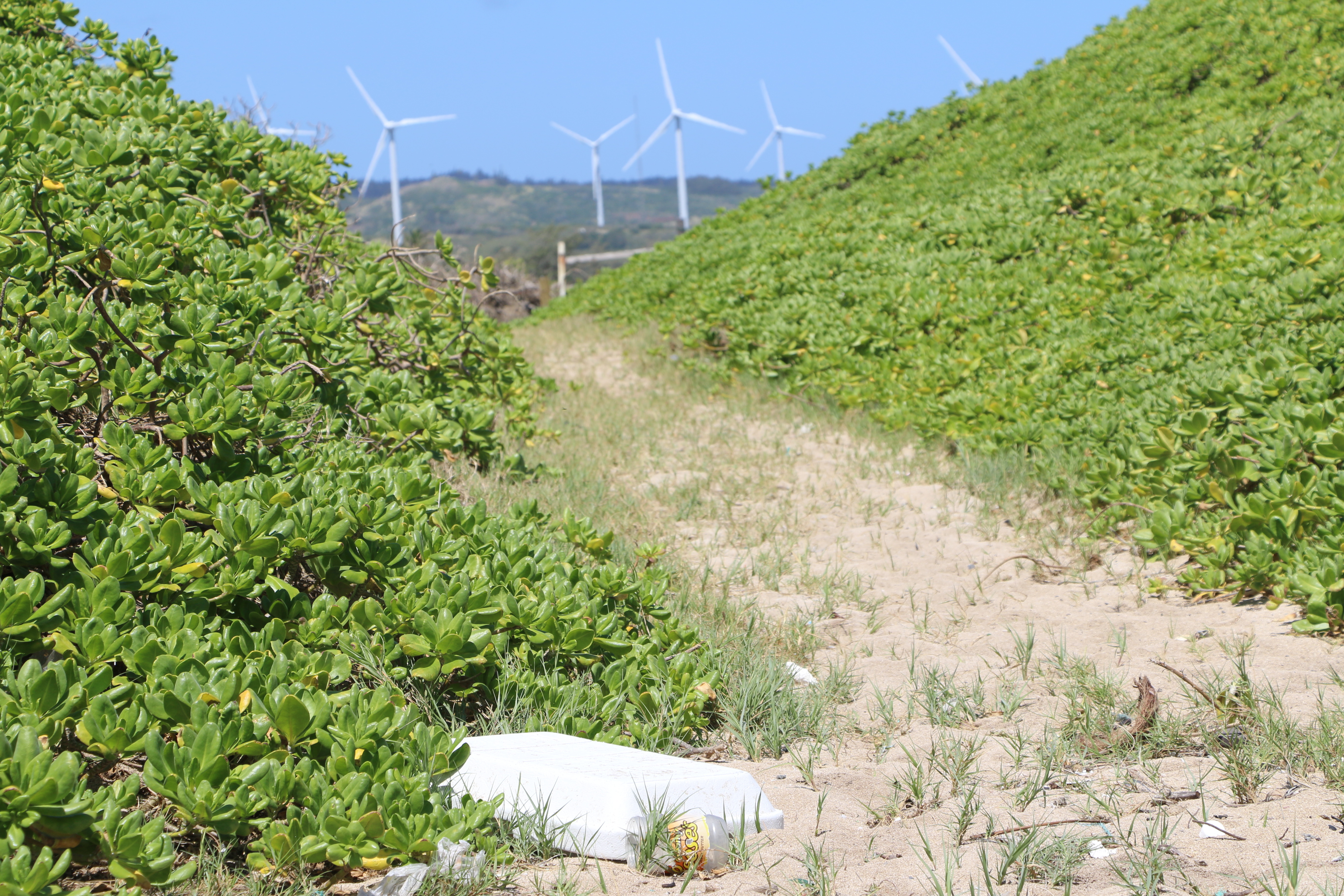
Oʻahu-Imagery analysis identified a total of 984 pieces of marine debris. Most common type was plastic (63%). Marine debris was concentrated on the northern tip of the island, particularly around Kahuku.
Hawaiʻi-Imagery analysis identified a total of 2,200 pieces of marine debris. Most common type was plastic (52%). Marine debris was concentrated on the southeastern tip of the island, particularly around Kamilo Point.
Kauaʻi-Imagery analysis identified a total of 1,849 pieces of marine debris. Most common type was plastic (49%). Marine debris was concentrated on the eastern shores of the island, particularly at the northern and southern extents.
Niʻihau-Imagery analysis identified a total of 7,871 pieces of marine debris. Most common type was plastic (46%), followed by buoys and floats (25%). Niʻihau had the great debris densities on east-facing shores.
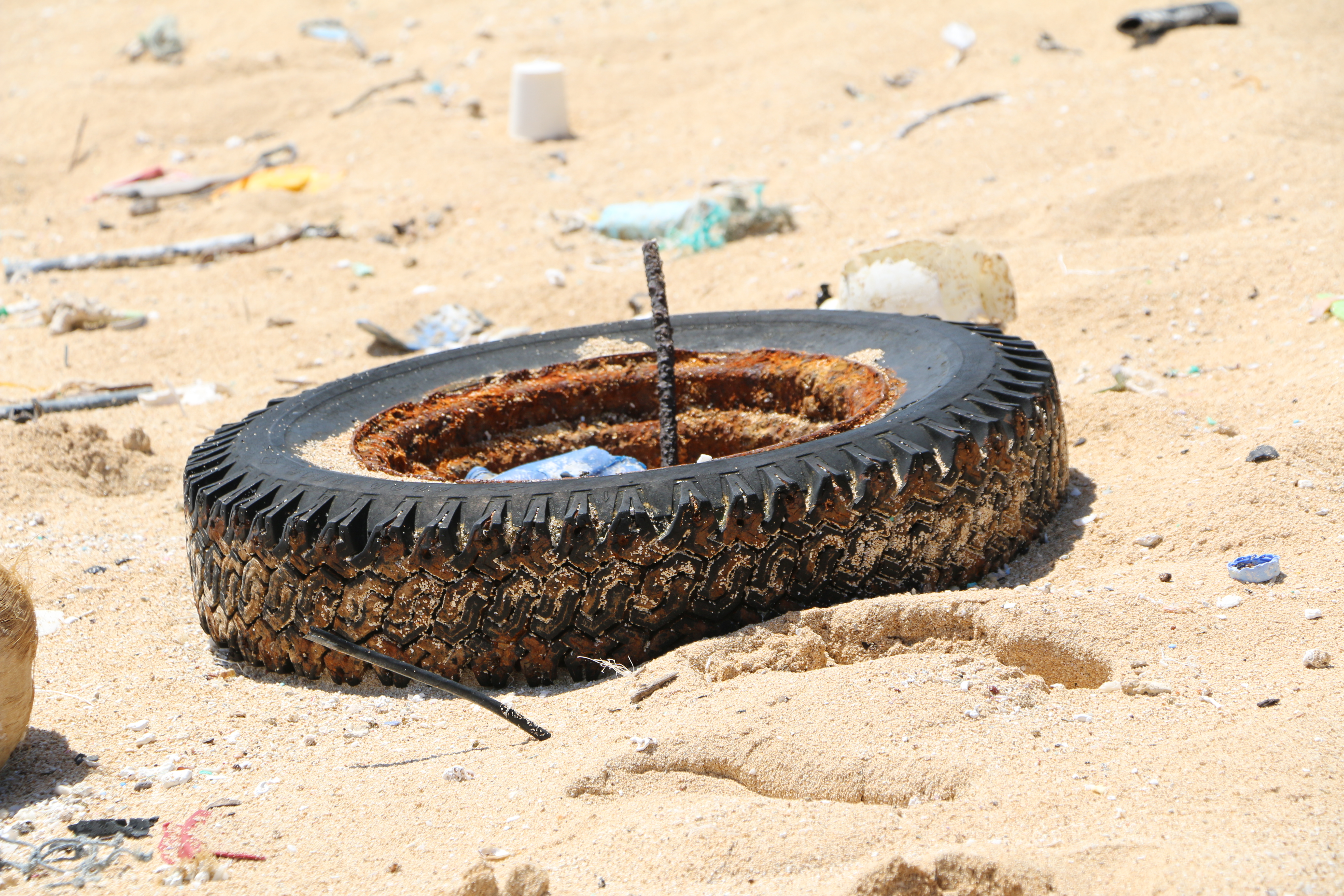
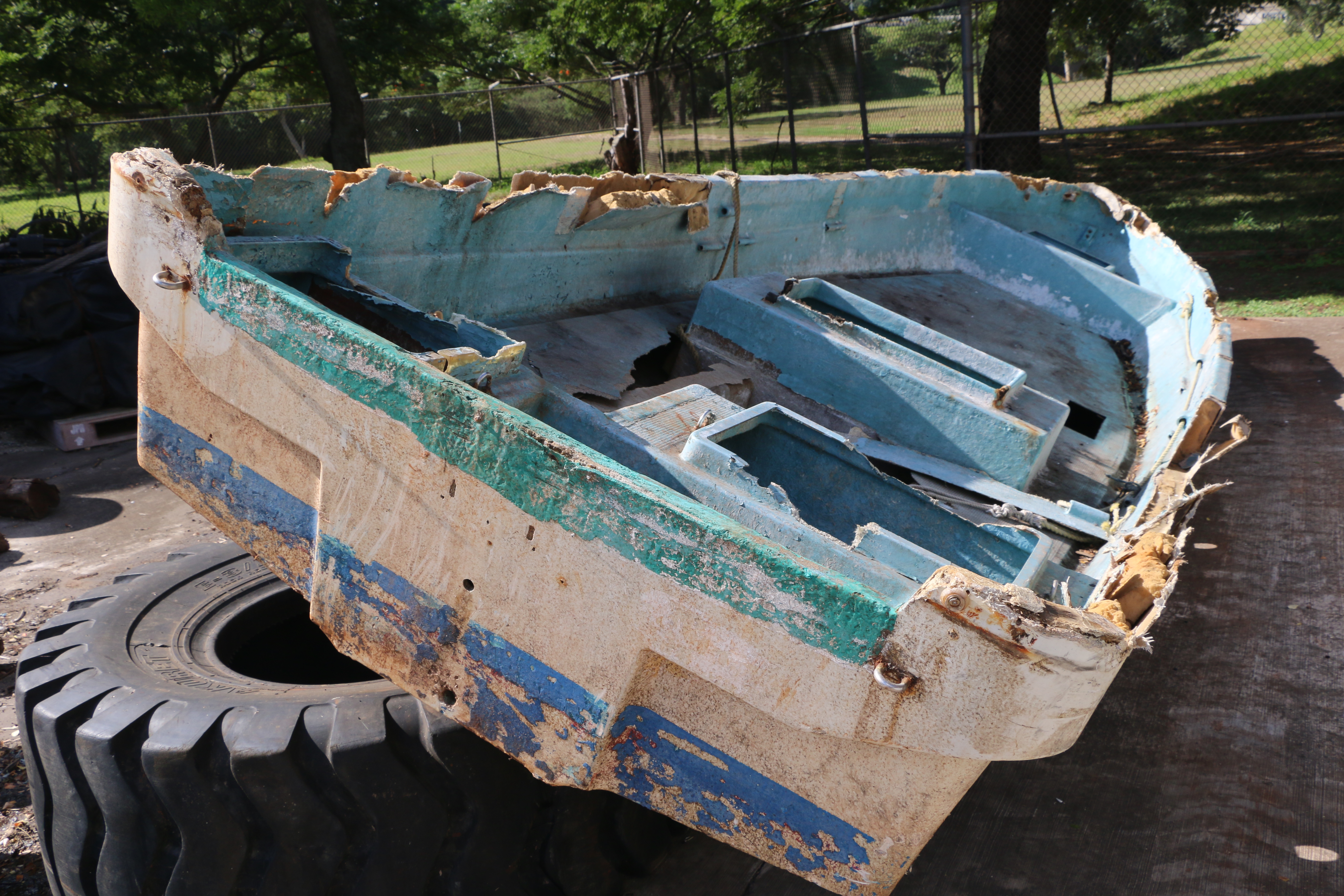
In addition to plastic, buoys and floats, the surveys identified derelict fishing gear, foam, tires and “other” types of debris, including wood, metal, cloth and vessels.
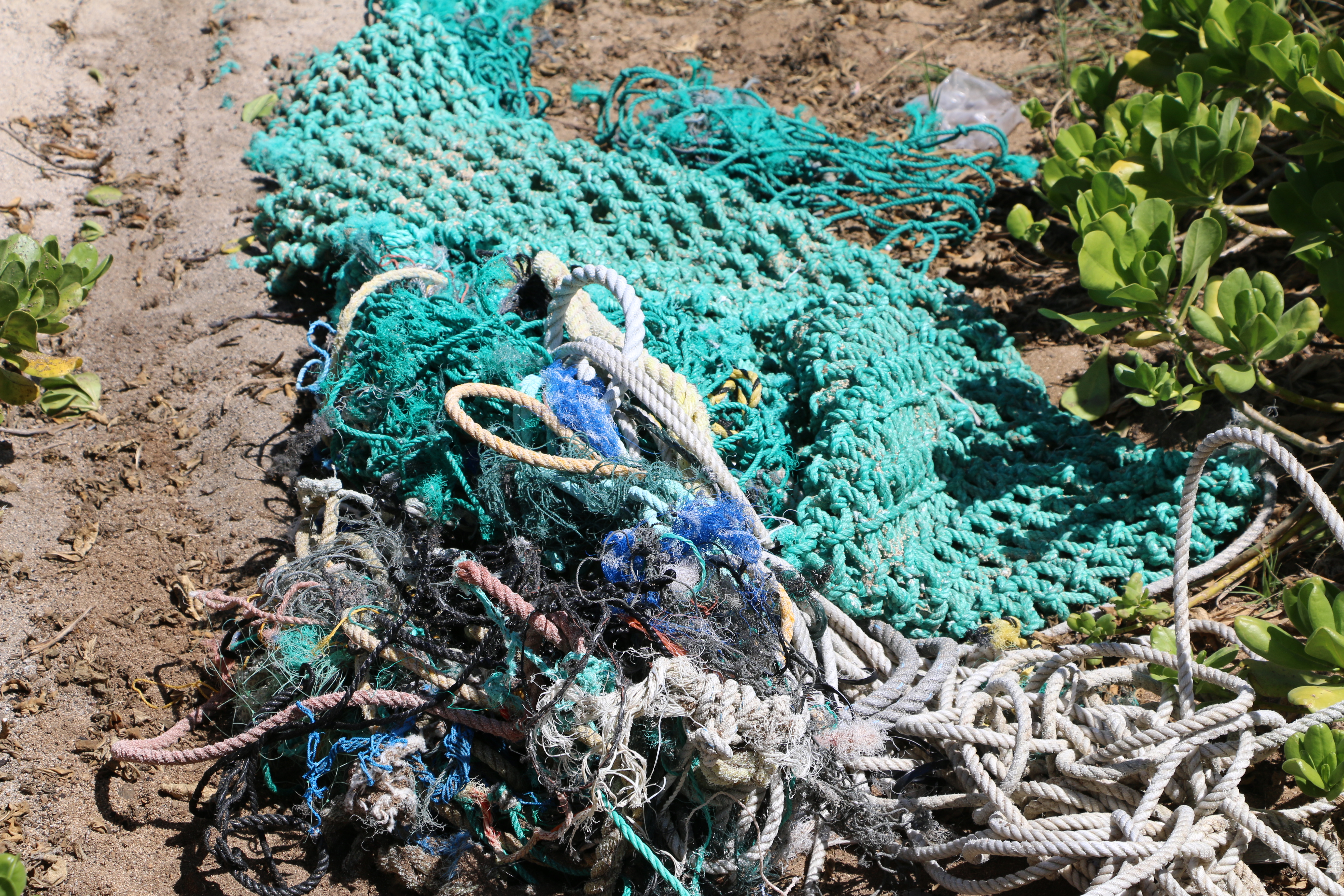
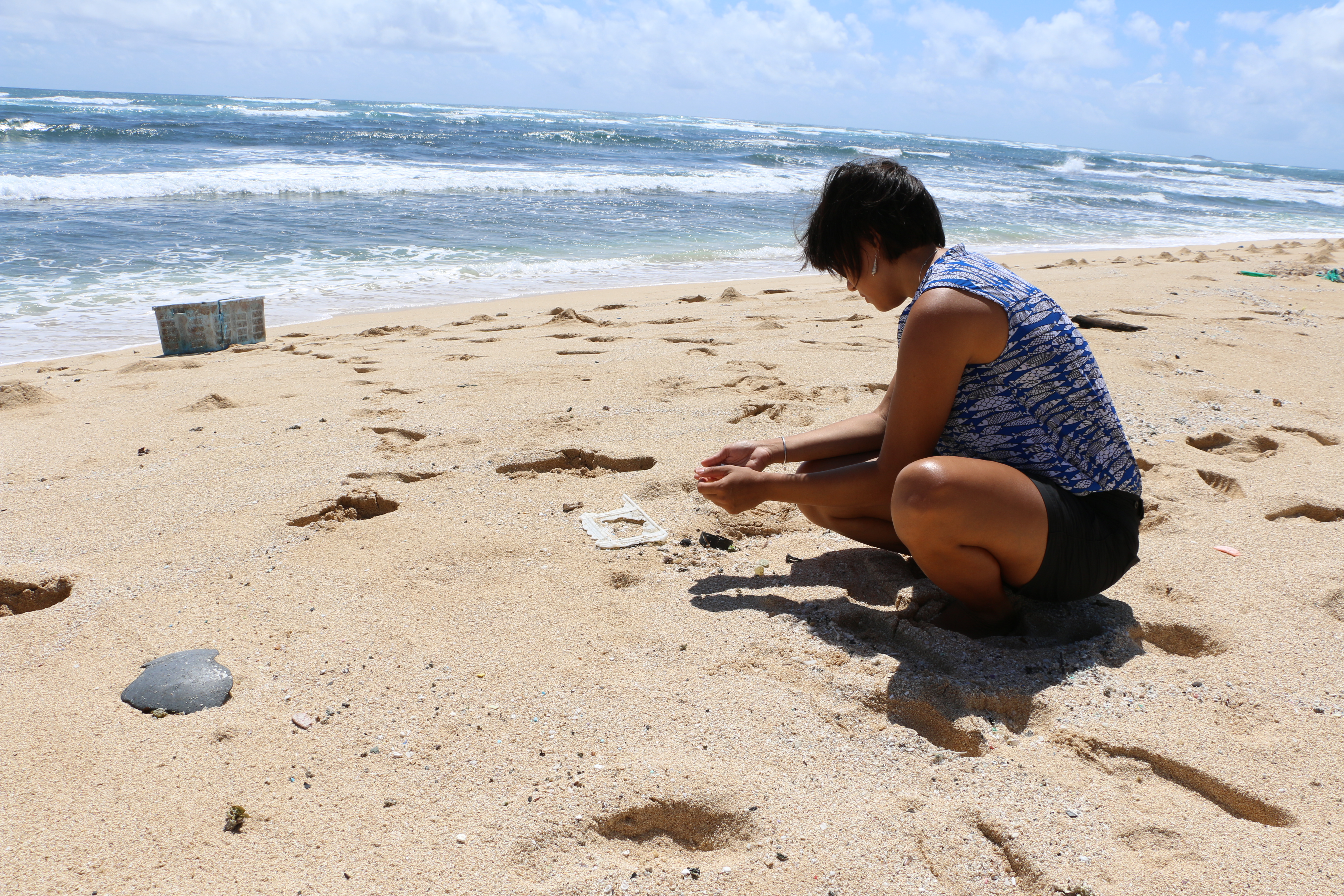
The study found that 38% of the total debris identified in aerial surveys is on Niihau, and is likely due to its position in the island chain, and the particular ocean currents surrounding it. All other islands had 14% or less, with Oʻahu having the least density at only 5%. Image: Kahuku, Oʻahu courtesy DLNR.
The study found that 38% of the total debris identified in aerial surveys is on Niihau, and is likely due to its position in the island chain, and the particular ocean currents surrounding it. All other islands had 14% or less, with Oʻahu having the least density at only 5%. Image: Kahuku, Oʻahu courtesy DLNR.
The study found that 38% of the total debris identified in aerial surveys is on Niihau, and is likely due to its position in the island chain, and the particular ocean currents surrounding it. All other islands had 14% or less, with Oʻahu having the least density at only 5%. Image: Kahuku, Oʻahu courtesy DLNR.
The study found that 38% of the total debris identified in aerial surveys is on Niihau, and is likely due to its position in the island chain, and the particular ocean currents surrounding it. All other islands had 14% or less, with Oʻahu having the least density at only 5%. Image: Kahuku, Oʻahu courtesy DLNR.
The study found that 38% of the total debris identified in aerial surveys is on Niihau, and is likely due to its position in the island chain, and the particular ocean currents surrounding it. All other islands had 14% or less, with Oʻahu having the least density at only 5%. Image: Kahuku, Oʻahu courtesy DLNR.
The study found that 38% of the total debris identified in aerial surveys is on Niihau, and is likely due to its position in the island chain, and the particular ocean currents surrounding it. All other islands had 14% or less, with Oʻahu having the least density at only 5%. Image: Kahuku, Oʻahu courtesy DLNR.
Sponsored Content


