

Trade Swell Increases, New NW Expected

Image: Asa Ellison
Alerts (as of 1:00 a.m.)
Small Craft Advisory: For northeast winds up to 25 knots with 30 knot gusts through 6 p.m. Saturday.
**Click directly on the images below to make them larger. Charts include: Maui County projected winds, tides, swell direction & period and expected wave heights.**
Maui Surf Forecast
North: Northwest swell is shoulder/head high + with the best breaks running a couple feet overhead.
West: Spots catching the northwest wrap could get up to head high to overhead. Spots open to the southwest are up to about knee/waist high.
South: Surf heights are knee/waist high today with some spots getting up to chest/shoulder high.
A long-period west-northwest swell is expected to continue filling in and hold into the weekend before fading into next week.
Surf heights along east facing shores will start to increase Friday into the weekend as the trades return and strengthen. We could see advisory level surf by Monday / Tuesday.
Along south facing shores small waves are forecast through the weekend with mainly small background long-period energy expected. A long-period south swell is expected to fill in Wednesday.
Keep in mind, surf heights are measured on the face of the wave from trough to crest. Heights vary from beach to beach, and at the same beach, from break to break.
**Click here for your detailed Maui County weather report.**
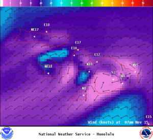
Image: NOAA
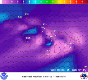
Image: NOAA
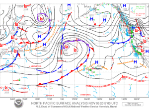
Image: NOAA

Image: NOAA

Image: NOAA

Image: NOAA

Image: NOAA
Sponsored Content


