

Extreme Caution Urged as MacKenzie Recreation Area Reopens
The state is reopening MacKenzie State Recreation Area in Lower Puna on Saturday, Sept. 8, 2018, but is urging the public to use extreme caution when visiting the area. The park had been closed since shortly after the beginning of the East Rift Zone eruption in early May.
The decision to reopen was made in by the state DLNR Division of State Parks, in consultation with other DLNR divisions and the Hawai‘i County Civil Defense Agency.
While the park is reopening, there are continuing restrictions for people traveling across recent lava flows to reach the shoreline at Pohoiki.
The route traverses through a portion of the Malama Kī Forest Reserve, which was also closed for several months, and over state unencumbered land. The forest reserve, also closed for several months due to eruptive activity, is reopening simultaneously with MacKenzie SRA.
A safety buffer of 50 meters from recent lava flows in the forest reserve will be maintained until further notice.
Anyone venturing into the restricted zone is still subject to citation or arrest for loitering in a disaster zone. More than 90 people were cited over the course of several months when the entire area had been declared off-limits.
Gordon Heit, the Hawai‘i island Land Agent with the DLNR Land Division warned, “We expect a significant number of people will be wanting to explore the newly created beaches on the unencumbered lands north of MacKenzie SRA. People need to use extreme caution when approaching the water. In some locations, steep, unstable cliffs were formed by recent lava flows and they drop into very deep water where ocean currents are very unpredictable.”
Hikers, sightseers and ocean recreationists should carry ample water, have sun protection and wear sturdy footwear to cross over the rough and uneven ground from MacKenzie to Pohoiki.
The state boat ramp at Pohoiki was never closed during the eruption, but is currently cut off from the ocean by a new black sand beach. Officials from the DLNR Division of Boating and Ocean Recreation plan to assess conditions at Pohoiki again next week to determine whether in the future the boat ramp can be used again or begin making plans to build a new ramp at another location along the lower Puna coast. The construction of a new ramp is dependent on funding and road access to the shoreline.
Lava Tree State Monument, closer to Fissure #8, remains closed and will need significant repairs to make it safe after earthquakes associated with volcanic activity cracked sidewalks and potentially damaged the park’s water system, leaving comfort stations inoperable.
DLNR State Parks Administrator Curt Cottrell said, “We are reopening MacKenzie SRA with full knowledge and it is anticipated that many people will use it as the gateway to hike to Pohoiki. We strongly encourage anyone making this trip to be completely self-sufficient and well prepared. The landscape has changed in dramatic and still unknown ways and folks need to be very cautious and pay attention to the terrain.”
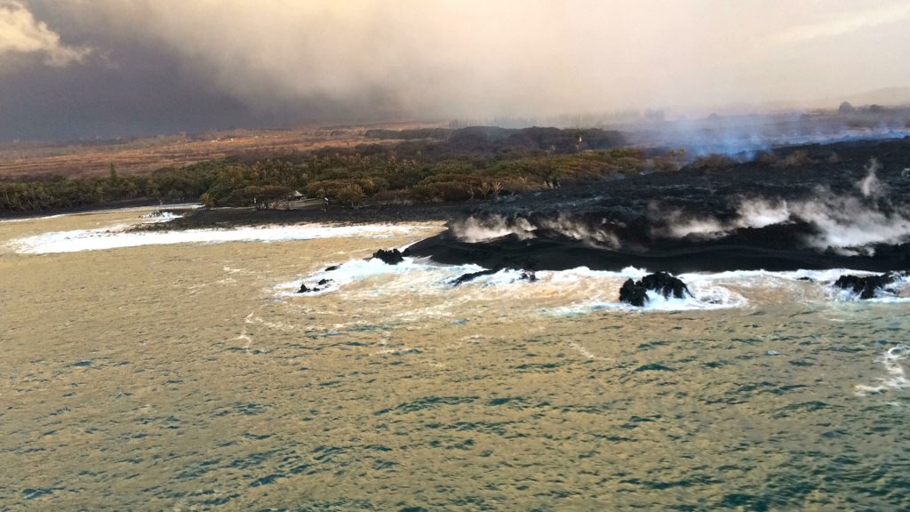
At the coast, the lava flow in the Ahalanui area remained less than 0.1 miles from the Pohoiki boat ramp at Isaac Hale Park (left of center in this photo) on July 26, 2018. The active ocean entry was a few hundred yards east (right) of this photograph. PC: USGS 7.26.18
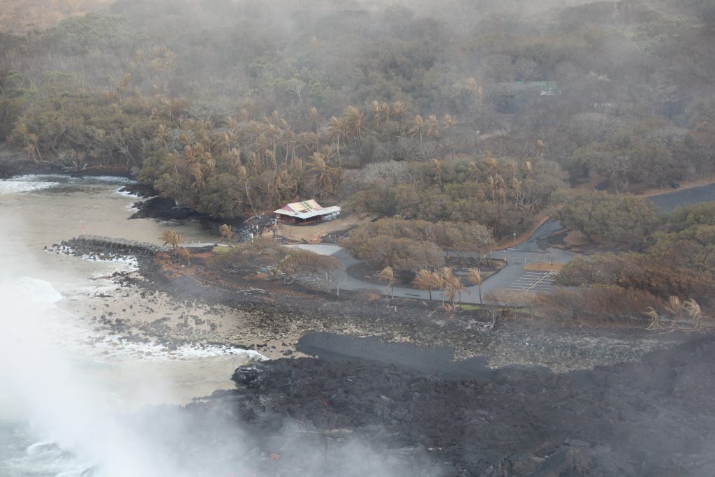
Another view of Isaac Hale Beach Park and the Pohoiki boat ramp from an overflight (Aug. 5, 2018) . The active ocean entry and laze plume can be seen at lower left. PC: Aug. 5, 2018 courtesy USGS
The US Coast Guard Barbers Point Air Station provided space on a low-flying C-130 plane to DLNR representatives on Wednesday, July 25, 2018 to look for any green sea turtles that could be trapped by lava flowing into the ocean on the coast near Kapoho Bay and the Pohoiki Boat Ramp. PC: DLNR Hawaiʻi
The US Coast Guard Barbers Point Air Station provided space on a low-flying C-130 plane to DLNR representatives on Wednesday, July 25, 2018 to look for any green sea turtles that could be trapped by lava flowing into the ocean on the coast near Kapoho Bay and the Pohoiki Boat Ramp. PC: DLNR Hawaiʻi
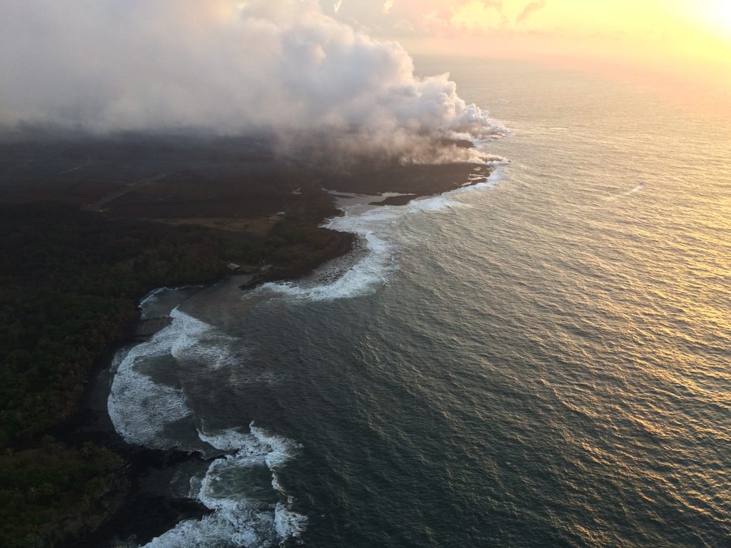
Lava continued to enter the sea near Ahalanui during an HVO helicopter overflight of Kīlauea’s lower East Rift Zone (view to northeast) in late July 2018. The southern margin of the flow was about 500 m (0.3 mi) from the boat ramp at Isaac Hale Park on that day. The jetty along the launch ramp is visible near the center of the photo. (PC: USGS/7.23.18)
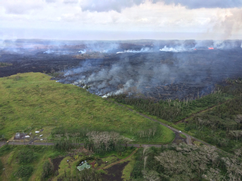
View of the now-sluggish lava flow that crossed Pohoiki Road on Monday (5.28.18) ; the flow originated from fissure 8. During the close of an overflight on May 28, 2018, lava began erupting downrift of fissure 8 in the area between about fissure 7 and 21 (low fountains in upper right). This photo was taken at about 1:45 p.m. HST on 5.28.18. PC: US Geological Survey
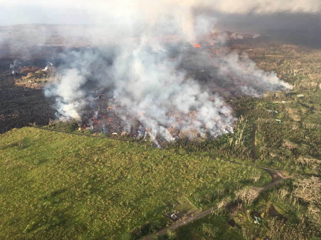
Aerial view of active lava flow crossing Pohoiki Road during an overflight on May 28, 2018 about 7 a.m. HST. Pohoiki Road cuts through middle of photograph. Note lava fountains erupting (top right) from fissure 8 (left-side fountain) and 24 (right-side fountain) from the fissure complex. PC: US Geological Survey
Sponsored Content


