

November 20, 2018 Surf Forecast
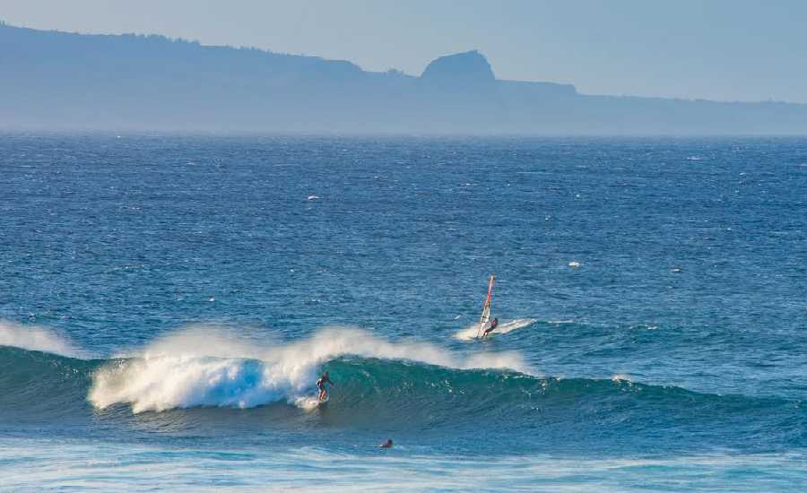
Photo: Asa Ellison
Swell Summary
Outlook through Tuesday November 27: The small northwest swell peaking today will lower gradually through midweek. Another northwest swell is forecast to begin filling in on Saturday with a larger and longer period northwest swell expected Saturday night and Sunday. Advisory-level surf is possible with this longer period swell. The largest swell of the season will be possible next Monday with heights potentially exceeding warning levels. Specifics will come in later forecasts as confidence rises.
Surf heights are forecast heights of the face, or front, of waves. The surf forecast is based on the significant wave height, the average height of the one third largest waves, at the locations of the largest breakers. Some waves may be more than twice as high as the significant wave height. Expect to encounter rip currents in or near any surf zone.
North
am ![]()
![]() pm
pm ![]()
![]()
Surf: Waist to stomach high NW ground swell with occasional chest high sets.
Conditions: Semi clean/sideshore texture and current in the morning with E winds 10-15mph. Sideshore/choppy conditions for the afternoon as the winds increase to 15-20mph.
South
am ![]()
![]() pm
pm ![]()
![]()
Surf: Ankle to knee high S long period swell in the morning builds for the afternoon with occasional sets up to thigh high.
Conditions: Glassy in the morning with WNW winds less than 5mph. Semi glassy/semi bumpy conditions for the afternoon with the winds shifting to the W.
West
am ![]()
![]() pm
pm ![]()
![]()
Surf: Knee to thigh high N wind swell for the morning going more NNW during the day.
Conditions: Clean with E winds 10-15mph in the morning shifting ENE 15-20mph in the afternoon.

Image: NOAA

Image: NOAA
Image: NOAA

Image: NOAA

Image: NOAA
**Click directly on the images below to make them larger. Charts include: Maui County projected winds, tides, swell direction & period and expected wave heights.**
Data Courtesy of NOAA.gov and SwellInfo.com
Sponsored Content


