

January 08, 2019 Surf Forecast
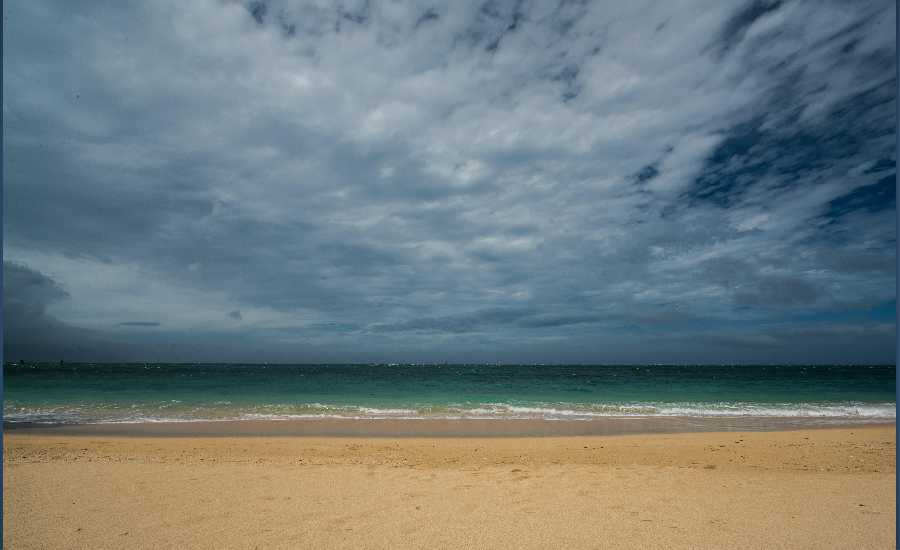
Photo: Chris Archer
Swell Summary
Outlook through Tuesday January 15: A long period north-northeast swell arriving tonight is expected to cause surf to reach the High Surf Advisory threshold along east facing shores Wednesday. This swell will slowly subside Thursday and Friday. Otherwise, small to moderate northwest swells will persist through Friday. A large northwest swell arriving late Friday night may increase surf to the High Surf Warning criteria along north and west facing shores this weekend. This northwest swell will remain elevated early next week, so advisory level surf may persist next Monday and Tuesday.
Surf heights are forecast heights of the face, or front, of waves. The surf forecast is based on the significant wave height, the average height of the one third largest waves, at the locations of the largest breakers. Some waves may be more than twice as high as the significant wave height. Expect to encounter rip currents in or near any surf zone.
North
am ![]()
![]() pm
pm ![]()
![]()
Surf: Knee to waist high NNW medium period swell for the morning with occasional stomach sets. This rotates more N and builds in the afternoon with sets up to 1-2′ overhead high.
Conditions: Semi clean/textured in the morning with ESE winds 10-15mph. Sideshore texture/chop conditions for the afternoon with the winds shifting E 15-20mph.
South
am ![]()
![]() pm
pm ![]()
![]()
Surf: Knee high SSW short period wind swell for the morning going more S during the day.
Conditions: Clean in the morning with NNE winds less than 5mph. Semi glassy/semi bumpy conditions for the afternoon with the winds shifting to the WNW.
West
am ![]()
![]() pm
pm ![]()
![]()
Surf: Knee to waist high NNW ground swell in the morning builds in the afternoon with occasional sets up to head high.
Conditions: Clean with E winds 5-10mph in the morning increasing to 10-15mph in the afternoon.
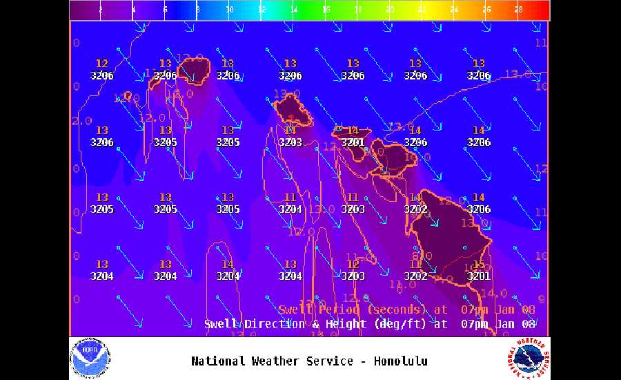
Image: NOAA
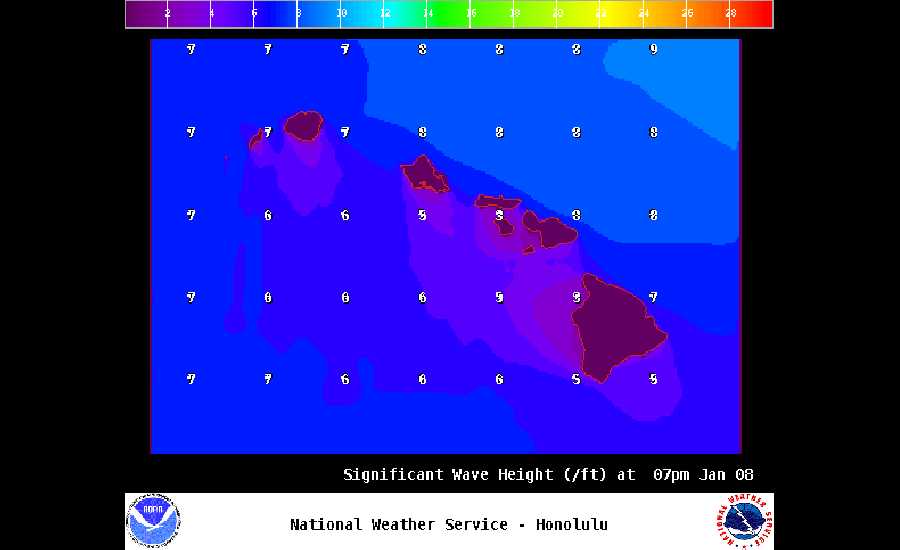
Image: NOAA
Image: NOAA
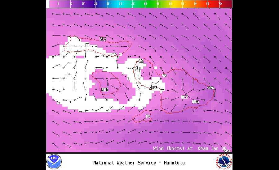
Image: NOAA
Image: NOAA
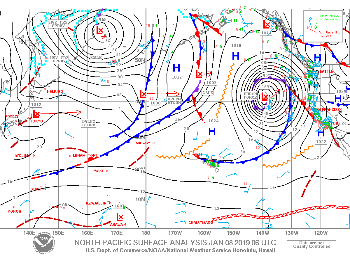
Image: NOAA
**Click directly on the images below to make them larger. Charts include: Maui County projected winds, tides, swell direction & period and expected wave heights.**
Data Courtesy of NOAA.gov and SwellInfo.com
Sponsored Content


